2 Jan 2020
Pontius Pilate and the shape of the waters /23. The legend lives on
Pontius Pilate and the Sibillini Mountain Range, in the Italian Apennines. A necromantic Lake entitled to the first-century Roman prefect who sentenced Jesus Christ to death. A basin of dark waters encircled by the precipitous ravines of Mount Vettore: a sinister, solitary nest that once housed a glacier set in the Sibillini Mountain Range, and vanished thousands of years ago.
In the present research paper, we have been riding through the centuries, in search of the shape of the Lake of Pilate: one Lake, two Lakes, and, finally, no Lake at all.
A long journey that has taken us from the sinister Lake of past centuries down to the scant, depleted Lakes of our present times, and their anticipated, imminent death in a future that is as close as global climate change.
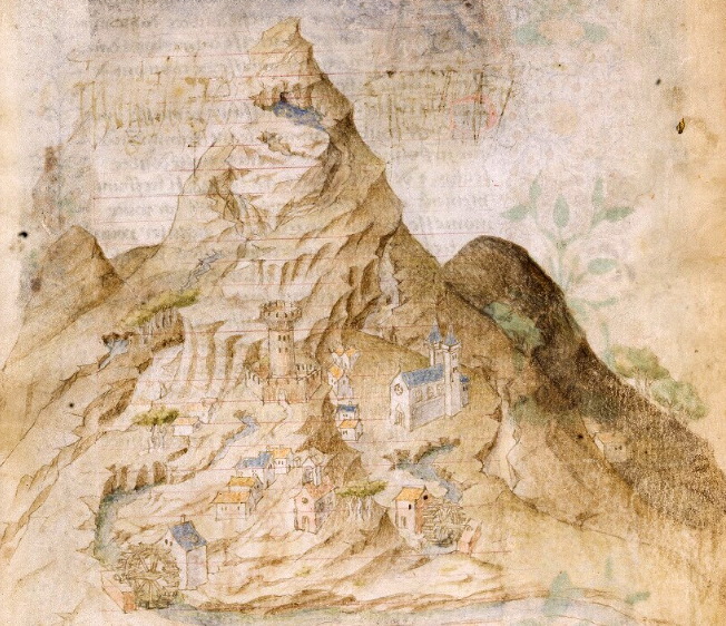
We started our travel from the fourteenth century, with Petrus Berchorius and his emotional words: «amid the peaks which raise near that town [Norcia] there is a lake, which from antique times is sacred to demons and conspicuously inhabited by them...». Then, we joined French gentleman Antoine de la Sale in his 1420 visit to the Lake, named after Pilate and the Sibyl (Fig. 1). From then on, descriptions and references of an ominous Lake sitting amid the mountains of the Sibyl, in central Italy, begin to follow one after another, across the fifteenth, sixteenth and seventeenth century.
Pope Pius II Piccolomini, Flavio Biondo, Arnold von Harff, Leandro Alberti provide mentions about the gloomy Lake set amid the cragged cliffs of the mountains of the Sibyl. A single, ominous Lake, as portrayed in many geographical maps across the centuries: its likeness is depicted on the walls of the illustrious Gallery of Maps at the Vatican Museums in Rome; Giuseppe Moleti, in his edition of Ptolemy's "Geography" draws a single Lake, and an elongated version of it is presented by Gerard de Jode in his “Speculum Orbis Terrae”; it pops up from the map set down by Giubilio and Maggi in 1592, then it appears in Gerardus Mercator's “Atlas sive Cosmographicae Meditationes de fabrica mundi et fabricati figura”, in Giovanni Antonio Magini's “Italy - A General Description”, in Philipp Clüver's “Italia Antiqua”, and in Joan Blaeu's “Nova et accuratissima totius terrarum orbis tabula".
In all the listed literary and cartographic references, the Lake of Pilate is always one: a single, impressive Lake, concealed beneath the rocky arms of Mount Vettore. Only one instance, in the sixteenth century, provides us with a different vision: two scanty, separate Lakes, as attested in manuscript Vat. Lat. 5241, a graphical account of a visit possibly carried out during a hot, dry summer. But this account remained buried for centuries, hidden amid the many vellum folia which contained a collection of ancient Latin inscription, and was found and taken back to light only in 1982.
So, in past centuries, the usual shape of the Lake of Pilate was that of one basin, with temporary summer depletions which led to a partition marked by two smaller Lakes. Nonetheless, its fame across Europe concerned a single Lake: it was one, and it was necromantic, and it was legendary.
When we reached the seventeenth and eighteenth century, we found nothing different from the past: the Lake was still represented as a single Lake, consistently firm in its uniqueness, as we retrieve it in further maps edited by Silvestro Amanzio Moroncelli and Guillaume de L'Isle. We also retraced the steps of two great Jesuit cartographers, Christopher Maire and Ruggero Giuseppe Boscovich, with their misadventurous passage across the Sibillini Mountain Range: they did not see the Lake of Pilate, so that the basin is utterly missing in their comprehensive map of the Papal States. And we found another, isolated description of the Lakes in their depleted summer form: it is contained in the “Chronicles of the Antique Town of Norsia” by Father Fortunato Ciucci, who wrote that they appeared «in the form of spectacles», adding that «I saw from various signs that they come together making up a single lake; but in Summer, in the lack of running water, they split, so that they are seen in the shape of eyeglasses». But his text had no circulation at all: only four manuscripted copies of the "Chronicles" are extant, and they were never printed in a book, if not in a modern edition dating to 2003.
It is in the course of the nineteenth century that a change begins to be apparent, amid the Sibillini Mountain Range. However, no modification is still visible when a geographer of the Imperial and Royal Military Geographical Institute of Austria draws a gorgeous maps of Tuscany and the Papal States: between 1841 and 1843, the Lake is still seen by the professional eyes of Giovanni Marieni as a single basin, and so reported in the relevant cartographic sheet.
The second half of the century brings in a new shape for the Lake. Initially, nothing seems to have undergone any change: in the summer season, the Lake appears split in two smaller ponds as it occurred in past centuries, too. We can read about its shape in the report written during the summer of 1877 by Count Girolamo Orsi, an illustrious member of the then-young Italian Alpine Club: «between the two branches [of Mount Vettore], at the very bottom of titanic ravines, the Lakes of Pilate are found», he writes, «the Lakes of Pilate, and their deep-blue waters, and the frightful ravine nearby». And, in 1887, Giovanni Battista Miliani also sees the two summer Lakes: «down in the valley on the left side, the Lake of Pilate is seen; in summer, as when I saw it, it has a shape of spectacles».
And there are also occasions in which the Lake still retains its original, impressive appearance as a single mirror of waters. When the members of the Italian Alpine Club visited Mount Vettore in 1879, they beheld the ancient vista already described by Antoine de la Sale more than four hundred years earlier: a large, single Lake, ominously nested within the arched crests of the mountain, the way it appears in the drawing published by "L'Illustrazione Italiana" at the time. A vision also confirmed by another report, independently written by Countess Lucia Rossi Scotti, who had joined the alpinists on their climb that day: «... the greenish, gloomy Lake of Pilate, lying in that gorge out of the melting of snows...».
But at the end of the nineteenth century time has come for the Lake to undergo a change. For unknown reasons, snows and rains appear not to be able to fill it up to its single-basin shape anymore. From now on the Lake of Pilate will increasingly begin to turn into the two Lakes of Pilate we know today.
The most accurate description of the new typical shape of our legendary basin is set down by Italian philologist Pio Rajna in 1897: «the Lake appeared to me divided in two elliptical mirrors [...]. The comparison with a pair of spectacles [...] is truly pictorial». An usual occurrence, in summer. But that specific summer plenty of snow was there, accumulated on the sides of Mount Vettore's glacial cirque, manifestly without being able to confer the Lake its larger, single shape:
«I found snow in fair quantity around the lake; and normally Mount Vettore never denies this garniture to itself, as Antonio told me. In Foce (a small hamlet lying in the valley underneath) people told me that once there was a period of nine years when a lack of snowfalls was registered in winters, too, but this occurred and ended twenty years ago».
Had anything happened to the Lake of Pilate? According to Rajna, «today the lake is not what it was in past times anymore»: some forty years earlier «it broke the natural dike at its front, a barrier that never formed again. So Antoine de la Sale beheld a lake with a significantly different appearance, and deeper». And, truly enough, in 1859 a great earthquake struck the territory of Norcia: was it the cause for a dramatic collapse of the northern side of the glacial basin which holds the necromantic Lake? Did the seismic waves change the appearance of the basin forever, with an inability to return to its single form even when snow was present?
As we detailed in the present research paper, we cannot tell. The 1859 earthquake was certainly strong enough to turn Norcia into a heap of ruins; yet, its magnitude and epicentre do not seem to feature the attributes and power required to affect Mount Vettore in so dramatic a way, and no reports on such conjectural event have ever been found in local records as yet. Furthermore, if such an event had actually happened, the members of the Italian Alpine Club could not have experienced a vision of a single Lake as late as 1879, as reported by an Italian magazine of the time.
Anyway, despite its final, occasional appearance as a single basin, starting from the second half of the nineteenth century the shape of the Lake of Pilate was destined to tread a path of growing duplication, and increasing water depletion: the Lake will begin to present itself as a basin substantially split in two smaller ponds, either utterly parted or joined by a narrow strip of water. In summers and winters. Because, during winters, it usually will not regain its original, single form. A sign of growing scarcity of snowfalls and rainfalls, and possibly of variations in the physical configuration of the rocky basin.
The late nineteenth-century cartography drawn by the Italian Military Geographical Institute shows an elongated Lake now visibly indented at the middle, ready to part in two fully distinct ponds. The same deep notch will be portrayed by Cesare Lippi-Boncambi in his drawing dating to 1947. And though other military maps edited in 1952 present the Lake in its flourishing though elongated form, actual reality at that time was markedly different: vintage postcards and aerial photographs cannot but ascertain that the Lake of Pilate had already changed its shape into two smaller ponds, increasingly affected by a significant lack of water supply and possibly overwhelmed by remarkable masses of debris ceaselessly falling from the adjacent crests.
Partition, depletion and insufficient provision of water. A condition that will be repeatedly observed across the first decades of the twenty-first century. The pictures of the Lakes, sadly shrinked to two tiny ponds, and the portraits of a glacial valley utterly deprived of any trace of water, as happened in 2017 and 2020, are truly heartbreaking.
In the present paper, we summarized the potential reasons which may be at the origin of such severe depletion. We could not confirm Pio Rajna's piece of information concerning a mid-nineteenth-century collapse of the Lake's front dike. We reviewed the position of researchers as to the possible drainage of waters from the bottom of the basin into the underlying bedrock, owing to new cracks and fissures potentially produced in the soil by the 2016 earthquakes; but accurate surveys have shown no evidence of such a drainage at the site.
So we identified two main effects, both of a nasty nature, which are affecting the health conditions and overall shape of the Lakes of Pilate. Two adverse effects that are gradually bringing the mountain basin to a fated, inexorable termination.
A first, most critical cause for the increasing depletion of the Lakes of Pilate is climate change. And this statement, alone, resounds in our ears as a sentence of death.
From the fourteenth century to the middle of the nineteenth, the Little Ice Age, a climate condition which affected Europe and was marked by moderately lower temperatures as compared to the previous time periods, ensured an optimal water feeding to the Lake of Pilate: winters were colder, snowfalls were abundant, plenty of accumulated snow was present on the Sibillini Mountain Range, and copious rainfalls helped the Lake to preserve its water balance.
Thus, throughout many centuries, and as attested by the many sources we explored in the present research paper, the Lake of Pilate was a well-fed, single, impressive, necromantic mountain basin. With only temporary depletion affecting the shape of the Lake during the good season.
Then climate began to change.
The effects of man-driven changes started to manifest from the mid of the nineteenth century onwards, with a rapid rise of temperatures around the globe. And the Italian Apennines, like the whole of Europe, were affected, too.
The Lake of Pilate began to mutate: the transformation process into two separate Lakes was gradual, as snowfalls became increasingly less intense on average, and the same happened to rainfalls.
In August 1876, Count Girolamo Orsi was able to behold, in the glacial cirque within Mount Vettore, «the Lakes of Pilate [...], fed by an extended volume of ice, the seed of a persistent glacier, which hides itself down there from direct sunlight. [...] The perennial snows down there, [...] in the gorge set northeast of the peak of Petrara; the same snows that feed those Lakes...» (in the original Italian text: «i Laghi di Pilato, alimentati da quella estesa lente di ghiaccio, embrione di un ghiacciaio perenne, che laggiù si nasconde ai raggi del sole. [...] Quelle nevi perpetue interposte ai tre culmini, là in quella gola nord-est del Petrara, che danno alimento a quei, laghi»).
And Giovanni Battista Miliani, in 1886, wrote that «across all the valley [where the Lakes of Pilate lie], in the spots most sheltered from direct sunrays, accumulated snow persists, which only seldom melts and vanishes in summers» (in the original Italian text: «In tutta questa valle, nei luoghi più riparati dal sole, esistono depositi di neve, che assai di rado sgelano completamente in estate»).
Today, those perennial snows exist nomore, thoroughly erased by the scorching action of the summer heat generated by global warming: the very same warming that is killing glaciers all over the world.
A process which began to be noticeable at the end of the nineteenth century, as reported by Pio Rajna in his writings:
«I found snow in fair quantity around the lake; and normally Mount Vettore never denies this garniture to itself, as Antonio told me. In Foce [a small hamlet lying in the valley underneath] people told me that once there was a period of nine years when there a lack of snowfalls was registered in winters, too, but this occurred and ended twenty years ago».
[In the original Italian text: «Ho trovato neve in discreta quantità dattorno al lago: e per solito il Vettore non si priva mai, come dice Antonio, di questo ornamento. A Foce mi si è detto tuttavia esserci stato un periodo di nove anni, finito da un ventennio, in cui neve non s'ebbe neppure in inverno»].
So the Lake indented and then parted, two distinct Lakes appeared, and not only in dry summers but all year long, and all years. And, as global warming grew, snow and rain became unable to sustain the basin's needs in terms of water, with scant supplies and periods of severe droughts.
The result of this grievous process is emptiness and dryness.
However, this is not the only effect which is leading the Lakes of Pilate to an irrevocable death. Because a second, most severe cause is landslides.
Like deadly claws, two major historical landslides loom over the Lakes of Pilate from the western and eastern sides of Mount Vettore's glacial cirque. For centuries and centuries they have been sending rocks and rubble and debris from the high cliffs straight into the waters underneath. And the eastern landslide, in particular, has gradually built up a central ridge, which splits the original Lake in two different ponds.
So the bottom of the basins is raising and raising, across many centuries and the multiple earthquakes that certainly provide a contribution to the acceleration of the long, historical, uninterrupted process of filling-up. A process that, possibly, experienced some sort of advancement between 1879 and 1897: from the vision of a healthy Lake as seen by the Italian alpinists to the parted, fully-separate Lakes observed by Pio Rajna, despite the presence of melting snow.
Landslides and bottom raising. Climate change and water depletion. Nasty effects which suffocate and choke the basin set amid the cliffs of Mount Vettore.
That's why we are now facing the impending, final, irrevocable death of the Lakes of Pilate.
At all appearances, the Lake of Pilate of past centuries, in its illustrious, single shape as it was celebrated for many hundreds of years across Europe, is extant nomore. And it will never come back.
And the Lake as we ourselves know it today, in its lesser form made up by two smaller, separate Lakes, is currently dying.
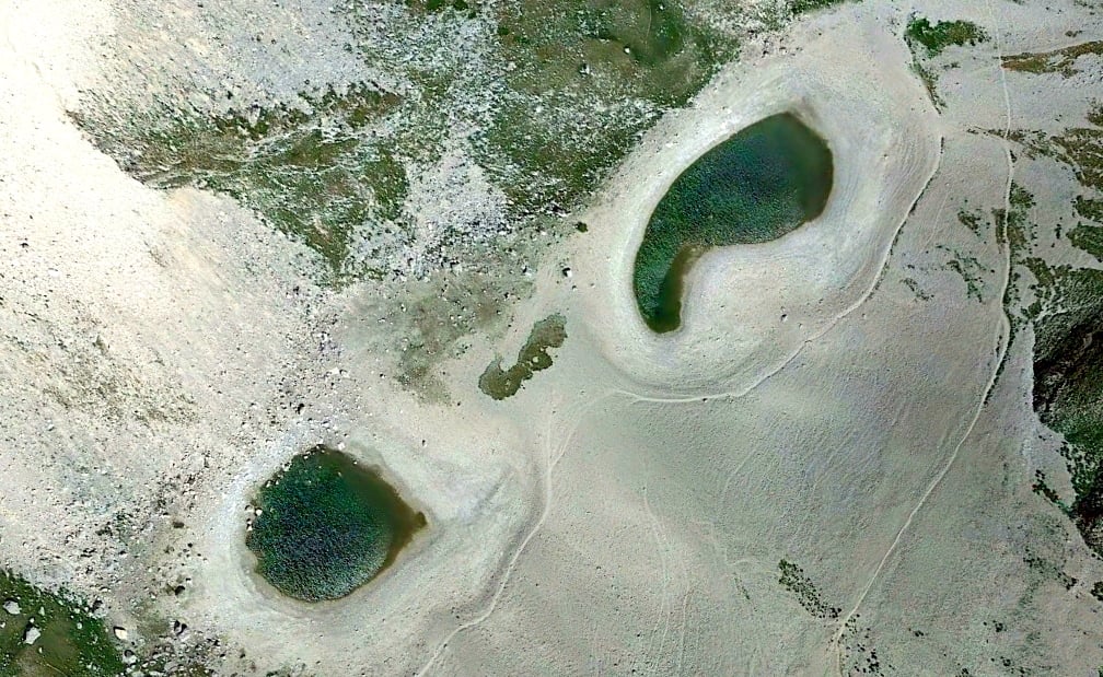
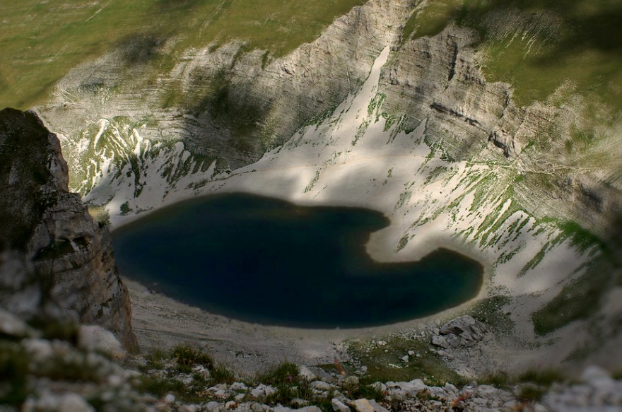
Here they are, in a beautiful satellite picture taken in July, 2017. They are small and powerless and vulnerable. They are only a pale ghost of what the Lake used to be in past centuries. And they are fading away (Fig. 2).
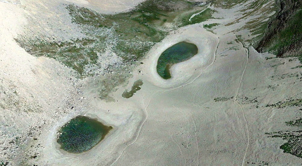
Yet their pure, utterly clear waters are still shimmering with billions of sparks of light. Their history seems to shine through their present fragility. Their legend - its legend, of a Lake concealed within the remote peaks of the Apennines, in central Italy, has been talking to people for centuries across all nations of Europe. Its mystery still resounds, in our present days, in our fascinated ears, when we still read the ancient, blood-curdling tales of the necromantic waters which house demons and raise tempests, as we strive to bring to light the enigma which lies under its liquid, crystal-like surface, the way we did in a previous, groundbreaking research paper ("Sibillini Mountain Range, the chthonian legend") (Fig. 3).
And we want to see it, the Lake, for a last time, the way it was in the ripeness of the early centuries during which visitors flocked by its shore and mentions flowed through manuscripts and printed books.
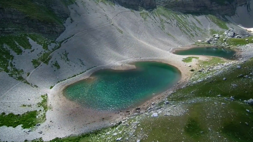
Here is the Lake of Pilate, as Antoine de la Sale saw it, six hundred years ago. A sinister, single, impressive Lake, fully deserving its dedication to a key figure of the Gospels, Pontius Pilate. A Lake of mystery. A Lake of dream (Fig. 4).
The Lake of Pilate may be dying. But its legendary fascination will live on forever.
Ponzio Pilato e la forma delle acque /23. La leggenda vive ancora
Ponzio Pilato e i Monti Sibillini, nella catena degli Appennini. Un Lago negromantico dedicato al nome di un prefetto romano vissuto nel primo secolo, il funzionario imperiale che condannò Gesù Cristo alla morte. Un bacino ricolmo di acque oscure, circondato dagli spaventosi precipizi del Monte Vettore: uno spazio solitario e sinistro che un tempo ospitava un ghiacciaio situato proprio tra i Monti Sibillini, e svanito migliaia di anni orsono.
Nel presente studio, abbiamo cavalcato attraverso i secoli, in cerca della forma del Lago di Pilato: un Lago, due Laghi e, infine, nessun Lago.
Un lungo viaggio, che ci ha condotto dal sinistro Lago dei secoli passati fino ai Laghi depauperati e sofferenti del nostro tempo presente, e alla loro prevedibile, imminente estinzione in un futuro che è distante da noi quanto lo è il mutamento climatico globale.
Abbiamo iniziato il nostro itinerario partendo dal quattordicesimo secolo, con Petrus Berchorius e le sue inquietanti parole: «tra le montagne che si innalzano in prossimità di questa città [Norcia] si trova un lago, dagli antichi consacrato ai dèmoni, e da questi visibilmente abitato...». Ci siamo poi uniti al gentiluomo francese Antoine de la Sale nella sua visita, effettuata nell'anno 1420, al Lago il cui nome è dedicato a Pilato e alla Sibilla (Fig. 1). Da allora in poi, le descrizioni e i riferimenti a proposito di un sinistro Lago nascosto tra le montagne della Sibilla, nell'Italia centrale, si sono susseguiti l'uno dopo l'altro, attraverso i secoli quindicesimo, sedicesimo e diciassettesimo.
Papa Pio II Piccolomini, Flavio Biondo, Arnold von Harff, Leandro Alberti menzionano quel Lago oscuro situato tra le dirupate vette delle montagne della Sibilla. Un singolo, impressionante Lago, così come ritratto in diverse mappe geografiche nel corso dei secoli: il sembiante di quelle acque è dipinto sulle pareti della celebre Galleria delle Carte Geografiche presso i Musei Vaticani in Roma; Giuseppe Moleti, nella sua edizione della "Geografia" di Tolomeo disegna un singolo Lago, e una versione oblunga di esso viene presentata da Gerard de Jode nel suo "Speculum Orbis Terrae"; lo specchio d'acqua fa anche capolino nella mappa elaborata da Giubilio e Maggi nel 1592, apparendo poi nell'"Atlas sive Cosmographicae Meditationes de fabrica mundi et fabricati figura" di Gerardus Mercator, nell'"Italia descritta in generale" di Giovanni Antonio Magini, nell'"Italia Antiqua" di Philipp Clüver, e nella "Nova et accuratissima totius terrarum orbis tabula" di Joan Blaeu.
In tutti i citati riferimenti letterari e cartografici, il Lago di Pilato è sempre uno: un singolo, impressionante Lago, occultato tra le braccia di roccia del Monte Vettore. Solamente una testimonianza, nel corso del sedicesimo secolo, ci fornisce una visione differente: due Laghi separati e scarsamente alimentati, come attestato nel manoscritto Vat. Lat. 5241, contenente il resoconto di una visita effettuata forse duranta un'estate calda e asciutta. Ma questa testimonianza rimarrà sepolta per secoli, nascosta tra i numerosi fogli di pergamena che raccoglievano una collezione di antiche iscrizioni latine: una testimonianza che fu riscoperta e riportata nuovamente alla luce solamente nel 1982.
E così, negli scorsi secoli, la forma ordinaria del Lago di Pilato era quella di un singolo bacino, con temporanee perdite d'acqua nella stagione estiva in grado di condurre il Lago verso una partizione caratterizzata dalla presenza di due Laghi più piccoli. Nondimeno, la sua fama attraversava l'Europa nella forma di un singolo Lago: era uno, ed era negromantico, ed era leggendario.
Quando abbiamo raggiunto i secoli diciassettesimo e diciottesimo, non abbiamo rinvenuto nulla di nuovo rispetto al passato: il Lago era ancora rappresentato come un singolo specchio d'acqua, stabilmente fedele alla propria unicità, come possiamo reperire in ulteriori mappe edite da Silvestro Amanzio Moroncelli e Guillaume de L'Isle. Abbiamo anche potuto ripercorrere i passi di due grandi cartografi gesuiti, Christopher Maire e Ruggero Giuseppe Boscovich, con il loro difficile e avventuroso passaggio attraverso i Monti Sibillini: essi non videro il Lago di Pilato, e dunque il bacino appare essere totalmente assente dalla loro dettagliata mappa dello Stato Ecclesiastico. E ci siamo imbattuti in un'ulteriore, isolata descrizione dei Laghi nella loro carente forma estiva: è contenuta nelle "Istorie dell'antica città di Norsia" di Padre Fortunato Ciucci, il quale scrisse che essi apparivano in «forma d'occhiale», aggiungendo che «ho visto, e considerato da molti segni che si riduchino insieme e faccino un sol lago; ma l'Estate mancandoli il corso dell'acqua vengono a separarsi, come si vedono in forma d'occhiali». Ma questo testo non ebbe alcuna circolazione: ne esistono infatti solamente quattro copie manoscritte, ed esse non furono mai stampate in volume, se non in una moderna edizione pubblicata nel 2003.
È nel corso del diciannovesimo secolo che un cambiamento, tra i Monti Sibillini, inizia a manifestarsi. Malgrado ciò, nessuna modificazione pare essere visibile quando un geografo dell'Imperiale e Regio Istituto Geografico Militare austriaco traccia una bellissima mappa della Toscana e dello Stato Pontificio: tra il 1841 e il 1843, il Lago si mostra ancora, agli occhi professionali di Giovanni Marieni, come un singolo bacino, e in tal modo viene riportato nel relativo foglio cartografico.
La seconda metà del secolo introduce una nuova forma per il Lago. Inizialmente, nulla sembra essere mutato: nella stagione estiva, il Lago si presenta suddivisio in due specchi d'acqua più piccoli, così come era accaduto anche nei secoli precedenti. Possiamo leggere dell'aspetto del Lago nella relazione scritta, nell'estate del 1877, dal Conte Girolamo Orsi, un illustre membro del Club Alpino Italiano, all'epoca di recente fondazione: «fra queste [due parti del Monte Vettore], in fondo agli enormi precipizi, sono i Laghi di Pilato», egli scrive, «i Laghi di Pilato, e le loro acque sì intensamente azzurre, e l'orrido burrone che lì vicino sprofonda». E, nel 1887, anche Giovanni Battista Miliani può osservare i due Laghi estivi: «in fondo a valle, a sinistra, si scorge il Lago di Pilato, che in estate, come quando lo vidi io, ha forma di occhiali».
E si verificano anche occasioni in cui il Lago ritorna ancora alla sua forma originaria e impressionante, un singolo specchio d'acqua. Quando i soci del Club Alpino Italiano visitarono il Monte Vettore nel 1879, essi poterono contemplare l'antica visione già descritta da Antoine de la Sale più di quattrocento anni prima: un grande, singolo Lago, minacciosamente annidato tra le creste arcuate della montagna, nel modo in cui esso si presenta nel disegno pubblicato all'epoca da "L'Illustrazione Italiana". Una visione confermata anche da un altro resoconto, vergato in modo indipendente dalla Contessa Lucia Rossi Scotti, la quale si era unita agli alpinisti nella loro ascesa di quel giorno: «... L'oscuro verde Lago di Pilato formatosi fra quelle gole per il disgelamento dei ghiacci...».
Ma alla fine del diciannovesimo secolo arriverà il tempo, per il Lago di Pilato, di esperimentare una trasformazione. Per qualche ragione, nevi e piogge parrebbero non essere più in grado di riempirlo fino alla forma di singolo bacino. Da quel momento in poi, il Lago di Pilato inizierà a trasformarsi, in modo sempre più marcato, nei due Laghi di Pilato che conosciamo oggi.
La più accurata descrizione del nuovo aspetto tipico del nostro leggendario bacino è delineata dal filologo italiano Pio Rajna nel 1897: «Il lago mi si è presentato diviso in due specchi elittici [...] Il paragone con un par d'occhiali [...] è realmente grafico». Un'occorrenza usuale, in estate. Ma in quella specifica estate la neve non mancava affatto, accumulata sui versanti del circo glaciale del Monte Vettore, pur non essendo palesemente in grado di conferire al Lago la sua forma unica ed estesa:
«Ho trovato neve in discreta quantità dattorno al lago: e per solito il Vettore non si priva mai, come dice Antonio, di questo ornamento. A Foce mi si è detto tuttavia esserci stato un periodo di nove anni, finito da un ventennio, in cui neve non s'ebbe neppure in inverno».
Era forse accaduto qualcosa, al Lago di Pilato? Secondo Rajna, «il lago non è più ora ciò che fu un tempo»: circa quaranta anni prima «esso ruppe le dighe naturali della sua fronte, le quali non si sono più riformate. Antoine de la Sale lo vide dunque notevolmente diverso d'aspetto e più profondo». E, in effetti, nel 1859 un grande terremoto aveva colpito la regione di Norcia: era stata forse questa la causa del drammatico collasso della porzione settentrionale del bacino glaciale che ospita il Lago negromantico? Erano state le onde sismiche a mutare l'aspetto del bacino per sempre, con l'impossibilità di un ritorno alla forma singola seppure in presenza di neve?
Come abbiamo avuto modo di illustrare nel presente articolo di ricerca, non siamo stati in grado di accertarlo. Il terremoto del 1859 fu certamente abbastanza intenso da ridurre Norcia a un cumulo di rovine; eppure, la sua magnitudo e il suo epicentro non sembrano essere stati marcati dalla potenza e dalle caratteristiche necessarie per potere agire sul Monte Vettore in modo così drammatico, e nessun resoconto che sia relativo a un tale ipotetico evento è stato mai reperito, fino ad oggi, negli archivi locali. Inoltre, se veramente un evento del genere fosse mai accaduto, i membri del Club Alpino Italiano non avrebbero potuto esperimentare la visione di un Lago singolo in un'epoca così tarda come risulterebbe essere il 1879, e come invece riporta una rivista illustrata di quegli anni.
In ogni caso, malgrado il manifestarsi occasionale di quelle acque in qualità di singolo bacino, a partire dalla seconda metà del diciannovesimo secolo la forma del Lago di Pilato sarà destinata a percorrere un sentiero che conduce verso una crescente duplicazione e un incremento nella carenza di acqua: il Lago comincerà a presentarsi come un bacino sostanzialmente suddiviso in due Laghi più piccoli, sia totalmente separati che uniti da una stretta striscia d'acqua. Sia in estate che in inverno. Perché, durante l'inverno, esso non riuscirà più a riguadagnare la propria forma singola e originaria. Un segnale della crescente scarsità di precipitazioni nevose e piovose, e forse di possibili variazioni nella configurazione fisica del bacino roccioso.
La cartografia tardo-ottocentesca tracciata dall'Istituto Geografico Militare mostra un lago allungato ora visibilmente intaccato al centro, pronto a separarsi in due distinti specchi d'acqua. La stessa indentazione sarà rappresentata da Cesare Lippi-Boncambi nel proprio diagramma risalente al 1947. E benché ulteriori mappe militari pubblicate nel 1952 presentino il Lago nella sua forma più florida, seppure assai allungata, la realtà effettiva era significativamente diversa: vecchie cartoline postale e fotografie aeree non possono che certificare come il Lago di Pilato abbia già mutato la propria forma distribuendosi su due bacini più piccoli, colpiti in modo crescente da una evidente carenza idrica, nonché forse soffocati da ingenti masse di detriti in continua caduta dalle creste circostanti.
Duplicazione, esaurimento e insufficiente alimentazione idrica. Una condizione che sarà ripetutamente osservata nel corso dei primi decenni del ventunesimo secolo. Le immagini dei Laghi, tristemente ridotti a due piccoli stagni, e le testimonianze fotografiche relative a una valle glaciale completamente svuotata di ogni traccia di acqua, così come accaduto nel 2017 e nel 2020, non possono che spezzare il cuore.
Nel presente articolo, abbiamo riepilogato le possibili ragioni che potrebbero trovarsi all'origine di un depauperamento così critico. Non abbiamo potuto fornire una conferma di quanto sostenuto da Pio Rajna in merito al collasso della barriera settentrionale del bacino che ospita il Lago, un collasso che sarebbe avvenuto alla metà del diciannovesimo secolo. Abbiamo ripercorso le varie posizioni espresse dai ricercatori in relazione al possibile svuotamento della acque attraverso il fondo del bacino e verso il sottostante strato di calcare massiccio, a causa di nuove fessurazioni potenzialmente prodottesi nel suolo a seguito dei terremoti del 2016; ma accurate investigazioni non hanno evidenziaro la sussistenza di un tale processo di svuotamento presso il sito del Lago.
Abbiamo allora identificato due effetti principali, entrambi di natura avversa, che stanno agendo sulle condizioni di salute e sulla forma complessiva dei Laghi di Pilato. Due effetti negativi che stanno gradualmente conducendo il bacino montano verso una conclusione fatale e inesorabile.
Una prima causa, assai critica, per il crescente depauperamento dei Laghi di Pilato è il cambiamento climatico. Ed è sufficiente questa affermazione per far risuonare nelle nostre orecchie una sentenza di morte.
A partire dal quattordicesimo secolo e fino alla metà del diciannovesimo, la Piccola Era Glaciale, una condizione climatica che ha avuto effetti sull'Europa ed è stata caratterizzata da temperature moderatamente più basse rispetto ai precedenti periodi temporali, ha assicurato un'alimentazione idrica ottimale al Lago di Pilato: gli inverni sono stati più freddi, le nevicate più intense, abbondanti accumuli di neve sono stati presenti nei Monti Sibillini, e piogge copiose hanno sostenuto il Lago preservandone il bilancio delle acque.
Per questo, durante molti secoli, e come testimoniato dalle molte fonti da noi investigate nel presente articolo, il Lago di Pilato era un singolo, impressionante, negromantico bacino montano ben alimentato, e segnato da depauperamenti solamente temporanei che influivano sulla forma del Lago durante la buona stagione.
Poi, il clima iniziò a mutare.
Gli effetti dei cambiamenti indotti dall'uomo cominciarono a manifestarsi a partire dalla metà del diciannovesimo secolo, con un rapido incremento delle temperature globali. E gli Appennini italiani, come il resto del continente europeo, ne subirono parimenti le conseguenze.
Il Lago di Pilato iniziò a cambiare: il processo di trasformazione in due Laghi separati ebbe un carattere graduale, con nevicate statisticamente sempre meno intense, e piogge analogamente in lenta riduzione.
Nell'agosto del 1876, il Conte Girolamo Orsi poté osservare, all'interno del circo glaciale del Monte Vettore, «i Laghi di Pilato, alimentati da quella estesa lente di ghiaccio, embrione di un ghiacciaio perenne, che laggiù si nasconde ai raggi del sole. [...] Quelle nevi perpetue interposte ai tre culmini, là in quella gola nord-est del Petrara, che danno alimento a quei, laghi».
E Giovanni Battista Miliani, nel 1886, scrisse che «in tutta questa valle [dove giacciono i Laghi], nei luoghi più riparati dal sole, esistono depositi di neve, che assai di rado sgelano completamente in estate».
Oggi, quelle nevi perenni non esistono più, totalmente cancellate dall'ardore del calore estivo generato dal riscaldamento globale: lo stesso fenomeno di riscaldamento che sta uccidendo i ghiacciai in molte aree del mondo.
Un processo che iniziò ad essere rilevabile alla fine del diciannovesimo secolo, come riferito da Pio Rajna nei propri scritti:
«Ho trovato neve in discreta quantità dattorno al lago: e per solito il Vettore non si priva mai, come dice Antonio, di questo ornamento. A Foce mi si è detto tuttavia esserci stato un periodo di nove anni, finito da un ventennio, in cui neve non s'ebbe neppure in inverno».
Così il Lago cominciò a presentare una sorta di indentazione, e poi si suddivise, facendo apparire due Laghi distinti: non solo nelle estati aride, ma durante tutto il corso dell'anno, e tutti gli anni. E, mentre il riscaldamento globale continuava a crescere, le nevi e le piogge non furono più in grado di sostenere le necessità idriche del bacino, in presenza di scarsa alimentazione e periodi di intensa siccità.
I risultati di questo nefasto fenomeno sono svuotamento e inaridimento.
Purtroppo, però, non è questo il solo effetto negativo che sta oggi agendo sui Laghi di Pilato, conducendoli nella direzione di un'irrevocabile estinzione. Perché una seconda causa, assai critica anch'essa, è costituita dagli smottamenti.
Come artigli mortali, due grandi smottamenti storici incombono sui Laghi di Pilato dai versanti orientale e occidentale del circo glaciale del Monte Vettore. Per secoli e secoli essi hanno scagliato massi, pietre e detriti dalle alte vette circostanti direttamente nelle acque sottostanti. E la frana orientale, in particolare, ha edificato, a mano a mano, una cresta centrale, che divide il lago originale in due differenti bacini.
E così il fondo degli specchi d'acqua si è innalzato sempre di più, attraverso molti secoli e molteplici terremoti, i quali hanno certamente contribuito all'accelerazione di questo lungo, storico, ininterrotto processo di riempimento. Un processo che ha esperimentato forse una qualche sorta di avanzamento tra il 1879 e il 1897: dalla visione di un florido Lago così come contemplato dai soci del CAI ai due Laghi completamente separati osservati da Pio Rajna, malgrado la presenza di neve in scioglimento.
Smottamenti e innalzamento del fondo. Cambiamento climatico e depauperamento idrico. Effetti avversi che strangolano e soffocano il bacino posto tra le creste del Monte Vettore.
Ecco perché siamo ora di fronte alla morte imminente, finale e irrevocabile, dei Laghi di Pilato.
In tutta evidenza, il Lago di Pilato dei secoli passati, nella sua forma singola e illustre così come fu celebrata per molte centinaia di anni in tutta Europa, non esiste più. E non potrà tornare mai più.
E il Lago come noi lo conosciamo oggi, nella sua forma minore, composta da due Laghi più piccoli e separati, sta morendo.
Eccoli qui, in una splendida immagine satellitare acquisita nel luglio 2017. Sono piccoli e indifesi e vulnerabili. Essi sono solo un pallido fantasma di ciò che il Lago era solito essere negli scorsi secoli. E stanno lentamente svanendo (Fig. 2).
Eppure le loro acque così pure, così completamente trasparenti scintillano ancora di milioni di faville di luce. La loro storia pare brillare attraverso la loro attuale fragilità. La loro leggenda - la sua leggenda, quella di un Lago nascosto tra i remoti picchi degli Appennini, al centro dell'Italia, ha parlato agli uomini per secoli attraversando tutte le nazioni d'Europa. Il suo mistero risuona ancora, ai nostri giorni, alle nostre orecchie affascinate, quando ci troviamo a rileggere gli antichi, spaventosi racconti a proposito delle acque negromantiche che ospitavano demoni e suscitavano tempeste, mentre tentiamo di portare alla luce l'enigma che giace al di sotto della sua superficie liquida e cristallina, così come abbiamo cercato di fare in un nostro precedente, straordinario articolo ("Monti Sibillini, la leggenda ctonia") (Fig. 3).
E noi vogliamo contemplarlo, quel Lago, per un'ultima volta, nel modo in cui esso si presentava nella piena maturità di quei secoli durante i quali i visitatori si affollavano presso le sue rive e le menzioni fiorivano nei manoscritti e nei volumi a stampa.
Eccolo, il Lago di Pilato, come Antoine de la Sale poté osservarlo, seicento anni fa. Un Lago sinistro, singolo, impressionante, che meritava pienamente la propria dedicazione nei confronti di una figura chiave dei Vangeli, Ponzio Pilato. Un Lago di mistero. Un Lago di sogno (Fig. 4).
Il Lago di Pilato sta forse morendo. Ma il suo fascino leggendario non potrà che vivere per sempre.




31 Dec 2020
Pontius Pilate and the shape of the waters /22. Landslides: when the mountain swallows its siblings
Climate change is certainly leading the Lakes of Pilate, once a single, impressive Lake, towards extinction. An extinction which is basically to be considered as a side effect of a much larger, global-scale process that is putting at risk huge geographical features all around the world, including glaciers in the Alps.
However, we strongly repute that possibly this is not the one and only effect, of a nasty nature, which has been unfavourably affecting the life of the Lake of Pilate across the last one hundred fifty years.
Another physical effect, on a local scale, may have significantly influenced the shape of the water basin set amid the cliffs of Mount Vettore. An additional effect which, when combined with the decrease in snowfalls and rainfalls due to climate change, is equivalent to a mortal blow inflicted to our legendary Lake: a stifling grip around its neck, leading to utter suffocation.
And this grip is landslides.
As we already noted in a previous paragraph, the whole area of the Sibillini Mountain Range is subject to recurrent earthquakes and violent seasonal storms. And Mount Vettore's glacial cirque is at the core of all this.
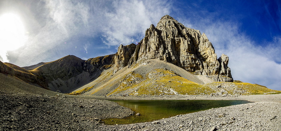
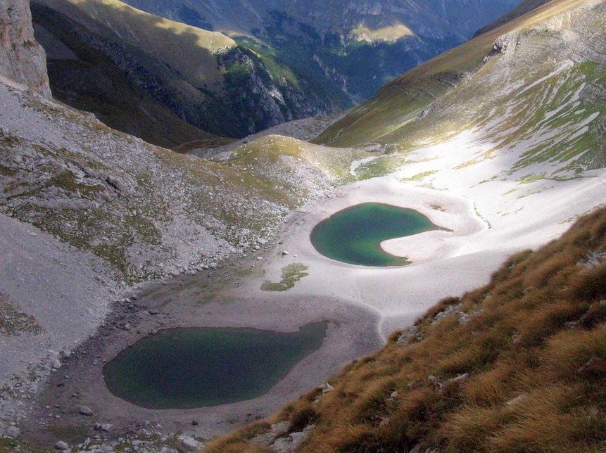
The very shape and nature of the rocky cradle that once housed a glacier render the site prone to landslides from the overhanging cliffs which encircle the whole arched space. The rock is fractured and grinded by the action of the now-vanished ice mass. Debris and rubble cover the bottom of the cirque. Earthquakes and storms continue to effect an uninterrupted strain on the titanic walls of sheer stone, from which pebbles and rocks and boulders, across the decades and centuries, keep on sliding and falling onto the Lake (Fig. 1).
This ceaseless process has induced a progressive raise in the elevation of the Lake's bottom, thus leaving less volume available to the water content of the basin, and creating a growing barrier of debris at the middle of the glacial cirque, which eventually caused the partition of the Lake, in earlier times a single basin, into two ordinarily separated ponds.
So, in the past the glacial cirque was markedly deeper, allowing for more water; across the centuries, the site's bottom slowly raised, and less water can be accommodated within the cirque without overflowing from the northern side into the underlying valley. Gilberto Pambianchi, a geologist at the University of Camerino, claimed that the process was accelerated by the great seismic sequence which occurred in 2016: according to his estimate, the landslides which followed the earthquakes precipitated stones and debris right into the Lakes, with a rise of the bottom's elevation of about three feet, though this figure has not yet been confirmed nor reported in scientific papers.
However, we are interested in less recent landslides. Are there any of them which are visible around the glacial cirque that houses the Lakes of Pilate?
Yes. Ancient, historical landslides are there.
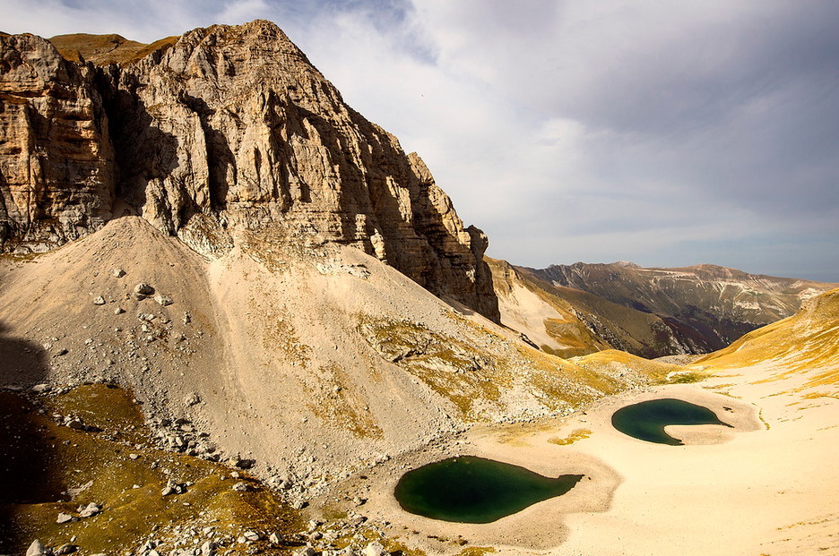
A first one is found on the western side of the rounded glacial valley: a funnel-shaped mass of debris coming down from a vertex set up above, below the peaks of Cima del Redentore and Pizzo del Diavolo. This large quantity of rubble keeps on rolling and falling into the smaller, southernmost pond, which appears to be almost overwhelmed by the neverending accumulation of stones (Fig. 2).
But it is the second landslide that possibly sealed the destiny of the larger Lake of Pilate as it was known in the past.
This further landslide is set on the opposite, eastern side of the glacial cirque of Mount Vettore. And it is impressive altogether.
It originates from the mountainside which goes up to the most elevated peak of the whole mount, once called the Petrara peak. A sort of wound, a veritable scar marks this portion of the cliff: from it, as if it were a spring of fresh mountain water, rocks and debris seem to pour out and sprinkle onto the underlying Lakes (Fig. 3).
Such copious flow of stones and pebbles is hurled right onto the low ridge that separates the two ponds. Actually, it makes up and feeds that ridge.
This is the landslide that gave rise to the two Lakes: from a single Lake to a dual configuration, increasingly parted by an ever-growing mass of rocks ceaselessly falling into the waters from the eastern side of the glacial cirque.
It is manifestly clear that centuries and centuries of slowly-flowing landslides, fuelled and accelerated on specific occasions by earthquakes, storms and temperature variations, gradually filled up the bottom of the Lake's basin. A simultaneous, claw-shaped flank attack conducted on both sides, the eastern and the western, of the original Lake.
In the long term, a deadly attack.
When the bottom of the basin will be filled with enough rubble so as to reach the elevation of the front dike to the northern side of the basin (6,463 feet, as reported in a previous chapter in this same research paper), the Lake or Lakes will not be able to form anymore: water will just leave the glacial cirque unhindered by flowing straight down into the valley underneath.
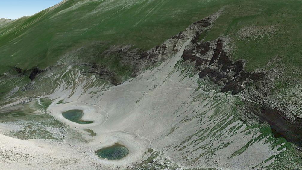
Across the centuries, the Lake's bottom has raised and raised up to the present level (6365 feet): still a gap of some 100 feet needs to be filled before the waters reach the northern dike's level. The landslides have still much work to do to achieve the utter eradication of the Lakes of Pilate. Mount Vettore is quietly, relentlessly swallowing up its own siblings, nested between its rocky arms (Fig. 4).
And yet the landslides are working nicely and steadily, with sudden accelerations due to earthquakes. They already succeeded in parting the Lake into two smaller Lakes, by building up a sort of ridge between the northern and southern basins.
Did this loading process experience some sort of boost at the middle of the nineteenth century? We actually don't know, because a geological investigation is needed if we intend to ascertain the age of the most significant flows of rubbles which are present within the two landslides. As a matter of fact, it was in 1879 that the aristocratic members of the Italian Alpine Clube saw the Lake in its healthy, single form for the last time; and it was in 1897, at the end of the nineteenth century, that Pio Rajna beheld the two Lakes fully separated by a portion of dry land, even though accumulated snow was all around: a sign that the central ridge was becoming high enough to ensure a successful partition of the two Lakes despite snowfalls and rainfalls.
A deadly attack, as we stated earlier in this chapter. But the more deadly it appears to be, when we come to consider the concurrent action of climate change and global warming.
Less snow. Less rain. Less space available to accommodate water. A relentless process, which is going ahead and ahead.
Until the Lakes of Pilate will eventually die.
Ponzio Pilato e la forma delle acque /22. Smottamenti: quando la montagna divora la propria progenie
Il cambiamento climatico sta certamente conducendo i Laghi di Pilato, un tempo un singolo e impressionante Lago, verso l'estinzione. Un'estinzione che deve essere fondamentalmente considerata come un effetto collaterale di un processo assai più vasto, e su scala globale, che sta ponendo a rischio grandi elementi geografici in tutto il mondo, inclusi i ghiacciai alpini.
Nondimeno, riteniamo convintamente che forse non sia questo il solo e unico effetto, di natura sfavorevole, che stia producendo effetti negativi sulla vita del Lago di Pilato nel corso degli ultimi centocinquanta anni.
Un altro effetto fisico, su scala locale, potrebbe avere significativamente influenzato la forma dello specchio d'acqua circondato dalle creste del Monte Vettore. Un effetto ulteriore che, se combinato con la rilevata diminuzione nelle precipitazioni nevose e nelle piogge connessa al cambiamento climatico, equivale a un colpo mortale inflitto al nostro leggendario Lago: una sorta di presa soffocante attorno al collo, in grado di condurre alla totale asfissia.
E questa presa mortale è costituita dagli smottamenti.
Come da noi già notato in un precedente paragrafo, l'intera area dei Monti Sibillini è soggetta a ricorrenti terremoti e violente tempeste stagionali. E il circo glaciale del Monte Vettore si trova proprio nel cuore di tutto questo.
La forma e la natura stessa della culla di roccia che un tempo ospitava un ghiacciaio rende il sito soggetto a frane in caduta dalle incombenti pareti che circondano l'intero spazio arcuato. La roccia risulta essere fratturata e triturata dall'azione della massa di ghiaccio oggi svanita. Pietre e detriti ricoprono il fondo del circo glaciale. Tempeste e terremoti continuano a esercitare un'ininterrotta pressione sulle mura titaniche di roccia verticale, dalle quali ghiaia, pietre e grandi massi, attraverso i decenni e i secoli, continuano a scivolare e a cadere nel Lago (Fig. 1).
Questo incessante processo ha prodotto un progressivo innalzamento nell'altitudine del fondo del Lago, lasciando così un volume descrescente a disposizione del contenuto in acqua del bacino, e creando una crescente barriera di detriti al centro del circo glaciale, una barriera che ha causato infine la partizione del Lago, un tempo un singolo bacino, in due specchi d'acqua usualmente separati.
Così, in passato il circo glaciale risultava essere significativamente più profondo, e in grado di accogliere maggiori quantità d'acqua; nel corso dei secoli, il fondo del sito si è lentamente innalzato, in modo tale da rendere possibile l'accoglimento di un volume d'acqua minore senza che si vada a verificare una tracimazione attraverso il lato settentrionale verso la vallata sottostante. Gilberto Pambianchi, un geologo dell'Università di Camerino, ha sostenuto che tale processo sia stato accelerato dalla grande sequenza sismica occorsa nel 2016: secondo la sua stima, le frane che avrebbero seguito le scosse avrebbero precipitato pietre e detriti direttamente nei Laghi, con un innalzamento del fondo pari a circa un metro, benché tale valutazione non sia stata ancora confermata né riportata in specifici articoli scientifici.
In ogni caso, il nostro interesse si concentra maggiormente su smottamenti storici e dunque meno recenti. Ve ne sono forse alcuni le cui tracce siano ancora visibili all'interno del circo glaciale che ospita i Laghi di Pilato?
Sì. Le frane storiche, antiche sono lì.
La prima è osservabile sul lato occidentale della vallata glaciale semicircolare: una massa di detriti a forma di imbuto, discendente da un vertice situato in alto, al di sotto dei picchi della Cima del Redentore e del Pizzo del Diavolo. Questa grande quantità di ghiaia e pietre continua a rotolare e a cadere nel più piccolo Lago meridionale, che appare essere quasi sopraffatto dall'instancabile accumulo di rocce (Fig. 2).
Ma è la seconda frana ad avere forse segnato il destino del grande Lago di Pilato così come esso era conosciuto in passato.
Questo ulteriore smottamento è collocato sul lato opposto, quello orientale, del circo glaciale del Monte Vettore. Ed è assolutamente impressionante.
Esso trova origine nel fianco della montagna che sale fino alle vetta più elevata dell'intero monte, un tempo chiamata Cima Petrara. Una sorta di ferita, una vera cicatrice segna questa porzione della parete: da essa, come se fosse una sorgente di fresca acqua di montagna, pietre e detriti sembrano sgorgare e quasi sprizzare nei due Laghi sottostanti (Fig. 3).
Questo copioso flusso di rocce e ghiaia è scagliato direttamente sulla bassa cresta che separa i due bacini. In effetti, è proprio questo flusso a generare e alimentare quella cresta.
È questa la frana che dette origine ai due Laghi: da un singolo Lago a una configurazione duplice, ripartita in modo sempre più netto da una crescente massa di rocce che ininterrottamente discendono nelle acque dal lato orientale del circo glaciale.
È dunque chiaro come secoli e secoli di smottamenti in lento movimento, alimentati e accelerati in specifiche occasioni da terremoti, tempeste e variazioni di temperatura, abbiano gradualmente riempito il fondo del bacino che ospita il Lago. Un attacco simultaneo, accerchiante, condotto da ambo i lati nei confronti del Lago originale: una sorta di tenaglia, che agisce sia dal lato orientale che da quello occidentale.
Nel lungo termine, un attacco mortale.
Quando il fondo del bacino sarà riempito con una quantità di detriti sufficiente a raggiungere l'altezza della diga frontale posta sul lato settentrionale del bacino stesso (1.970 metri, come illustrammo in un precedente capitolo di questa stessa ricerca), il Lago o i Laghi non saranno più in grado di formarsi: l'acqua abbandonerà semplicemente il circo glaciale senza più costrizioni, fluendo direttamente giù nella vallata sottostante.
Nel corso dei secoli, il fondo del Lago si è innalzato ininterrottamente, fino a raggiungere il livello attuale (1940 metri): un divario di circa 30 metri deve essere ancora colmato prima che le acque raggiungano il livello del fronte settentrionale. Le frane hanno ancora molto lavoro da fare prima di ottenere il risultato di una totale eradicazione dei Laghi di Pilato. Il Monte Vettore sta divorando, lentamente, silenziosamente, la propria stessa progenie, nascosta tra le sue braccia di pietra (Fig. 4).
Ma quelle frane stanno lavorando operosamente e senza posa, con improvvise accelerazioni causate dai terremoti. Esse sono già riuscite a suddividere il Lago in due Laghi più piccoli, costruendo una sorta di cresta tra il bacino più settentrionale e quello posto a meridione.
Questo processo di caricamento ha forse esperimentato una qualche sorta di accelerazione alla metà del diciannovesimo secolo? Non lo sappiamo con certezza, perché sarebbe necessario effettuare un'indagine geologica al fine di accertare l'epoca alla quale far risalire i flussi detritici maggiormente significativi presenti nell'ambito dei due smottamenti. Sappiamo che nel 1879 gli aristocratici membri del Club Alpino Italiano osservarono, per l'ultima volta, un singolo Lago in assai floride condizioni; e nel 1897, alla fine del diciannvesimo secolo, Pio Rajna contemplò i due Laghi distintamente separati tramite una porzione di terreno non ricoperta dall'acqua, benché attorno fossero presenti accumuli di neve: un segnale del fatto che la cresta centrale stava diventando sufficientemente rilevata da assicurare una completa ripartizione dei due Laghi malgrado piogge e nevicate.
Un attacco mortale, come abbiamo avuto modo di illustrare in questo capitolo. Ma ancor più letale esso appare, quando lo si venga a considerare assieme alla concomitante azione legata al cambiamento climatico e al riscaldamento globale.
Finché i Laghi di Pilato, alla fine, non si estingueranno.




28 Dec 2020
Pontius Pilate and the shape of the waters /21. Climate change: is the Lake's end near?
At the end of the nineteenth century, Vittorio Sella, the great alpinist and photographer, whose uncle was Quintino Sella, the founder of the Italian Alpine Club, ascended a number of elevated peaks of the Alps to portray the gorgeous, panoramic vistas with his camera equipped with large, high-quality photographic plates.
At the time, he did not know; yet he was dramatically contributing to the advancement of contemporary climatology, by providing future scientists with invaluable evidences of a most critical environmental process.
This process was climate change.
His pictures of alpine glaciers are being presently used by modern photographers and researchers to assess the fast-paced retreat of the ice masses under the pressure of global warming. Fabiano Ventura's project "On the trail of the glaciers" is currently documenting, with stunning photographs taken from the same positions as Vittorio Sella's, the shrinking of the glaciers which lie amid the Italian Alps: the decrease in snowfalls and the ever-growing heat which floods the icy surfaces during the warmest summers in the last one hundred fifty years are speeding up a melting process that was possibly triggered centuries ago by the start of the Industrial Revolution, in Europe initially and then throughout the whole world (Fig. 1).
Similar studies are being conducted in other portions of the Alps: in Switzerland, other astounding pictures provide a sad vision of the doom that is looming over all alpine glaciers, with a dramatic retreat of the ice and a depletion of the stocks of frozen water (Fig. 2).
On a general, worldwide basis the fate of glaciers is gloomily outlined in the "Fifth Assessment Report on Climate Change" (2013) edited by the Intergovernmental Panel on Climate Change:
«More than 600 glaciers have disappeared over the past decades. Even if there is no further warming, many more glaciers will disappear. It is also likely that some mountain ranges will lose most, if not all, of their glaciers. [...] Larger glaciers will continue to shrink over the next few decades, even if temperatures stabilise. Smaller glaciers will also continue to shrink, but they will adjust their extent faster and many will ultimately disappear entirely».
This is the incoming death of glaciers. A termination which certainly is strongly linked with the condition of our Lakes set in the Apennines, between the provinces of Umbria and Marche.
Because climate change, of course, is not limited to Alps.
A remarkable paper issued by the Regional Administration for Environment and Preservation of Emilia-Romagna in 2010 ("Climatology and annual variations of snow on the Apennine in Emilia-Romagna", De Bellis et al.) analyses the trends in snowfalls and accumulated snow in a mountainous region which lies not far from the Sibillini Mountain Range, on their northwestern side. According to the study, the climatology of snow in the southern portion of the investigated area, the Romagna, is similar to that «of the Adriatic versant of Central Apennines», which means the Sibillini region.
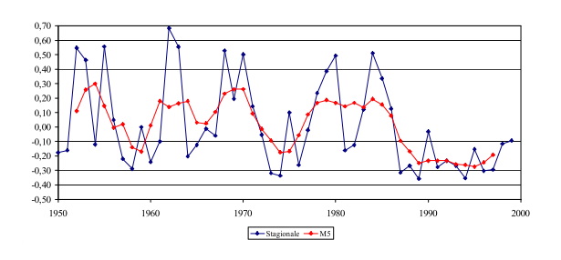
The diagrams processed by the researchers on the amount of snowfalls in the area in the second half of the twentieth century are highly significant. The thickness of the accumulated snow in winters, as measured by a number of stations set across the Emilia-Romagna Apennines, shows a dramatic decrease in the deposited quantities of snow at the end of the 1980s (Fig. 3). This is linked to a steady growth of the maximum temperatures in winters on those same mountainous reliefs across the years.
In the research paper, an interesting correlation is established with a global index specifically used in contemporary climatology: the North Atlantic Oscillation (NAO).
The NAO is a large-scale atmospheric phenomenon which affects climate variations across the European and northern-Atlantic regions. It is connected to the positions and seasonal parameters of the Azores High and Icelandic Low, with a strong influence on jet streams at tropospheric altitude. According to the study, the strong decrease in snowfalls observed in the Romagna region in the 1980s «is matched by the very same period in which the NAO index begins to grow».
So the NAO index appears to be a main factor in the triggering of snowfalls and snow accumulation over the land of Emilia-Romagna and the nearby Apennines; and its influence extends across the whole European territory, as shown by a Swiss study and a further Romanian research carried out respectively on the Alps and the Carpathian Mountains, which both led to a same conclusion.
Vanishing glaciers, decrease in rainfalls and snowfalls, ominous variations of the North Atlantic Oscillation: all these factors, all linked to the current change which is affecting global weather and climate, are marking the potential, impending end of the Lakes of Pilate.
And we want to conclude this sorrowful paragraph by providing a true, unmistakable vision of the main factor which will lead the Lakes of Mount Vettore to their final death.
In the previous paragraph, dedicated to the 'Little Ice Age', we already saw a diagram taken from the IPCC's "Third Assessment Report on Climate Change" (2001), showing, on its rightmost portion, the rapid, amazing, almost unbelievable rise in global temperature observed from the middle of the nineteenth century and up to our current days.
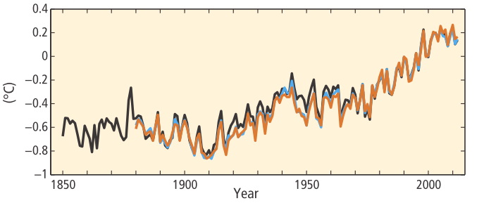
A further, astounding, updated view is provided by a diagram presented in the "Climate Change 2014 Report" issued by the IPCC.
It's a diagram which shows the global average temperatures between 1850 and 2012 (Fig. 4).
It rises. And rises. And rises. Very fast.
And another diagram is shown in the same report (Fig. 5).
It's our world. The Earth. And it is warming up. Quickly.
Increased heat. Vanishing glaciers. Less snow. Less rain. In this gloomy framework, there is no question about the final destiny of the Lakes of Pilate, in the Sibillini Mountain Range.
They will disappear. Their cradle of rock will remain eventually empty.
And this will not be a problem only for a small, legendary, fascinating basin of water lost amid the Mountains of the Sibyl.
This will be a problem for mankind as a whole.
Ponzio Pilato e la forma delle acque /21. Cambiamento climatico: la fine dei Laghi è vicina?
Alla fine del diciannovesimo secolo, Vittorio Sella, il grande alpinista e fotografo, nipote di Quintino Sella, il fondatore del Club Alpino Italiano, scalò una serie di elevati picchi appartenenti alla catena delle Alpi al fine di ritrarne i meravigliosi panorami con la sua macchina fotografica, equipaggiata con lastre di grandi dimensioni e di alta qualità.
A quell'epoca, egli non poteva ancora saperlo; eppure, egli stata contribuendo in modo straordinario al progresso della climatologia contemporanea, fornendo ai futuri scienziati prove di importanza fondamentale in relazione a un processo ambientale estremamente critico.
Quel processo era il cambiamento climatico.
Le sue immagini dei ghiacciai alpini sono oggi utilizzate dai moderni fotografi e ricercatori per valutare il rapido ritrarsi delle masse di ghiaccio sotto la pressione del riscaldamento globale. Il progetto di Fabiano Ventura "Sulle tracce dei ghiacciai" sta oggi documentando, con impressionanti fotografie scattate dalle medesime posizioni un tempo utilizzate da Vittorio Sella, la riduzione dei ghiacciai che si trovano tra le vette delle Alpi italiane: la diminuzione delle precipitazioni nevose e il calore ininterrottamente crescente che si diffonde sulle superfici ghiacciate durante le più roventi estati degli ultimi centocinquanta anni stanno provocando l'accelerazione di un processo di scioglimento che fu forse attivato, alcuni secoli fa, dall'inizio della Rivoluzione Industriale in Europa e, in seguito, in tutto il mondo (Fig. 1).
Ricerche analoghe sono oggi in corso in altre sezioni delle Alpi: in Svizzera, ulteriore immagini, del pari strabilianti, rendono disponibile un'amara visione del destino che incombe su tutti i ghiacciai alpini, con una drammatica riduzione dei ghiacci e il depauperamento delle riserve di acqua congelata (Fig. 2).
Da un punto di vista più generale e globale, il fato dei ghiacciai è tristemente delineato nel "Quinto Rapporto di Valutazione sul Cambiamento Climatico" (2013), pubblicato dal Gruppo Intergovernativo sul Cambiamento Climatico (IPCC):
«Più di 600 ghiacciai sono scomparsi nel corso degli ultimi decenni. Se anche non vi fosse un ulteriore riscaldamento, molti altri ghiacciai sono comunque destinati a svanire. È anche probabile che molte catene montuose vedranno la perdita della maggior parte dei propri ghiacciai, se non addirittura di tutti. [...] I ghiacciai di maggiori dimensioni continueranno a ridursi nel corso dei prossimi decenni, anche se la temperatura si stabilizzasse. I ghiacciai più piccoli continueranno parimenti a ridursi, ma la loro estensione subirà mutamenti più rapidi e molti di essi alla fine scompariranno del tutto».
È questa la fine imminente dei ghiacciai. Una conclusione che, certamente, è fortemente connessa alla condizioni dei nostri Laghi situati tra gli Appennini, ai confini delle regioni dell'Umbria e delle Marche.
Perché il cambiamento climatico, naturalmente, non è limitato alle Alpi.
Un interessantissimo studio elaborato dall'Agenzia Regionale Prevenzione e Ambiente dell'Emilia-Romagna nel 2010 ("Climatologia e variabilità interannuale della neve sull’Appennino Emiliano-Romagnolo", De Bellis et al.) analizza le tendenze nelle precipitazioni nevose e negli accumuli di neve in una regione montuosa che giace non lontano dai Monti Sibillini, in direzione nordoccidentale. Secondo questo studio, la climatologia della neve nella porzione territoriale più meridionale, corrispondente alla Romagna, è analoga a quella «del versante Adriatico dell’Appennino Centrale», che corrisponde proprio ai Monti Sibillini.
I diagrammi elaborati dai ricercatori in relazione alle quantità di precipitazioni nevose nell'area nel corso della seconda metà del ventesimo secolo sono estremamente significativi. Lo spessore del manto nevoso invernale, misurato tramite una serie di stazioni distribuite lungo l'Appennino emiliano e romagnolo, mostrano una drastica diminuzione nelle quantità di neve depositatesi al suolo alla fine degli anni 1980 (Fig. 3). Ciò appare essere legato a un costante incremento delle temperature massime rilevate nelle stagioni invernali su questi stessi rilievi montuosi attraverso gli anni.
Nell'articolo di ricerca viene inoltre stabilita un'interessante correlazione con un indice globale specificamente utilizzato dalla climatologia contemporanea: l'Oscillazione Nord Atlantica (North Atlantic Oscillation - NAO).
Il NAO è un fenomeno atmosferico su larga scala che agisce sulle variazioni climatiche nell'area dell'Europa e nella regione del Nord Atlantico. Esso è connesso con la posizione e i parametri stagionali dell'Anticiclone delle Azzorre e della Depressione d'Islanda, con una significativa influenza sui flussi delle correnti a getto ad altitudine troposferica. Secondo lo studio, la drastica diminuzione di precipitazioni nevose osservata nella regione della Romagna negli anni 1980 «coincide esattamente con il momento in cui l’indice NAO inizia la sua crescita».
Dunque l'indice NAO appare essere un fattore primario per l'innesco di precipitazioni nevose e l'accumulo di nevi nell'area dell'Emilia-Romagna e degli adiacenti Appennini: e la sua influenza si estende su tutto il territorio europeo, come mostrato da uno studio svizzero e da un'ulteriore ricerca romena, analisi relative rispettivamente alle Alpi e ai Carpazi: due studi che hanno condotto, entrambi, alle medesime conclusioni.
Ghiacciai che svaniscono, diminuzione delle piogge e delle nevi, negative variazioni dell'Oscillazione Nord Atlantica: tutti questi fattori, interconnessi tra loro e con il cambiamento che sta oggi modificando il tempo meteorologico e il clima globale, stanno segnando la potenziale, incombente fine dei Laghi di Pilato.
E vogliamo concludere questo amaro paragrafo rendendo disponibile una veridica, inequivocabile visione del principale fattore che condurrà i Laghi di Pilato verso la propria morte finale.
Nel precedente paragrafo, dedicato alla 'Piccola Era Glaciale', abbiamo già avuto occasione di mostrare un diagramma tratto dal "Terzo Rapporto di Valutazione sul Cambiamento Climatico" elaborato dall'IPCC, il quale presenta, nella porzione situata più a destra, il rapido, strabiliante, quasi incredibile incremento della temperatura globale osservato a partire dalla metà del diciannovesimo secolo e fino ai nostri giorni.
Un'ulteriore visione, aggiornata e che lascia senza parole, ci viene fornita da un diagramma presentato nel "Rapporto sul Cambiamento Climatico 2014" pubblicato dallo stesso IPCC.
Si tratta di un diagramma che mostra l'andamento delle temperature medie globali tra il 1850 e il 2012 (Fig. 4).
La temperatura cresce. E cresce. E cresce. Molto rapidamente.
E un altro diagramma viene mostrato in quello stesso rapporto (Fig. 5).
È il nostro mondo. La Terra. E si sta riscaldando. Velocemente.
Calore crescente. Ghiacciai in scioglimento. Meno neve. Meno pioggia. In questo oscuro scenario, non vi è alcun dubbio di quale possa essere il destino finale dei Laghi di Pilato, posti tra i Monti Sibillini.
Essi scompariranno. La loro culla di pietra rimarrà infine vuota.
E non sarà solo un problema per un piccolo, leggendario, affascinante specchio d'acqua perduto tra le vette dei Monti della Sibilla.
Sarà un problema per l'intera umanità.






27 Dec 2020
Pontius Pilate and the shape of the waters /20. Climate change: a golden, glacial period
It was in the fourteenth century that winters began to get cooler and snow invaded Europe: the continent was entering what scientists call the Little Ice Age (LIA). An age of lower temperatures which will last half a millennium.
There is no widespread agreement among researchers as to the characteristics, reasons and accurate dating of this weather phenomenon, which seems to have affected the Northern Hemisphere only. Its definition is the result of a number of studies involving many heterogenous disciplines and sources, including history, literature, climatology, glaciology and even figurative arts. However, it is a fact that a series of clues appear to indicate that at some point in time Europe became colder, and that this moderate cooling lasted, with variations, until the mid of the nineteenth century.
The appearance of colder weather conditions over Europe was not distributed geographically in a homogeneous way. First reports of a specific cooling trend refer to Iceland and pack ice drifting around the northern-Atlantic isle ("Abrupt onset of the Little Ice Age triggered by volcanism and sustained by sea-ice/ocean feedbacks", Miller et al., 2012):
«The expansion of ice caps after Medieval times was initiated by an abrupt and persistent snowline depression late in the 13th Century, and amplified in the mid 15th Century. [...] Sea ice was rarely present on the North Iceland shelf from 800 AD until the late 13th Century, when an abrupt rise in sea-ice proxies suggests a rapid increase in Arctic Ocean sea ice export, followed by another increase around 1450 AD, after which sea ice was continuously present until the 20th Century. [...] LIA summer cold and ice growth began abruptly between 1275 and 1300 AD, followed by a substantial intensification 1430–1455 AD».
Further evidences of a European-wide cooling are provided by the occurrence of the Great Famine in the years 1315-1317, when unusual cold and heavy, persistent rains struck a large portion of Europe and caused an extensive failure of crops. The river Thames froze many times in the subsequent centuries, as attested by paintings as well (Fig. 1). The winter season between 1709 and 1710 was known in Europe as "The Great Frost": it is considered as one of the coldest winters ever occurred in the Continent. And, throughout the LOI age, glaciers in the Alps seem to have gained in extension, as illustrated in a further research paper ("Glacier fluctuations during the past 2000 years", Solomina et al., 2016):
«In the Alps the maximum extent of the glaciers was reached in the 17th - 19th centuries [...]. A maximum glacier advance also occurred in the Alps in the 14th century».
Another study ("The Little Ice Age signature in a 700-year high-resolution chironomid record of summer temperatures in the Central Eastern Alps", Ilyashul et al., 2018) provides evidences of «a notable decreasing trend of - 1.2 °C from ca AD 1300 until ca AD 1800 [... with] a prolonged period of predominantly cooler conditions during AD 1530–1920, which is temporally largely equivalent to the climatically defined LIA in Europe. [...] The main LIA phase appears to have consisted of two cold time intervals divided by slightly warmer episodes in the second half of the 1600s. The most severe cooling occurred during the eighteenth century».
Bits and pieces of information, which scientists are trying to match with the available data on average estimated temperatures, with an eye to the subsequent period of dramatic warming due to the Industrial Revolution and contemporary human activity, as shown in the diagram included in the Third Assessment Report on Climate Change (2001) elaborated by the Intergovernmental Panel on Climate Change: a decreasing line from the Middle Ages to 1850, the footprint of the Little Ice Age, and then a fast rise towards today's global warming temperature levels (Fig. 2).
So, in past centuries the weather in Europe was cooler. Hubert Lamb, a passionate, early forerunner of the investigation into past climate variations, in his book "Climate, History and the Modern World" (1982) wrote that «snowfall was much heavier than recorded before or since, and the snow lay on the ground for many months longer than it does today». It can be assumed that snowfalls were more abundant and accumulated snow persisted on mountaintops for longer times.
What happened in Italy? What happened to our Lake of Pilate during the Little Ice Age?
A number of sources and reports are related to specific events occurred in the Italian peninsula across many centuries. As an example, an insight paper ("The Little Ice Age in Italy from documentary proxies and early instrumental records", Camuffo et al., 2014) highlights the years in which the Lagoon of Venice froze totally or partially: extremely cold winters occurred in 1408, 1413, 1477, 1511, 1560, 1684, 1776, 1820 and 1864, with a number of less severe episodes interspersed amid the listed dates, with only a handful of occurrences being registered during the twentieth century (Fig. 3).
So, while glaciers in the Alps extended, the prolonged effects of cooling also acted on the southern portion of Europe, including Italy, as inferred by another scholar ("The 'Little Ice Age' and its Geomorphological Consequences in Mediterranean Europe", Grove, 2001):
«Alpine glacier advances in the 'Little Ice Age' took place in the decades around 1320, 1600, 1700 and 1810. They were the outcome of snowier winters and cooler summers than those of the twentieth century. Documentary records from Crete in particular, and also from Italy, southern France and southeast Spain point to a greater frequency in Mediterranean Europe's mountainous regions of severe floods, droughts and frosts at times of 'Little Ice Age' Alpine glacier advances. Deluges, when more than 200 mm of rain fall within 24 hours, are most frequent on mountainous areas near the coast».
Therefore, the climate in Italy between the fourteenth century and the mid of the nineteenth century was certainly cooler, and more snow and rain used to fall on the whole peninsula. Including mountainous reliefs.
Has all this any relevance to the issue which concerns the shape of the Lake of Pilate, in the Sibillini Mountain Range, at the center of Italy?
Yes indeed. This is actually the sort of climate-related finding we expected to register. Because the epoch of the Little Ice Age is actually the very same multicentennial period during which the Lake of Pilate has being presenting itself as a single, gloomy, ominous basin.
A Lake effectively fed by rainfalls and snowfalls. And made healthy by generous accumulations of snow deposited over the steep versants of Mount Vettore's glacial cirque.
A single Lake, as it was described by the literary sources dating back to the fourteenth century (Petrus Berchorius) and the fifteenth (Antoine de la Sale), and then across the subsequent centuries in written references and geographical maps. Always a single basin of dark waters, apart from the specific mentions provided by manuscript Vat. Lat. 5241 and Father Fortunato Ciucci, which both portray a dual-shaped Lake observed during the summer season.
The Little Ice Age, a European-wide climate-related phenomenon marked by lower temperatures and a general though moderate cooling of the whole continent, is possibly the main reason for the semblance of the Lake of Pilate across many centuries, and up to the second half of the nineteenth century.
At that time, something began to change.
As we comprehensively illustrated in the previous paragraphs of the present research paper, the Lake of Pilate was gradually turning into two separate Lakes: the Lakes of Pilate as we know them today.
And one of the main drivers for the transformation of our necromantic basin is always the same: climate change.
Or, more appropriately, man-driven climate change.
Ponzio Pilato e la forma delle acque /20. Cambiamento climatico: un dorato periodo glaciale
Fu nel quattordicesimo secolo che gli inverni iniziarono a diventare più freddi e la neve invase l'Europa: il continente stava entrando in ciò che gli scienziati chiamano la Piccola Era Glaciale ('PEG', o 'Little Ice Age', 'LIA', in inglese). Un'era di temperature più basse che durerà per mezzo millennio.
Tra i ricercatori, non esiste un consenso unanime in merito alle caratteristiche, alla cause e ad una precisa datazione di questo fenomeno climatico, che parrebbe avere agito solamente sull'emisfero nord del mondo. La sua definizione è il risultato di una serie di studi che coinvolgono molte differenti discipline e fonti eterogenee, tra le quali la storia, la letteratura, la climatologia, la glaciologia e anche le arti figurative. Eppure, è un fatto che una serie di elementi appaiano indicare come a un certo punto nel tempo l'Europa sia divenuta più fredda, e che questo moderato raffreddamento sia durato, con alcune variazioni, fino alla metà del secolo diciannovesimo.
L'instaurazione di condizioni meteorologiche più fredde sull'Europa non è stata caratterizzata da modalità geograficamente omogenee. I primi resoconti concernenti una specifica tendenza al raffreddamento sono riferiti all'Islanda e al ghiaccio marino alla deriva attorno all'isola del Nord Atlantico ("Abrupt onset of the Little Ice Age triggered by volcanism and sustained by sea-ice/ocean feedbacks", Miller et al., 2012):
«L'espansione delle coperture ghiacciate dopo il periodo medievale ebbe inizio con un'improvvisa e persistente depressione portatrice di neve nel tardo tredicesimo secolo, che si amplificò alla metà del quindicesimo. [...] Il ghiaccio marino era stato raramente presente sulla piattaforma dell'Islanda settentrionale tra l'800 d.C. e il tardo tredicesimo secolo, finché un drastico incremento dei marcatori relativi al ghiaccio marino non hanno iniziato a suggerire il verificarsi di una rapida crescita nella produzione di ghiaccio proveniente dall'Oceano Artico, seguita da un ulteriore incremento attorno al 1450 d.C.; dopo tale data, il ghiaccio marino risulta essere continuativamente presente fino al ventesimo secolo. [...] Le fredde estati della Piccola Era Glaciale e la crescita dei ghiacci ebbero bruscamente inizio tra il 1275 e il 1300, e furono seguiti da una sostanziale intensificazione tra il 1430 e il 1455».
Ulteriori evidenze relative a un raffreddamento dell'intera Europa sono fornite dal verificarsi della Grande Carestia degli anni 1315-1317, quando piogge fredde, intense e persistenti, aventi carattere straordinario, colpirono una vasta porzione dell'Europa e causarono una estesa perdita dei raccolti. Nel corso dei secoli successivi, le acque del fiume Tamigi si congelarono molte volte, così come testimoniato anche da vari dipinti (Fig. 1). La stagione invernale che si collocò tra il 1709 e il 1710 fu conosciuta in Europa come "Il Grande Inverno": essa è considerata come uno degli inverni più freddi mai occorsi nel continente. E, attraverso tutta la Piccola Era Glaciale, i ghiacciai delle Alpi avrebbero incrementato la propria estensione, come illustrato in un'ulteriore ricerca ("Glacier fluctuations during the past 2000 years", Solomina et al., 2016):
«Nelle Alpi la massima estensione dei ghiacciai fu raggiunta tra i secoli diciassettesimo e diciannovesimo [...]. Un picco nell'avanzamento dei ghiacciai si verificò nelle Alpi durante il quattordicesimo secolo».
Un altro studio ("The Little Ice Age signature in a 700-year high-resolution chironomid record of summer temperatures in the Central Eastern Alps", Ilyashul et al., 2018) presenta alcune evidenze relative a «una significativa tendenza alla riduzione delle temperature di - 1.2 °C dal 1300 al 1800 [... con] un prolungato periodo in cui hanno prevalso condizioni più fredde tra il 1350 e il 1920; tale periodo è largamente equivalente, dal punto di vista degli intervalli temporali, con la definizione climatica di Piccola Era Glaciale in Europa. [...] Sembrerebbe che la fase principale della PEG sia consistita in due differenti intervalli di tempo più freddo, separati da episodi moderatamente più caldi occorsi nella seconda metà del 1600. Il raffreddamento più intenso sarebbe occorso durante il diciottesimo secolo».
Frammenti e lacerti di informazione, che gli scienziati tentano di porre in relazione con i dati disponibili relativi alle stime delle temperature medie, con un occhio al successivo periodo di significativo riscaldamento causato dalla Rivoluzione Industriale e dall'attuale attività umana, così come mostrato nel diagramma incluso nel Terzo Rapporto di Valutazione sul Cambiamento Climatico (2001) elaborato dal Gruppo Intergovernativo sul Cambiamento Climatico (Intergovernmental Panel on Climate Change - IPCC): una linea decrescente dal Medioevo al 1850, l'impronta della Piccola Era Glaciale, seguita da una rapida ascesa verso i livelli di temperatura tipici del riscaldamento globale osservabili ai nostri giorni (Fig. 2).
Dunque, nei secoli passati il clima in Europa era più freddo. Hubert Lamb, un appassionato anticipatore delle investigazioni relative alle variazioni climatiche del passato, nel suo libro "Climate, History and the Modern World" (1982) ebbe occasione di scrivere che «le precipitazioni nevose erano molto più intense rispetto a quanto registrato in precedenza o successivamente, e la neve ricopriva il suolo per un numero di mesi superiore rispetto a quanto accade oggi». Possiamo quindi desumere che le nevicate fossero più abbondanti e gli accumuli di neve persistessero sulle cime delle montagne assai più a lungo.
Cosa avvenne in Italia? Cosa accadde al nostro Lago di Pilato durante la Piccola Era Glaciale?
Esiste una serie di fonti e resoconti riguardanti specifici eventi occorsi nella penisola italiana nel corso di molti secoli. A titolo di esempio, un articolo di approfondimento ("The Little Ice Age in Italy from documentary proxies and early instrumental records", Camuffo et al., 2014) pone in evidenza gli anni in cui la Laguna di Venezia pervenne a totale o parziale congelamento: inverni estremamente rigidi si verificarono nel 1408, 1413, 1477, 1511, 1560, 1684, 1776, 1820 e 1864, con una certa quantità di ulteriori episodi caratterizzati da minore intensità, frammisti tra le date indicate, mentre solamente un numero limitato di eventi simili sarà registrato durante il ventesimo secolo (Fig. 3).
E così, mentre i ghiacciai delle Alpi guadagnavano in estensione, i prolungati effetti del raffreddamento agivano anche sulle porzioni più meridionali d'Europa, tra le quali l'Italia, così come rilevato da un altro studioso ("The 'Little Ice Age' and its Geomorphological Consequences in Mediterranean Europe", Grove, 2001):
«L'avanzamento dei ghiacciai alpini durante la 'Piccola Era Glaciale' ebbe luogo nelle decadi attorno al 1320, 1600, 1700 e 1810. Si trattò del risultato di inverni maggiormente innevati e di estati più fresche rispetto a quelle tipiche del ventesimo secolo. Le fonti documentarie provenienti da Creta in particolare, e anche dall'Italia, dalla Francia meridionale e dalla Spagna sudorientale segnalano un'accresciuta frequenza, nelle aree montane dell'Europa mediterranea, di intense inondazioni, siccità e gelate al tempo dell'avanzamento dei ghiacciai alpini nel corso della 'Piccola Era Glaciale'. Piogge assai intense, con la caduta di più di 200 mm di precipitazioni nelle 24 ore, sono più frequenti nelle regioni montuose in prossimità delle coste».
Quindi il clima in Italia tra il quattordicesimo secolo e la metà del diciannovesimo fu certamente più freddo, e sulla penisola erano solite cadere precipitazioni di pioggia e neve molto più intense. Anche sui rilievi montuosi.
Tutto questo ha forse qualche legame con la questione relativa alla forma del Lago di Pilato, tra i Monti Sibillini, nell'Italia centrale?
Certamente sì. Si tratta esattamente del genere di considerazione, legata a fattori climatici, che ci aspettavamo di registrare. Perché l'epoca della Piccola Era Glaciale coincide con lo stesso periodo plurisecolare nel corso del quale il Lago di Pilato si è presentato come un singolo, tenebroso, inquietante bacino.
Un Lago efficacemente alimentato dalle piogge e dalle nevi. E reso florido da generosi accumuli di neve depositati sui ripidi versanti del circo glaciale del Monte Vettore.
Un singolo Lago, come esso fu descritto dalle fonti letterarie risalenti al quattordicesimo secolo (Petrus Berchorius) e al quindicesimo (Antoine de la Sale), e poi attraverso i secoli successivi in numerosi riferimenti letterari e carte geografiche. Sempre un singolo specchio ricolmo di oscure acque, ad esclusione delle specifiche menzioni fornite dal manoscritto Vat. Lat. 5241 e da Padre Fortunato Ciucci, le quali ritraggono, entrambe, un Lago duplice osservato durante la stagione estiva.
La Piccola Era Glaciale, un fenomeno paneuropeo legato al clima, caratterizzato da temperature più basse a da un generale, seppure moderato raffreddamento dell'intero continente, rappresenta forse la principale ragione da porsi alla base dell'aspetto del Lago di Pilato, attraverso molti secoli, e fino alla seconda metà del diciannovesimo.
Fu allora che qualcosa cominciò a cambiare.
Come da noi estesamente illustrato nei precedenti paragrafi della presente ricerca, il Lago di Pilato iniziò gradualmente a trasformarsi in due Laghi separati: i Laghi di Pilato, come li conosciamo oggi.
E uno dei principali motori di questa trasformazione occorsa al nostro negromantico bacino non sarà legato ad altro che al medesimo fattore: il cambiamento climatico.
O, più precisamente, il cambiamento climatico provocato dall'uomo.
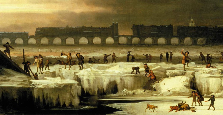





26 Dec 2020
Pontius Pilate and the shape of the waters /19. Why are the Lakes fading away?
In recent years what was known in the past as the Lake of Pilate has shrinked to two small ponds (Fig. 1), up to a point in which they both reduced to nothing.
However, in the fifteenth century the Lake of the Sibyl was large and extended, though within the limited boundaries of the glacial valley set within the cliffs of Mount Vettore. And, across the subsequent centuries, the Lake seems to have maintained its health and shape (despite the natural, repeated, seasonal variations in the water content of the basin), as reported not only by the literary sources, but also by a number of cartographers: if the Lake had been substantially a duplicated pond, some of them would have known and drawn in their maps, basing on the reports provided to them by their local correspondents. The only instances of a dual-shaped pond, a typical summer condition, are presented in manuscript Vat. Lat. 5241 and Father Fortunato Ciucci's "Chronicles of the Antique Town of Norsia", a sign that the duplication of the waters was not so frequent and was mainly caused by temporary summer droughts.
Certainly the second half of the nineteenth century was a turning point: from then on, the attestations to an increasing splitting of the basin dedicated to the name of Pontius Pilate are retrieved in many sources, both scholarly and cartographical. In the last quarter of the century a report written by Count Girolamo Orsi hints to a duplication of the waters. In 1879, the Lake was still seen as an ominous, single Lake by the members of the Italian Alpine Club; however, a few years later Giovanni Battista Miliani will describe the Lake as presenting itself in «the shape of spectacles», the same words which Pio Rajna, too, will use in 1897.
For the Lake of Pilate, the twentieth century is the age of increasing partition: across the annual seasons and the ceaseless variations of water levels, the basin will present a growing indentation duly represented in maps, aerial photographs and even vintage postcards. A notch that will eventually develop into a full separation of the two ponds, and total aridity in specific summer seasons of the current century.
Was such increasing depletion originated by some sort of collapse which happened, according to Pio Rajna, at the middle of the nineteenth century? We could not confirm Rajna's piece of information, provided to him by his local guides. Sure enough, a devastating earthquake hit Norcia and the adjoining land in 1859: however, we have no reports about severe damages which might have occurred in the area of Castelluccio di Norcia, not far from the Lake, nor we found any sources attesting to specific physical effects that might have been produced by the seismic waves on Mount Vettore and its glacial cirque, as it will actually happen one hundred fifty-seven years later during the frightful, much powerful 2016 earthquake.
May a possible reason be found in the most recent earthquakes? Scientists do not seem to support this sort of scenario.
In December 2019, a study on the potential variations of the hydrogeological conditions of the Lake after the 2016 seismic sequence, from which we already quoted at the beginning of the present research paper, highlighted «the absence of geomorphological evidence of seismic-induced surface fractures generated by the seismic sequence 2016-2017»: thus, water was not missing as an effect of possible leaks caused by cracks opened in the Lake's bottom. The researchers concluded that «the complete drying of the lake, occurred in summer 2017, was probably due to meteoclimatic reasons», rather than «not yet verified variations in the permeability characteristics of the surface deposits and/or bedrock affecting the infiltration towards the subsoil, caused by severe seismic shaking» (Fig. 2).
According to the above study, if water was missing the phenomenon occurred out of «water overflow through the Fonte del Lago spring [towards the underlying valley, editor's note] [...], the evaporation from the lake surface [... and] the drainage through the scarcely permeable glacial deposits towards the Basal Calcareous Aquifer, hosted within the limestone at lower altitude», with no observable drainage effect from potential sinkholes produced in the rock by earthquakes.
Can depletion in the Lake's water have been induced by other sorts of physical effects? The answer is yes indeed.
In the present paper, we are about to set down the reasons for the potential, imminent disappearance of the Lakes of Pilate, in a looming future which is now close to us.
From the mid of the nineteenth century onwards, two nasty effects have been heavily affecting the health and shape of the former Lake of Pilate.
Let's start with the most critical, most severe factor that is leading Mount Vettore's basin in the direction of a slow, fated death.
And this is climate change.
Ponzio Pilato e la forma delle acque /19. Perché i Laghi stanno sparendo?
In anni recenti, ciò che un tempo era conosciuto con il nome di Lago di Pilato si è ridotto a due piccoli bacini (Fig. 1), fino ad arrivare al punto in cui entrambi sono giunti a ridursi a nulla.
Eppure, nel quindicesimo secolo il Lago della Sibilla era grande ed esteso, seppure entro i confini limitati della valle glaciale situata tra le ripide pareti del Monte Vettore. E, nel corso dei secoli successivi, il Lago parrebbe avere mantenuto il proprio florido aspetto (malgrado le naturali, cicliche variazioni naturali dei livelli delle acque contenute nel bacino), così come riportato non solo nelle fonti letterarie, ma anche in varie mappe: se il Lago fosse stato costituito sostanzialmente uno specchio d'acqua duplice, alcuni di questi cartografi ne sarebbero stati a conoscenza e ne avrebbero tracciato la forma nelle proprie opere grafiche, sulla base dei rapporti acquisiti grazie ai propri corrispondenti locali. Gli unici esempi di menzioni relative a un duplice bacino, una condizione tipicamente estiva, sono contenuti nel manoscritto Vat. Lat. 5241 e nelle "Istorie dell'antica città di Norcia", un segno del fatto che la duplicazione delle acque non era così infrequente ed era principalmente causata da temporanei periodi di siccità estiva.
Di certo la seconda metà del diciannovesimo secolo ha costituito un punto di svolta: d'allora in poi, le testimonianze relative ad una crescente ripartizione delle acque del bacino dedicato a Ponzio Pilato sono rinvenibili in diverse fonti, sia di genere erudito che cartografico. Nell'ultimo quarto del secolo un resoconto scritto dal Conte Girolamo Orsi pare accennare a una duplicazione delle acque. Nel 1879, il Lago viene ancora osservato come un singolo, impressionante specchio d'acqua dai membri del Club Alpino Italiano; eppure, pochi anni dopo Giovanni Battista Miliani descriverà il Lago in «forma di occhiali», le stesse parole delle quali anche Pio Rajna farà uso nel 1897.
Per il Lago di Pilato, il ventesimo secolo rappresenta l'epoca della crescente ripartizione: attraverso i cicli annuali delle stagioni e l'incessante variabilità dei livelli delle acque, il bacino presenterà un'intaccatura sempre più evidente, nonché debitamente testimoniata nelle mappe, nelle fotografie aeree e anche nelle cartoline postali d'epoca. Un dente che evolverà infine verso una completa separazione dei due specchi d'acqua, e il completo inaridimento in specifiche stagioni estive del corrente secolo.
Questo crescente depauperamento è stato forse causato da una qualche sorta di collasso che ebbe luogo, secondo Pio Rajna, alla metà del diciannovesimo secolo? Non siamo stati in grado di confermare il dato fornito dal Rajna, e a lui comunicato dalle sue guide locali. Certamente, un devastante terremoto colpì Norcia e gli adiacenti territori nel 1859: nondimeno, non disponiamo di alcuna testimonianza a proposito di danni significativi che abbiano potuto verificarsi nell'area di Castelluccio di Norcia, non lontano dal Lago, né abbiamo potuto reperire alcuna fonte che attestasse l'occorrenza di specifici effetti visibili che possano essere stati prodotti dalle onde sismiche sul Monte Vettore e il suo circo glaciale; come in effetti avrà luogo, invece, centocinquantasette anni più tardi durante lo spaventoso e assai più potente terremoto del 2016.
Potremmo forse identificare una possibile ragione per il depauperamento del Lago nei più recenti terremoti? Gli scienziati non sembrano sostenere questo genere di scenario.
Nel dicembre del 2019, uno studio condotto in relazione alle possibili variazioni delle condizioni idrogeologiche del Lago a valle della sequenza sismica del 2016, dal quale abbiamo già avuto occasione di trarre interessanti considerazioni all'inizio del presente articolo di ricerca, mise in rilievo «l'assenza di evidenze geomorfologiche a proposito di fratture superficiali indotte dallo scuotimento che siano state generate dalla sequenza sismica 2016-2017»: dunque, la carenza d'acqua non pareva essere dovuta a potenziali perdite provocate da fessurazioni apertesi nel fondo del Lago. I ricercatori hanno quindi concluso che «il completo disseccamento del Lago, occorso nell'estate 2017, è stato probabilmente causato da ragioni meteoclimatiche», piuttosto che «da variazioni non ancora verificare nelle caratteristiche di permeabilità della superficie detritica e/o della roccia massiccia, che abbiano potuto influire sull'infiltrazione [delle acque] attraverso il sottosuolo, a causa delle intense sollecitazioni sismiche» (Fig. 2).
Secondo lo studio citato, se l'acqua appare mancare ciò è dovuto a «scarico delle acque attraverso la sorgente denominata Fonte del Lago [posta in direzione della sottostante valle, n.d.r.] [...], all'evaporazione della superficie del lago [... e] dall'assorbimento dell'acqua attraverso i depositi glaciali scarsamente permeabili in direzione della struttura acquifera calcarea sottostante, inglobata nella roccia a quote più basse», e quindi con nessuna perdita osservabile che sia causata da doline potenzialmente prodottesi nel calcare a seguito dei terremoti.
Forse la diminuzione dei livelli delle acque nel Lago è stata indotta da altre tipologie di effetti fisici? La risposta, certamente, è sì.
Nel presente articolo, stiamo per andare a illustrare le ragioni per la possibile, imminente sparizione dei Laghi di Pilato, in un incombente futuro che è ormai estremamente vicino.
Dalla metà del diciannovesimo secolo in poi, due effetti malevoli hanno pesantemente influito sulla salute e sulla forma di ciò che noi conoscevamo un tempo come il Lago di Pilato.
Cominciamo con il fattore più critico e più grave, che sta conducendo il bacino presente all'interno del Monte Vettore verso una lenta, inesorabile morte.
E questo fattore si chiama cambiamento climatico.
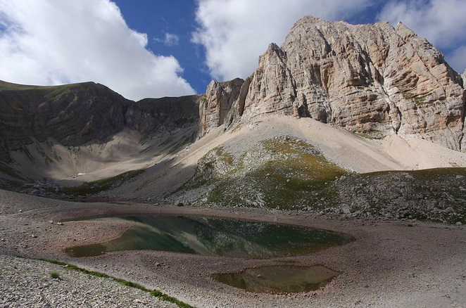

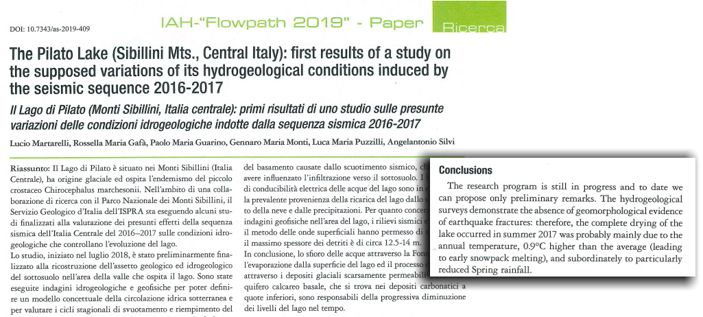

22 Dec 2020
Pontius Pilate and the shape of the waters /18. The Lakes, today
You may park your car at Forca di Presta, the pass set between Umbria and Marche, on the southern edge of Mount Vettore: from there, you may climb the titanic mountain up to the shelter 'Rifugio Zilioli'; then the trail leads straight down into the glacial cirque. Or, as an alternative track, you may reach the isolated hamlet of Foce di Montemonaco, and then walk up the valley of River Aso and get to the glacial cirque from below.
In both cases, you will get to the astounding setting in which the Lakes of Pilate lie: two enchanted, fascinating mirrors of greenish-blue waters surmounted by lofty towers of sheer rock (Fig. 1).
And the vista is even more overwhelming from high above, if you are so bold as to walk the narrow, arched crests of Mount Vettore, set between precipitous ravines on both sides: the Lakes, down below, appear to be lost in their glacial cradle, with all their load of legends and sinister tales (Fig. 2).
However, when you happen to behold this place hidden within the most secret heart of Mount Vettore, in the very core of the Sibillini Mountain Range, an undisputable fact is to be noted: the Lakes are always two.
In our present days, nobody has ever had the chance to see a large single Lake anymore, the way it was depicted by Antoine de la Sale in his fifteenth-century manuscript or, in more recent times, by the magazine "L'Illustrazione Italiana" in 1879.
The large, rounded, or even elongated Lake of Pilate, as portrayed in numerous maps and described by many ancient literary sources, is lost forever.
Today, in years when rainfalls and snowfalls are copious and summers are not exceedingly hot, visitors may still hope to see the Lakes partially joined to form a sort of oblong, indented basin: this condition is documented by a number of pictures taken in the first fifteen years of the twenty-first century, both in winters and summers (Fig. 3). Nonetheless, the basic disposition of the basin to arrange itself in a dual pattern remains clear and indubitable, with ample variations of water levels having been observed across the years.
But in more recent years, the intense heat scorching the Lakes during the latest, extremely warm summers, and the increasing scarcity of rainfalls and snows, have endangered the very existence of these Apennine waters.
Pictures taken in 2007 (Fig. 4), 2011 (Fig. 5) and 2020 (Fig. 6) provide a gloomy vision of a progressive, though widely oscillating, decrease in the water content of the glacial basin: the two ponds appear to be fully parted, with an overall reduction of the liquid surfaces.
Conditions of strong depletion were not infrequent in the past, too. If we look at a picture dating to 1990, we find a similar contraction of the waters (Fig. 7); and all this cannot but remind us of the sixteeenth-century drawing which is found in manuscript Vat. Lat. 5241, with the two ponds marked by a similar, substantial lack of waters.
However, it is undeniable that complete depletion of the liquid content of both Lakes is increasingly becoming a sort of almost normal condition: the severe droughts which occurred in 2017 (Fig. 8) and 2020 (Fig. 9) rendered the two ponds a ghostly footprint of themselves, with the utter disappearance of all traces of water.
And the contrast between the large, single Lake as seen by Antoine de la Sale, and our current duplicated, dried-up Lakes is blatantly outright. And almost unbearable.
Before the above visions, we stand speechless.
Yet we must progress further into our investigations, and address the possible, additional reasons for the potential disappearance of the Lakes of Pilate.
Ponzio Pilato e la forma delle acque /18. I Laghi, oggi
Potete parcheggiare la vostra auto a Forca di Presta, il passo situato tra Umbria e Marche, presso il lato meridionale del Monte Vettore: da lì, potete ascendere la titanica montagna su fino al Rifugio Zilioli; poi, il sentiero conduce direttamente giù all'interno del circo glaciale. Oppure, come percorso alternativo, potete recarvi presso l'isolato villaggio di Foce di Montemonaco , e poi risalire lungo la valle del fiume Aso fino a raggiungere il circo glaciale partendo da quote più basse.
In entrambi i casi, arriverete fino allo straordinario scenario nel quale giacciono i Laghi di Pilato: due affascinanti, incantati specchi ricolmi d'acqua turchese, sormontati da strapiombanti torri di roccia precipite (Fig. 1).
E la vista sarà ancora più strabiliante se salirete più in alto, e se avrete il coraggio di percorrere le sottili, arcuate creste del Monte Vettore, poste tra spaventosi precipizi che si aprono sul vuoto da ambo i lati: i Laghi, lì sotto, sembrano perdersi all'interno della loro culla glaciale, con tutto il loro carico di leggende e tenebrosi racconti (Fig. 2).
Eppure, quando vi capiterà di contemplare questi luoghi nascosti nel cuore più segreto del Monte Vettore, al centro dei Monti Sibillini, non potrete non notare un fatto indiscutibile: i Laghi sono sempre due.
Ai nostri giorni, nessuno ha più avuto la possibilità di osservare un singolo Lago, così come esso fu rappresentato da Antoine de la Sale nel proprio manoscritto quattrocentesco o, in tempi più recenti, nella rivista "L'Illustrazione Italiana" nell'anno 1879.
Quel grande Lago di Pilato, arrotondato o anche in forma allungata, ritratto in varie mappe e descritto in numerose fonti letterarie antiche, è perduto per sempre.
Oggi, in anni nei quali le piogge e le precipitazioni nevose sono abbondanti e le estati non sono eccessivamente torride, i visitatori possono ancora sperare di vedere i Laghi parzialmente uniti a formare una sorta di bacino oblungo e profondamente inciso: questa condizione è documentata da una serie di immagini scattate durante i primi quindici anni del ventunesimo secolo, sia in inverno che in estate (Fig. 3). Nondimeno, la fondamentale tendenza di quello specchio d'acqua a disporsi secondo una configurazione duale rimane chiara e incontrovertibile, con ampie variazioni dei livelli di liquido osservabili nel corso degli anni.
Ma in anni più recenti, l'intenso calore che ha riscaldato i Laghi durante le ultime, roventi estati, e la crescente scarsità di piogge e nevi, hanno posto a rischio l'esistenza stessa di queste acque appenniniche.
Le fotografie scattate nel 2007 (Fig. 4), nel 2011 (Fig. 5) e nel 2020 (Fig. 6) ci presentano la cupa visione di un progressivo, seppure fortemente oscillante, decremento nel contenuto d'acqua del bacino glaciale: i due Laghi si mostrano al visitatore in modo completamente ripartito, con una complessiva riduzione delle superfici liquide.
Condizioni di forte depauperamento non sono state infrequenti nemmeno in passato. Se osserviamo immagini risalenti al 1990, ci imbattiamo in un'analoga contrazione delle acque (Fig. 7); e tutto questo non può non riportare alla nostra mente il diagramma rinvenuto all'interno del manoscritto cinquecentesco Vat. Lat. 5241, con i due bacini caratterizzati da una paragonabile, sostanziale mancanza d'acqua.
D'altra parte, è innegabile come un completo depauperamento nel contenuto liquido di entrambi i Laghi stia diventando, in modo sempre più frequente, una sorta di condizione quasi normale: le intense siccità occorse negli anni 2017 (Fig. 8) e 2020 (Fig. 9) hanno reso i due bacini una sorta di spettrali impronte di se stessi, con la completa sparizione di ogni traccia d'acqua.
E il contrasto tra il grande, singolo Lago osservato da Antoine de la Sale e i nostri attuali Laghi, duplicati e disseccati, diventa platealmente evidente. E quasi insopportabile.
Di fronte a una visione di questo genere, non si può che rimanere ammutoliti.
Eppure, dobbiamo ancora addentrarci ulteriormente nella nostra investigazione, e affrontare la questione che riguarda le possibili, ulteriori ragioni che stanno alla base della potenziale scomparsa dei Laghi di Pilato.
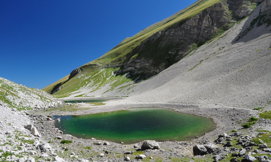

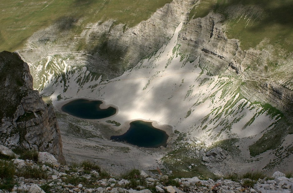

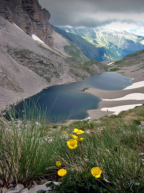

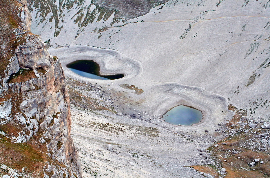

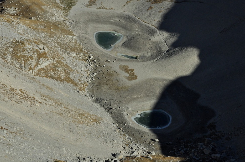

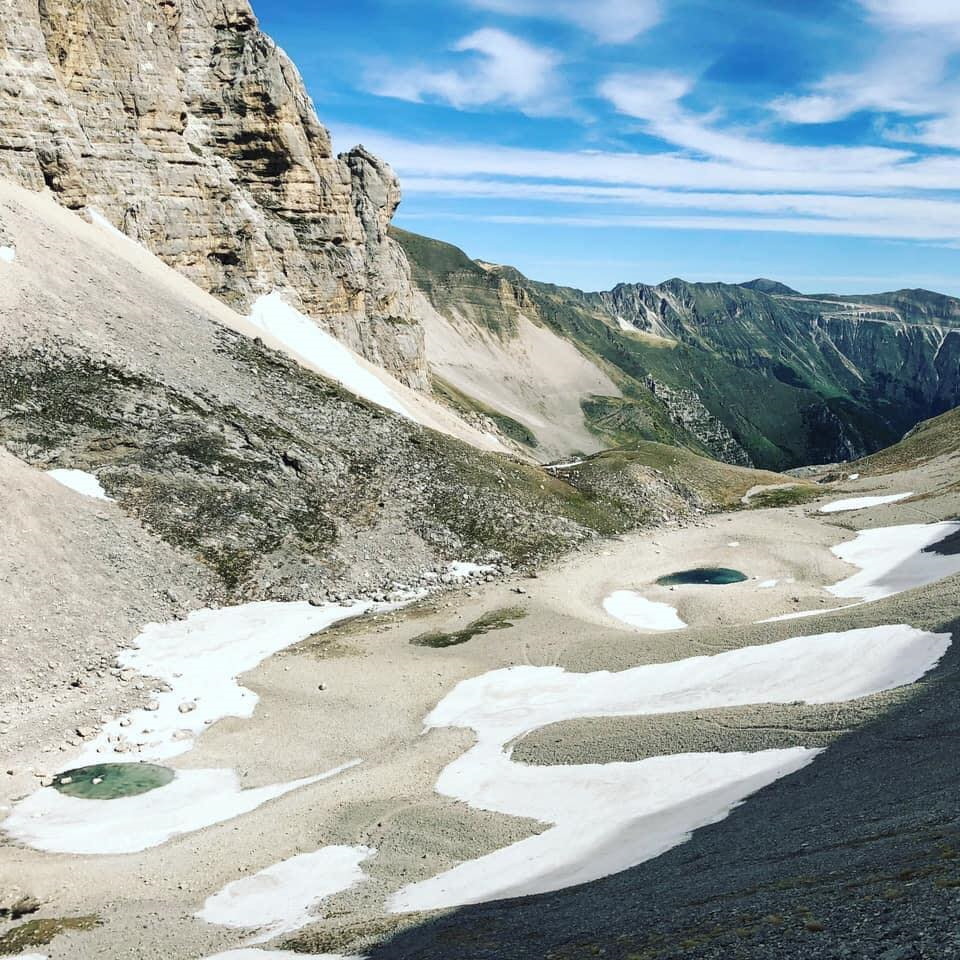

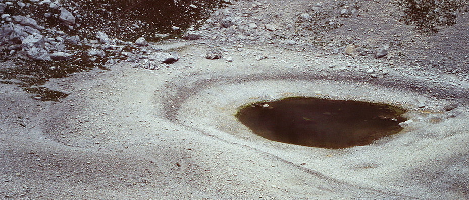

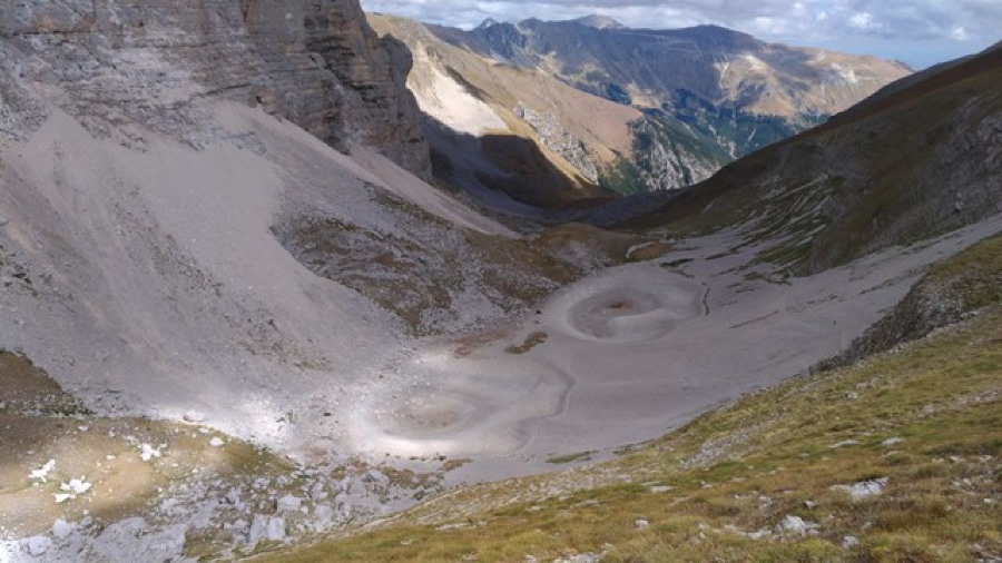

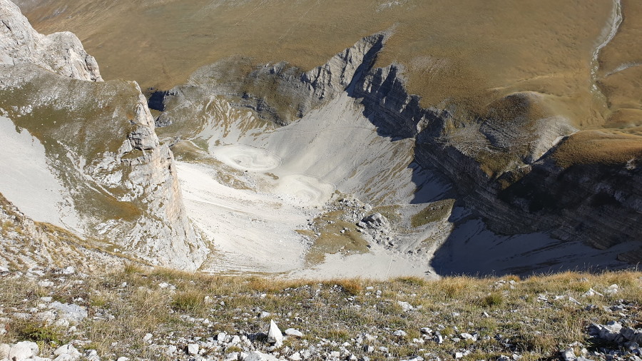

20 Dec 2020
Pontius Pilate and the shape of the waters /17. The twentieth century's Lakes
The Lakes of Pilate. Two fully separate Lakes, or, when at their best, two ponds connected by a slim stretch of water.
This is the shape that, from the end of the nineteenth century, throughout the twentieth and beyond, we finally observe for the basin set within the arms of Mount Vettore.
There will be no large, extended, single Lake anymore. Starting from the words written by Pio Rajna in 1897, which reverberate the same words already set down by Girolamo Orsi and Giovanni Battista Miliani a few years before, we will always encounter representations and descriptions of a substantially duplicated pond, with moments of extreme depletion and even total dryness.
A first image of a Lake of Pilate which is gradually splitting in two isolated mirrors of water is presented in the framework of a large mapping project which was initiated by the Kingdom of Italy in the year 1872 for the cartographic coverage of the whole Italian peninsula.
Between the end of the nineteenth century and the first half of the twentieth, the Italian Military Geographical Institute began to release a comprehensive cartography of the Italian territory, with a 1:100.000 scale. The complete series will include 285 sheets, each divided into four quadrants at a higher scale of 1:50.000.
The earliest phase of development of the above collection of sheets and quadrants is indicated as «first measurement campaign» («prima levata» in Italian). To this initial stage belongs the second quadrant of Sheet 132, drawn in 1895: it is the map of the territory of Arquata del Tronto, on the southern side of Mount Vettore. And, in it, we are given a vision of the Lake of Pilate as it appeared to visitors only two years before the place was reached by Pio Rajna (Fig. 1).
In this map, the geographers of the Military Geographical Institute depict a Lake of Pilate marked by a noticeable indentation, which almost parts the Lake into two smaller Lakes.
This is an early sign of the process which is leading, following a catastrophic event such as an earthquake or out of a potential increasing scarcity of rainfalls and snowfalls, to a substantial decrease in the level of water present in the Lake, with a growing tendency of the same waters to lie in two different, smaller basins, like the «pair of spectacles» that Pio Rajna will behold two years later.
Later in the twentieth century, we cannot retrieve any reference to the Lake of Pilate in the road maps of Italy published by the Italian Touring Club dating to 1940: the folium 16, which shows the eastern portion of central Italy, only portrays Mount Vettore with its arched glacial cirque, but with no trace of waters in it (Fig. 2).
Nonetheless, the spectacles-like appearance of the Lake of Pilate is further attested by a key protagonist of the scientific research concerning the Sibillini Mountain Range: Cesare Lippi-Boncambi, a professor of Mineralogy and Geology of the Department of Agronomy at the University of Perugia, who drafted a first comprehensive catalogue of the Umbrian hollows, including the Sibyl's Cave on Mount Sibyl, of which he drew a most famous map, dating to 1946 and depicting the entrance chamber.
In his “Circulation of subterranean waters in the plateau of Castelluccio” (1947), he provides a chart of the Pian Grande and Mount Vettore, which was set down following a number of on-site, geological-oriented surveys. And the shape of the Lake he portrays is very similar to that shown in the map released in 1895 by the Military Geographical Institute: the waters are marked by a deep notch at the middle of the basin, a clear sign of a tendency to part in two separate ponds (Fig. 3).
In a 1952 map of the territory of Arquata del Tronto, edited by the Italian Geographical Military Institute, we see a hale and hearty Lake of Pilate: its shape is exceedingly elongated, but the dividing notch is almost vanished, and the two basins appear to be fully connected via an adequate quantity of water (Fig. 4). However, this was not the actual truth about the real conditions of the Lake set within the Sibillini Mountain Range.
In that same year, a photographic postcard sent from the small town of Montemonaco to Rome portrays the Lake as it really was around that same period of time: a depleted basin, its waters almost completely parted by a rocky tongue covered with snow (Fig. 5). The ancient, single, rounded pond depicted by Antoine de la Sale was definitely gone; and no hint to the likeness of the impressive Lake represented in the magazine "L'Illustrazione Italiana" in 1879 can be retrieved anymore.
From now on, the decline in the water level observed at the Lake of Pilate appears to be inexorable.
In 1954 an aircraft of the Military Geographical Institute, flying at an altitude of 19,600 feet, shot an aerial photograph of the land down below. The black-and-white, high-resolution image shows a pair of distinct Lakes, a rocky stretch fully protruding between the two mirrors of water (Fig. 6).
And possibly to 1956 is to be dated another postcard which shows the sad reality of a once-single Lake: the two mirrors of waters are now portrayed in their isolation, with arms filled with shallow water that seem to make an attempt to reach one another. But it is just a tentative endeavour: it is clear that something has changed forever, and the two small Lakes never again will return to be a single, ominous Lake (Fig. 7).
Again, in another photographic postcard sent in 1960 and possibly shot in the late 1950s we find a Lake of Pilate only poorly filled with water, the southern pond stretching out its finger to reunite with its fellow-basin to the north (Fig. 8).
Thus a dual shape of the Lakes of Pilate will be the ordinary condition normally encountered throughout the twentieth century, as thousands of hikers who have repeatedly been visiting the Sibillini Mountain Range in the final quarter of the last century know well, and as attested by another aerial photograph, this time shot in the early fall of 1991 (Fig. 9).
So, the healthy Lake overflowing with water and popping up merrily from a later map published by the Military Geographical Institute in 2008 (Fig. 10) seems to be a mere ghost of some earlier site survey effected by the Italian geographers long time before: in that years, the Lake's real conditions were significantly sadder, and water's depletion was getting worse and worse.
Because now we have finally reached our twenty-first century.
And here are our Lakes of Pilate of today. In the next chapter.
Ponzio Pilato e la forma delle acque /17. I Laghi del ventesimo secolo
I Laghi di Pilato. Due Laghi totalmente separati, o, nelle condizioni migliori, due bacini collegati solamente tramite uno stretto braccio d'acqua.
È questa la forma che, a partire dalla fine del diciannovesimo secolo, attraverso tutto il ventesimo e anche oltre, possiamo osservare in relazione allo specchio d'acqua posto tra le braccia del Monte Vettore.
Quel singolo Lago, grande, esteso non apparirà mai più. A partire dalle parole scritte da Pio Rajna nel 1897, che echeggiano parole analoghe già vergate da Girolamo Orsi e Giovanni Battista Miliani alcuni anni prima, ci imbatteremo sempre in rappresentazioni e descrizioni concernenti un Lago sostanzialmente duplicato, con periodi di estrema sofferenza e anche di totale disseccamento.
Una prima immagine del Lago di Pilato in fase di graduale partizione in due isolati specchi d'acqua è presente nel contesto di un esteso progetto cartografico che fu intrapreso dal Regno d'Italia nell'anno 1872, al fine di mappare l'intera penisola italiana.
Tra la fine del diciannovesimo secolo e la prima metà del ventesimo, l'Istituto Geografico Militare iniziò a pubblicare una cartografia completa del territorio nazionale, in scala 1:100.000. La serie completa comprenderà 285 fogli, ognuno suddiviso in quattro quadranti rappresentati con una scala superiore pari a 1:50.000.
La prima fase di sviluppo del predetto catalogo di fogli e quadranti è indicata come «prima levata». A questo stadio iniziale appartiene il secondo quadrante del Foglio 132, tracciato nel 1895: si tratta della mappa relativa al territorio di Arquata del Tronto, il borgo posto sul lato meridionale del Monte Vettore. E, in questo quadrante, ci viene fornita una visione del Lago di Pilato così come esso appariva ai visitatori solamente due anni prima che il luogo fosse raggiunto da Pio Rajna.
In questa mappa, i cartografi dell'Istituto Geografico Militare ritraggono un Lago di Pilato segnato da una evidente intaccatura, la quale quasi suddivide il Lago in due Laghi più piccoli (Fig. 1).
Si tratta di un segno che anticipa il processo che sta conducendo, a seguito di un catastrofico evento quale un terremoto o forse a motivo della sempre più frequente scarsità di piogge e nevi, verso un decremento delle quantità d'acqua presenti nel Lago, con una crescente tendenza a ripartirsi su due differenti bacini di minori dimensioni, proprio come il «par d'occhiali» che sarà osservato da Pio Rajna due anni più tardi.
Inoltrandosi nel ventesimo secolo, non è possibile rinvenire alcun riferimento al Lago di Pilato nelle mappe stradali pubblicate dal Touring Club Italiano, risalenti al 1940: il foglio 16, che mostra la porzione orientale del centro Italia, riporta solamente il Monte Vettore con il suo arcuato circo glaciale, ma senza alcuna traccia di acque in esso (Fig. 2).
Malgrado ciò, la configurazione in forma d'occhiale del Lago di Pilato è ulteriormente attestata da un protagonista della ricerca scientifica avente ad oggetto i Monti Sibillini: Cesare Lippi-Boncambi, professore di Mineralogia e Geologia presso la Facoltà di Agraria dell'Università di Perugia, il quale per primo tracciò un esaustivo catalogo delle grotte e cavità umbre, compresa la Grotta della Sibilla posta sulla vetta dell'omonima montagna, della quale egli tracciò un celebre diagramma, risalente al 1946 e rappresentante il vano d'ingresso.
Nel suo articolo "Idrologia sotterranea dell’Altipiano di Castelluccio" (1947), egli fornisce un diagramma relativo al Pian Grande e al Monte Vettore, delineato sulla base di una serie di sopralluoghi geologici eseguiti in sito. E la forma del Lago da lui ritratto risulta essere molto simile a quella rappresentata nella cartografia rilasciata dall'Istituto Geografico Militare nell'anno 1895: le acque sono segnate da un profondo dente situato nel mezzo del bacino, un chiaro segnale che indica una progressiva tendenza verso una suddivisione in due separati specchi d'acqua (Fig. 3).
In una mappa risalente al 1952, elaborata dall'Istituto Geografico Militare e relativa al territorio di Arquata del Tronto, possiamo osservare un Lago di Pilato in ottime condizioni: il suo aspetto si presenta come eccessivamente allungato, ma il dente di partizione sembra essere quasi del tutto svanito, con i due bacini che sembrano essere in completa interconnessione grazie a un'adeguata quantità di acqua (Fig. 4). Eppure, non era affatto questa la verità in merito alle reali condizioni del Lago situato tra i Monti Sibillini.
In quello stesso anno, una cartolina postale inviata a Roma dalla piccola città di Montemonaco ritrae il Lago come esso realmente era in quel medesimo periodo di tempo: un bacino depauperato, le acque quasi completamente separate da una lingua rocciosa ricoperta di neve (Fig. 5). L'antico Lago, singolo e circolare, descritto da Antoine de la Sale era definitivamente sparito; e nessun segno dell'impressionante bacino rappresentato nel 1879 dalla rivista periodica "L'Illustrazione Italiana" può essere più rinvenuto.
Da allora in poi, il declino del livello delle acque, osservato presso il Lago di Pilato, appare essere irreversibile.
Nel 1954 un velivolo dell'Istituto Geografico Militare, volando a un'altitudine di 6.000 metri, scattò una serie di fotografie aeree del territorio che si dispiegava in basso, in lontananza. L'immagine in bianco e nero e ad alta risoluzione mostra una coppia di Laghi distinti, con un promontorio roccioso che si interpone in modo evidente tra i due specchi d'acqua (Fig. 6).
E forse al 1956 risale anche un'altra cartolina postale, che testimonia la triste realtà di un Lago un tempo singolo: i due bacini sono ora ritratti nel proprio pieno isolamento, con un braccio ricoperto da basse acque, nello sforzo vicendevole di raggiungersi e toccarsi. Ma si tratta solamente di un vano tentativo: è chiaro infatti come qualcosa sia cambiato per sempre, e come i due piccoli Laghi non siano più in grado di tornare a essere un singolo, impressionante bacino (Fig. 7).
Ancora, in un'ulteriore cartolina spedita nel 1960 e la cui immagine è stata forse acquisita sul finire degli anni 1950, troviamo un Lago di Pilato contenente una scarsa quantità d'acqua, con il bacino meridionale che protende il proprio liquido dito a tentare di riunirsi con il proprio compagno posto più a settentrione (Fig. 8).
Dunque una forma duplice dei Laghi di Pilato costituirà la condizione ordinaria usualmente osservabile durante tutto il corso del ventesimo secolo, come migliaia di escursionisti, recatisi più volte in visita presso i Monti Sibillini nell'ultimo quarto dell'ultimo secolo, sanno bene, e come attestato anche da un'altra fotografia aerea, scattata stavolta all'inizio dell'autunno del 1991 (Fig. 9).
E così, il florido Lago che fa felicemente capolino, con le proprie abbondanti acque, dalla più tarde mappe pubblicate dall'Istituto Geografico Militare nel 2008 (Fig. 10) non sembrano essere altro che il mero fantasma di qualche precedente sopralluogo, effettuato dai cartografi dell'Istituto molto tempo prima: in quegli anni, le reali condizioni del Lago erano assai più melanconiche, e la riduzione delle acque continuava a procedere in modo inesorabile.
Perché ora abbiamo raggiunto, infine, il nostro ventunesimo secolo.
Ed ecco come appaiono oggi i nostri Laghi di Pilato. Nel prossimo capitolo.
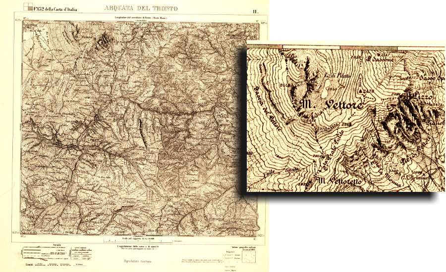

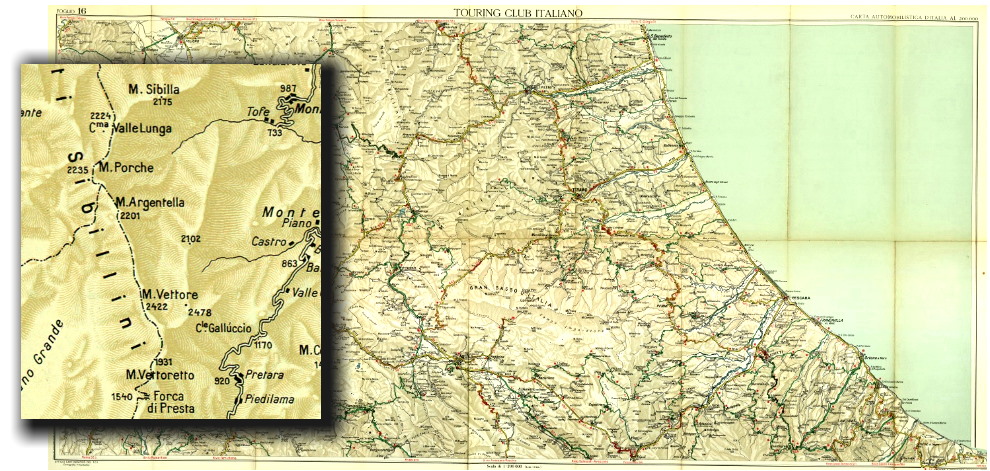

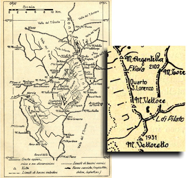

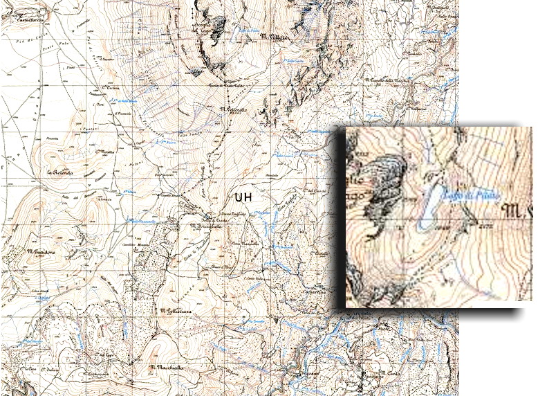

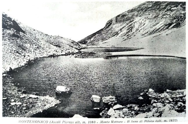

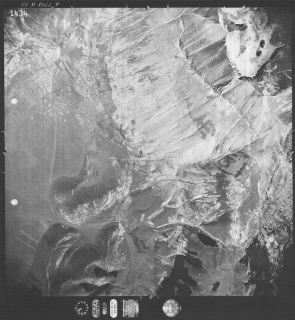

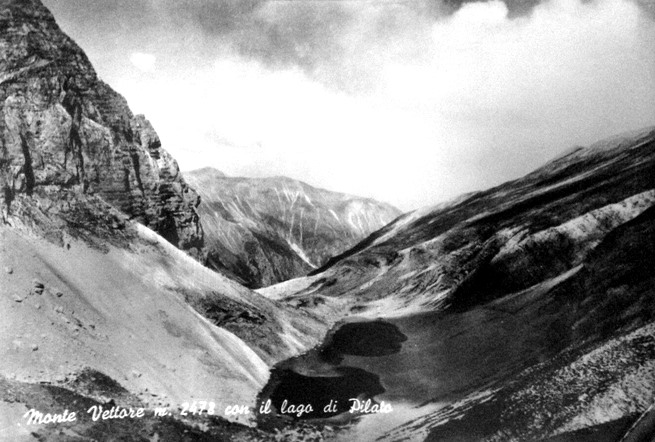

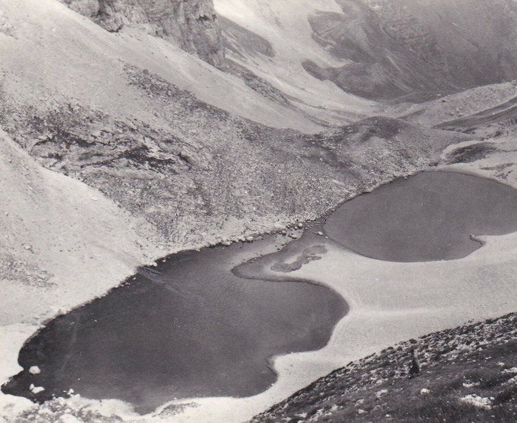

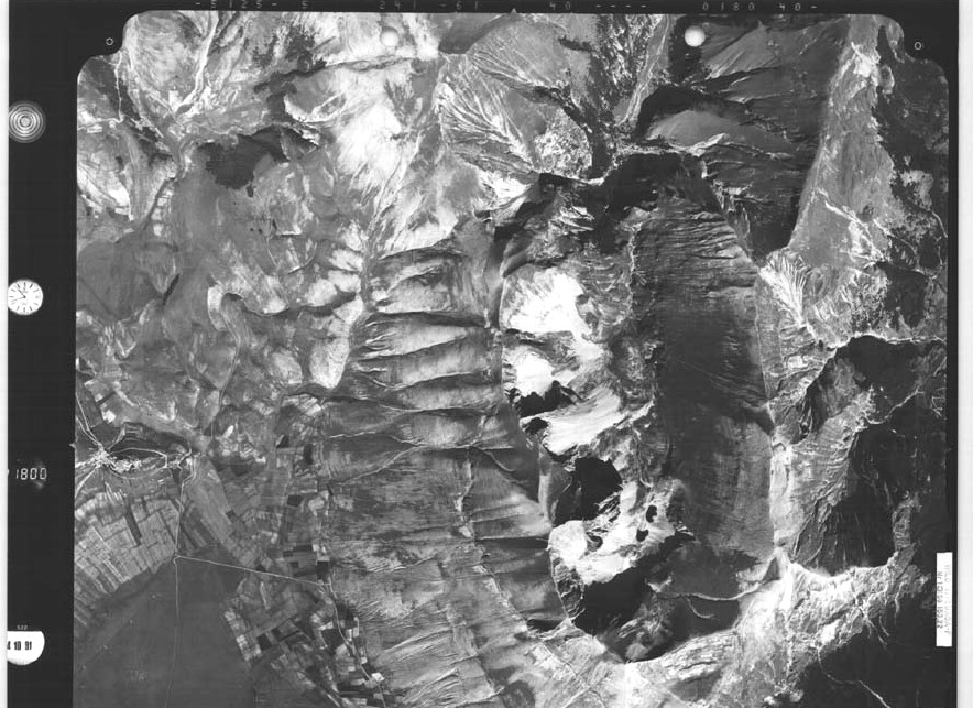

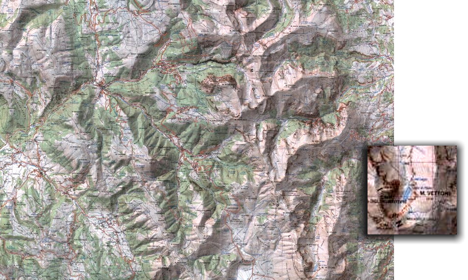

17 Dec 2020
Pontius Pilate and the shape of the waters /16. Italian Alpine Club vs. Pio Rajna: who's in the right?
According to the words written by Pio Rajna in 1897, the Lake of Pilate lost permanently its former aspect as a single basin some forty years earlier, possibly in 1859 as a side effect of the earthquake that hit Norcia that year. In this framework, the alpinists coming from Perugia in the summer of 1879 would have beheld a doubled surface of water, in the form of «a pair of spectacles», as Pio Rajna effectively happened to describe it.
But they saw a single Lake instead.
And their testimony is fully confirmed by another witness, who wrote a different account of the same journey carried out to Mount Vettore in 1879. The witness is an aristocratic lady from Perugia, Countess Lucia Rossi Scotti, who was so bold as to join the distinguished party of men, and men only, that left the Umbrian town to make that daring expedition in the wilderness of the Sibillini Mountain Range. In a letter written a few months later, she recounted their ascent to the high cliffs of Mount Vettore and the gorgeous vista into the glacial cirque underneath they were able to enjoy from up there (Fig. 1):
«... The greenish, gloomy Lake of Pilate, lying in that gorge out of the melting of snows...».
[In the original Italian text: «... L'oscuro verde Lago di Pilato formatosi fra quelle gole per il disgelamento dei ghiacci...»].
Again, no Lakes are mentioned; instead, we have one Lake.
Is something wrong with our tentative reconstruction of the possible event which led to a change in the shape of the Lake? And, did any such event really happen?
If Pio Rajna was right, how could the members of the Italian Alpine Club see a Lake of Pilate in a shape that was typical of older days? How could they observe a single basin, an aspect which sure enough nobody ever had the chance to behold again in more recent years, as we will see in later paragraphs?
There is no positive, confident answer to these questions.
If we stick to the proof provided by our 1879 magazine, "L'Illustrazione Italiana", and the words written by Countess Rossi Scotti, in the final quarter of the nineteenth century the Lake still happened to appear the way it was four hundred sixty years earlier, when Antoine de la Sale paid his visit to the land of the Sibyl.
For the sake of completeness, let's ask ourselves a further, ultimate question: is there any chance of a possible mistake having been made by the editors of "L'Illustrazione Italiana"?
We might try to consider that the magazine, which enjoyed a favorable renown owing to the high-quality drawings it used to publish, was overwhelmed at the time by the many sketches and descriptions that had been flowing in, sent by the enthusiastic attendees of the Annual Meeting:
«From the Alpinist congress held in Perugia drawings and accounts were shipped to the 'Illustrazione Italiana'; we publish the drawings of the trips to Mount Vettore and the Gran Sasso of Italy; the space is not enough to publish the most charming descriptions, written by the Alpinists, which complemented the sketches...» (Fig. 2).
[In the original Italian text: «Dal congresso degli Alpinisti tenuto a Perugia sono giunti all'Illustrazione disegni e descrizioni; pubblichiamo i disegni dell'escursione al Monte Vettore e al Gran Sasso d'Italia; lo spazio ci manca per pubblicare le bellissime descrizioni colle quali accompagnavano i disegni gli egregi alpinisti...»].
Maybe the editorial staff of the "L'Illustrazione" picked the sinister drawing which depicted the Lake of Pilate as it was in the past, while a second, unpublished sketch, less emotional, showed the Lakes in their true, duplicated form, as they possibly appeared to the alpinists. So the readers were given a vision of the Lake as it was earlier, and not as it was during the actual 1879 visit. And, perhaps, Lucia Rossi Scotti, who was no scientist nor scholar, did just write the sentence «... the greenish, gloomy Lake of Pilate...» even though he actually saw two ponds: an inaccuracy which would be fully pardonable with a Countess.
However, too many conjectures are involved in our attempt to stick to our assumption of a dual Lake in 1879, as a result of a potential, unproven collapse of the front edge of the Lake of Pilate in 1859. And so our whole effort seems to reduce to a mere, useless exercise.
Therefore, at this stage of our research, we can only accept the fact that in the year 1879 the Lake of Pilate had still the ability to appear to visitors in the form of a large, rounded, single basin, as portrayed in the pages of "L'Illustrazione italiana". Even though this piece of information appears to be in full contrast with the words written by Pio Rajna in 1897, which are possibly based on unreliable, erroneous words told to him by his local guides.
Further investigation will be needed to shed additional light on this puzzling issue, with specific research to be carried out at the historical archive in Montemonaco, the small town sitting on a hill before the cliff of Mount Sibyl, in search of hints and references to a possible depletion of the Lake which might have occurred at the mid of the nineteenth century, with a potential discharge of water down into the underlying valley and the course of the river Aso.
And there is also a further potential occurrence which might have dramatically altered the shape of the Lake of Pilate in this very same period. But we will confront with this possibility in a later chapter.
At the moment, only one thing seems to be certain: after 1879, nobody had the chance to see the Lake of Pilate in its impressive, single semblance ever again. From the end of the nineteenth century on, its ordinary shape will always be dual, with rare returns to an elongated, single-basin configuration in case of abundance of rainfalls and snowfalls.
We are now entering the final, twentieth-century phase of the life of our necromantic Lake. Let's see what happens.
Ponzio Pilato e la forma delle acque /16. Club Alpino Italiano contro Pio Rajna: chi ha ragione?
Secondo quanto scritto da Pio Rajna nel 1897, il Lago di Pilato perse permanentemente il proprio precedente aspetto di bacino singolo circa quaranta anni prima, forse nel 1859, in conseguenza del terremoto che colpì Norcia nel corso di quell'anno. In questo scenario, gli alpinisti che vennero da Perugia nell'estate del 1879 avrebbero dovuto osservare un duplice specchio d'acqua, nella forma di «un par d'occhiali», come Pio Rajna si trovò efficacemente a descriverli.
Essi, invece, videro un singolo Lago.
E la loro testimonianza ottiene un'ulteriore conferma da parte di un'altra testimone, la quale scrisse un differente resoconto della medesima escursione effettuata sul Monte Vettore nel 1879. Questa testimone è un'aristocratica gentildonna di Perugia, la Contessa Lucia Rossi Scotti, che arditamente decise di accompagnare il distinto gruppo di uomini, e soli uomini, che lasciarono la città umbra per recarsi, assai avventurosamente, tra le selvagge terre dei Monti Sibillini. In una lettera scritta alcuni mesi dopo, ella narrò di quell'ascesa compiuta raggiungendo le elevate creste del Monte Vettore, e della straordinaria vista che si apriva agli occhi degli escursionisti sul sottostante circo glaciale (Fig. 1):
«... L'oscuro verde Lago di Pilato formatosi fra quelle gole per il disgelamento dei ghiacci...».
Ancora una volta, non rinveniamo alcuna menzione a proposito di più Laghi: troviamo, invece, un ulteriore riferimento a un Lago singolo.
C'è qualcosa di sbagliato nel nostro tentativo di ricostruire il possibile evento che fu forse alla base di un mutamento nella forma del Lago? E, questo evento, accadde davvero?
Se Pio Rajna aveva ragione, come è possibile che i soci del Club Alpino Italiano abbiano potuto vedere un Lago di Pilato in una forma che era tipica di giorni ormai trascorsi? Come è possibile che essi abbiano osservato un bacino singolo, un aspetto che, certamente, nessun altro ebbe più modo di contemplare di nuovo in anni più recenti, come potremo verificare nei prossimi paragrafi?
Purtroppo, non esiste un risposta sicura e priva di incertezze a queste domande.
Se decidiamo di confidare nella prova fornita dalla nostra rivista pubblicata nel 1879, "L'Illustrazione Italiana", e nelle parole vergate nel medesimo anno dalla Contessa Rossi Scotti, nell'ultimo quarto del diciannovesimo secolo il Lago poteva ancora apparire nel modo in cui esso era solito presentarsi quattrocentosessanta anni prima, quando Antoine de la Sale effettuò la propria visita alle terre della Sibilla.
Per completezza e per non lasciare alcunché di intentato, proviamo a porci un'ultima, definitiva domanda: è forse possibile che i redattori de "L'Illustrazione Italiana" abbiano potuto commettere un errore?
Potremmo infatti prendere in considerazione il fatto che il periodico, il quale godeva di un buon successo di pubblico a motivo dei raffinati disegni che era solito pubblicare, fu sommerso, all'epoca, dai molteplici schizzi e descrizioni che erano stati inviati in redazione dagli entusiasti partecipanti al Congresso Annuale del C.A.I.: «dal congresso degli Alpinisti tenuto a Perugia sono giunti all'Illustrazione disegni e descrizioni; pubblichiamo i disegni dell'escursione al Monte Vettore e al Gran Sasso d'Italia; lo spazio ci manca per pubblicare le bellissime descrizioni colle quali accompagnavano i disegni gli egregi alpinisti...» (Fig. 2).
Forse lo staff editoriale de "L'Illustrazione" preferì scegliere il sinistro disegno raffigurante il Lago di Pilato come si presentava in passato, mentre un secondo disegno, mai pubblicato, perché meno emozionante, mostrava i Laghi nella loro vera forma duplice, così come esse erano forse apparsi agli occhi degli alpinisti? In questa ipotesi, ai lettori sarebbe stata proposta una visione del Lago come esso era in passato, e non come esso si presentò effettivamente durante quella visita del 1879. E, forse, Lucia Rossi Scotti, che non era né una scienziata, né un'erudita, scrisse quella frase «... l'oscuro verde Lago di Pilato...» malgrado ella avesse osservato, in effetti, un duplice bacino: un'imprecisione che risulterebbe essere del tutto scusabile in una Contessa.
Ma troppe ipotesi, troppe congetture occorre introdurre nel difficile tentativo di mantenere l'idea di un duplice Lago nel 1879, come conseguenza di un potenziale, ma mai provato collasso del fronte roccioso del Lago di Pilato nel 1859; così tante da ridurre il nostro intero sforzo a un esercizio inutile e vano.
Perciò, a questo stadio della nostra ricerca, non possiamo che prendere atto del fatto che nell'anno 1879 il Lago di Pilato aveva ancora la capacità di presentarsi di fronte ai visitatori nella forma di un grande, singolo bacino circolare, così come rappresentato nelle pagine de "L'Illustrazione italiana". Anche se questa occorrenza appare essere in totale contrasto con le parole scritte da Pio Rajna nel 1897, che sono forse basate su informazioni inaffidabili ed erronee a lui riferite dalle sue guide locali.
Saranno quindi necessarie ulteriori informazioni al fine di gettare ulteriore luce su questa questione che lascia alquanto perplessi, con ricerche specifiche da condursi presso l'archivio storico di Montemonaco, il piccolo borgo posto su di un colle che fronteggia il picco del Monte Sibilla, in cerca di indizi e riferimenti a proposito di un possibile svuotamento parziale del Lago che potrebbe avere avuto luogo alla metà del diciannovesimo secolo, con un potenziale riversamento di acque nella sottostante valle e lungo il corso del fiume Aso.
E c'è anche un altro potenziale evento che potrebbe avere alterato significativamente la forma del Lago di Pilato in quello stesso periodo. Ma affronteremo questa possibilità in un successivo capitolo.
Al momento, quindi, solo un fatto appare essere certo: dopo il 1879, nessuno ha più avuto modo di contemplare il Lago di Pilato nella sua impressionante forma singola. A partire dalla fine del diciannovesimo secolo, il suo aspetto ordinario sarà sempre duplice, con rare ricorrenze di una configurazione singola e assai allungata, in periodi di precipitazioni piovose e nevose particolarmente abbondanti.
Stiamo infatti per entrare nella fase finale, quella relativa al ventesimo secolo, nella vita del nostro negromantico Lago. Andiamo dunque a vedere cosa sta per accadere.
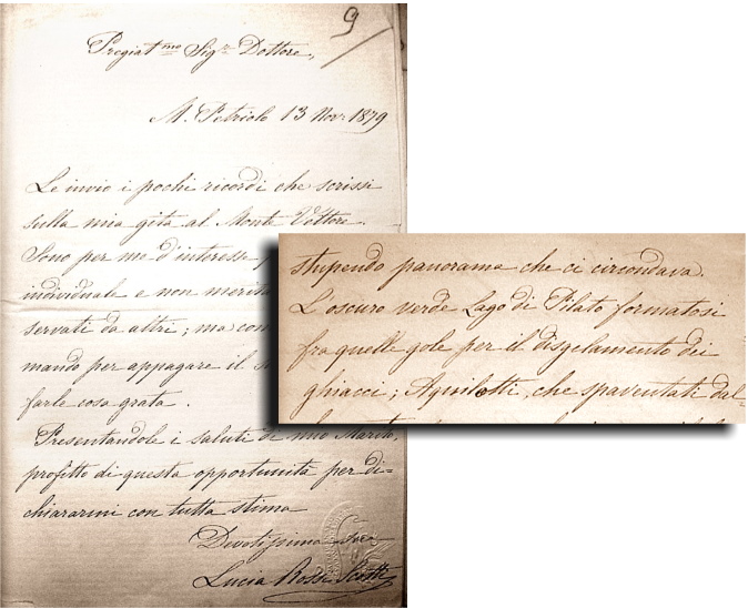

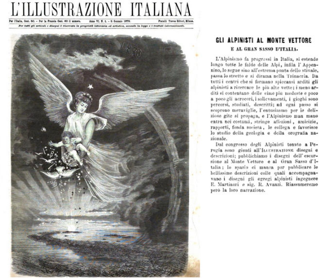

14 Dec 2020
Pontius Pilate and the shape of the waters /15. A dramatic change in 1859?
When Pio Rajna visited the Lake of Pilate in 1897, he positively beheld waters «divided in two elliptical mirrors», which looked like «a pair of spectacles»: a different vista when compared with the customary representation of the Lake, from Antoine de la Sale onwards. A vista which was possibly usual and ordinary in summer, as attested by a sixteenth-century drawing found in manuscript Vat. Lat. 5241, and subsequently confirmed by Father Fortunato Ciucci a century later.
However, when Pio Rajna sees the Lakes, a «fair quantity» of snow lies all around. Despite this most favourable presence, the mountain basin does not seem to be in good health: water is shallow and its shape is dual (Fig. 1).
Pio Rajna reports that, according to his local guides, «today the lake is not what it was in past times anymore. Around some forty years ago, it [the Lake] broke the natural dike at its front, a barrier that never formed again. So Antoine de la Sale beheld a lake with a significantly different appearance, and deeper».
Forty years earlier. Could that collapse have happened in the course of the earthquake that hit the region of Norcia in 1859?
In the original sources which narrate of the nineteenth-century seismic event, we can only retrieve partial information. Mannocchi does not provide any detail on the existing situation outside the town walls of Norcia following the shakings. Father Angelo Secchi reports that the small settlements north of Norcia (Abeto, Todiano, Ancarano, Capo del Colle) were extensively damaged. Large rocks tumbled down from the steep sides of Mount Patino, and cracks opened in the ground at specific locations of the town. Nonetheless, he states that Castelluccio di Norcia did not undergo any comparable level of destruction (Fig. 2):
«Castelluccio, a small hamlet set 5 miles from Norcia and built on solid rock was shaken but not damaged».
[In the original Italian text: «Il Castelluccio piccolo paese distante 5 miglia da Norcia posto sul sasso vivo fu scosso, ma non danneggiato»].
Certainly enough, the shaking, which according to Angelo Secchi was perceived as far as Camerino and Pesaro and even in Rome, also struck with some might the most elevated peaks of the nearby Sibillini Mountain Range, including Mount Vettore and its glacial cirque, set only a few miles east of Norcia. But did this nineteenth-century tremblor actually affect the rocky nest which houses the waters of the Lake of Pilate?
We are given no specific answer to this important question, which would provide an amazing link to the remark written by Pio Rajna in his 1897 report.
What we know for certain is that, in that same area, in 2016 a much stronger earthquake, featuring the very same epicentral point set at the foot of Mount Patino (Fig. 3), impacted visibly and titanically on Mount Vettore, the giant fault line running across its western side, and the most eleveted crests that loom over the Lakes of Pilate, with the opening of giant fissures at many spots of the mountain, and the total destruction of Castelluccio di Norcia.
On the other hand, an earthquake of similar magnitude (5.8) which occurred in the same region on 19 September 1979 did not affect significantly the area of the Pian Grande, as reported by Romano Cordella in his article “Visita ai centri del nursino colpiti dal terremoto” (1981) (Fig. 4):
«... a few small hamlets, some of them substantially untouched by the earthquake (Castelluccio, S. Pellegrino)...».
Therefore, we are not permitted to conclude that the 1859 earthquake was the cause of any sudden change in the shape of the Lake of Pilate as a consequence of a breach in the natural dike set at its northern front, «a barrier that never formed again», as noted by Pio Rajna in his account. So we cannot confidently provide any strong confirmation of the piece of information written by the Italian philologist at the end of the nineteenth century.
And the whole matter becomes even more entangled when we come to consider, once more, the drawing of our renowned waters as published in the pages of an Italian magazine, “L'Illustrazione Italiana”, in the year 1879, when the members of the Italian Alpine Club visited the place. As we already saw in a previous chapter, this source does not provide any confirmation to the scenario introduced by Pio Rajna with his mention of a possible collapse of the front portion of the Lake around the end of the 1850s: the Lake depicted in the magazine, twenty years after the 1859 earthquake, is just as hale and hearty as the basin portrayed by Antoine de la Sale centuries earlier: without the least sign of a collapse of its front edge, and full to the brim of dark, ominous waters (Fig. 5).
How can it that be?
Let's go and jump into this fascinating enigma, in an attempt to probe further into the possible meaning of all that.
Ponzio Pilato e la forma delle acque /15. Un mutamento sostanziale nel 1859?
Quando Pio Rajna visitò il Lago di Pilato nel 1897, egli constatò la presenza di un bacino «diviso in due specchi elittici», che apparivano nella forma di «un par d'occhiali»: una visione alquanto diversa rispetto all'usuale rappresentazione del Lago, a partire da Antoine de la Sale in poi. Una visione che era forse ricorrente in tempo d'estate, come attestato nel cinquecentesco diagramma rinvenuto all'interno del manoscritto Vat. Lat. 5241, e in seguito confermato da Padre Fortunato Ciucci un secolo dopo.
Nondimeno, quando Pio Rajna osserva i Laghi, una «discreta quantità» di neve giace nei paraggi. Malgrado questa favorevole presenza, lo specchio d'acqua montano non pare trovarsi in splendida salute: l'acqua è bassa, e la sua forma è duplice (Fig. 1).
Pio Rajna riferisce che, secondo le guide del luogo, «il lago non è più ora ciò che fu un tempo. Circa quarant'anni addietro esso ruppe le dighe naturali della sua fronte, le quali non si sono più riformate. Antoine de la Sale lo vide dunque notevolmente diverso d'aspetto e più profondo».
Quaranta anni addietro. È forse possibile che questo collasso abbia avuto luogo durante il terremoto che colpì il territorio di Norcia nel 1859?
Nelle fonti originali che raccontano di quell'evento sismico ottocentesco, siamo oggi in grado di reperire solo informazioni parziali. Mannocchi non fornisce alcun dettaglio in merito alla situazione esistente al di fuori delle mura di Norcia a seguito degli scuotimenti. Padre Angelo Secchi riferisce che i piccoli insediamenti a settentrione di Norcia (Abeto, Todiano, Ancarano, Capo del Colle) subirono danni assai estesi. Grandi rocce precipitarono dalle ripide pendici del Monte Patino, e fessure si aprirono nel suolo in alcune parti della città. Malgrado ciò, egli specifica come Castelluccio di Norcia non avesse subito alcun paragonabile livello di distruzione (Fig. 2):
«Il Castelluccio piccolo paese distante 5 miglia da Norcia posto sul sasso vivo fu scosso, ma non danneggiato».
Sicuramente, lo scuotimento sismico, che secondo Angelo Secchi fu percepito fino a Camerino e Pesaro, e anche a Roma, non poté che colpire con una certa energia anche i picchi più elevati degli adiacenti Monti Sibillini, compreso il Monte Vettore e il suo circo glaciale, posto solamente a poche miglia a est di Norcia. Ma questo terremoto del diciannovesimo secolo riuscì in qualche modo a danneggiare la culla di roccia che ospita le acque del Lago di Pilato?
Non disponiamo di alcuna specifica risposta a questa importante domanda, che potrebbe fornirci uno straordinario collegamento con la frase scritta da Pio Rajna nel 1897.
Ciò che sappiamo per certo è che, in quella stessa area, nel 2016 un terremoto molto più intenso, caratterizzato dal medesimo punto epicentrale, posto alle pendici del Monte Patino (Fig. 3), ebbe impatti visibili e titanici sul Monte Vettore, sulla gigantesca linea di faglia che corre attraverso il suo versante occidentale, e sulle creste più elevate che incombono proprio sui Laghi di Pilato, con l'apertura di enormi fenditure in diversi punti della montagna, e la totale distruzione di Castelluccio di Norcia.
Dall'altro lato, un terremoto caratterizzato da una magnitudo simile (5.8), occorso nella medesima regione il 19 settembre 1979, non modificò in modo significativo l'area del Pian Grande, come riferisce Romano Cordella nel proprio articolo “Visita ai centri del nursino colpiti dal terremoto” (1981) (Fig. 4):
«... poche frazioni, alcune delle quali non particolarmente toccate dal sisma (Castelluccio, S. Pellegrino)...».
Dunque, non ci è consentito di concludere che il terremoto del 1859 possa essere stato la causa di alcun sostanziale mutamento nella forma del Lago di Pilato in conseguenza di una rottura delle barriere naturali poste presso il fronte settentrionale, barriere che «non si sono più riformate», come annotato da Pio Rajna nel proprio resoconto. Dunque, non possiamo fornire alcuna conferma certa a proposito dell'elemento informativo posto per iscritto dal filologo italiano alla fine del diciannovesimo secolo.
E l'intera questione diviene ancora più intricata quando si vada a considerare, ancora una volta, il disegno relativo alle nostre rinomate acque, così come pubblicato nelle pagine di una rivista, “L'Illustrazione Italiana”, nell'anno 1879, quando i soci del Club Alpino Italiano si recarono in visita presso questi luoghi. Come abbiamo già avuto modo di vedere in un precedente capitolo, questa fonte non ci rende disponibile alcuna conferma in merito allo scenario introdotto da Pio Rajna con la sua menzione relativa a un possibile collasso della porzione frontale del Lago, avvenuta ipoteticamente alla fine degli anni 1850: il Lago ritratto dalla rivista venti anni dopo il terremoto del 1859, infatti, si presenta nel proprio pieno vigore, proprio come le acque rappresentate da Antoine de la Sale molti secoli prima. Senza il minimo segno di un collasso di quel fronte roccioso, e con un bacino pieno fino all'orlo di acque oscure e sinistre (Fig. 5).
Come può essere possibile?
Addentriamoci ancora all'interno di questo affascinante enigma, nel tentativo di approfondire ulteriormente il possibile significato di tutto ciò.
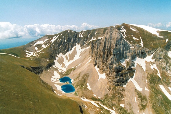


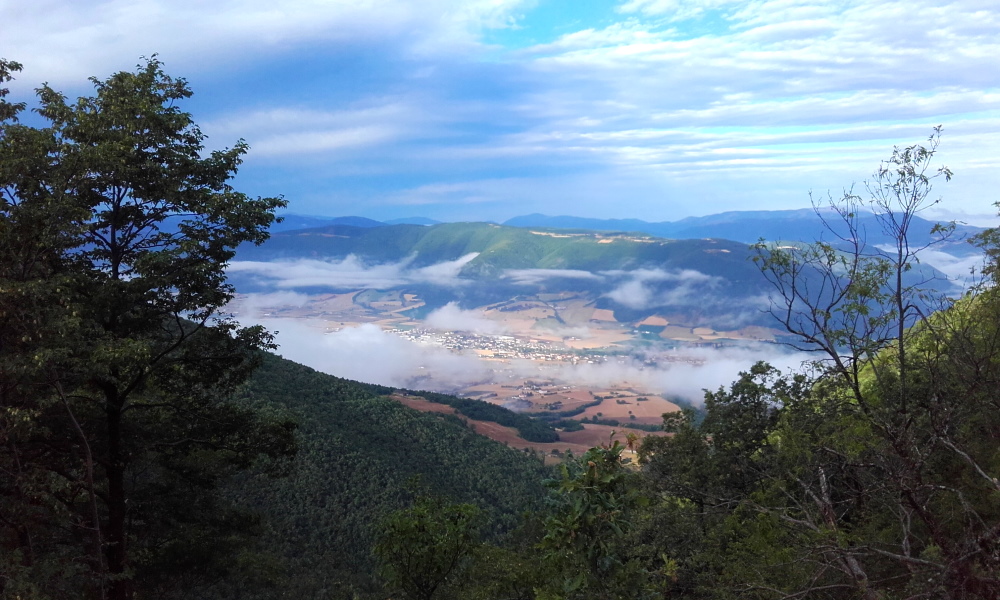

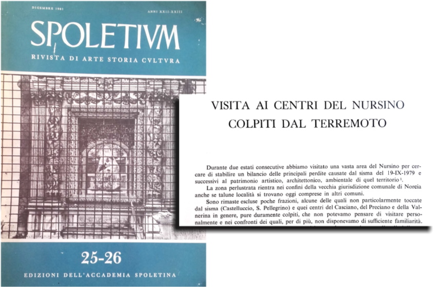


11 Dec 2020
Pontius Pilate and the shape of the waters /14. The earthquake of 22 August 1859
«The heat was intense and suffocating; the sky was encumbered with large clouds, murky and hideous, agitated and amassed horizontally towards the southwestern horizon [...] A powerful, vigorous bumping shake, accompanied by a deep grave roar, not different from the rumble of a great thunder [...] preceded six further wavering, horizontal shakes, which ended, as it seems, in the space of six or seven seconds» (Fig. 1).
[In the original Italian text: «Il calore era stemperato e soffocante: il cielo presentavasi ingombro di nuvoloni bruttamente torbidi, scomposti, ed accampati in aria, segnatamente verso Sud-Ovest, in senso orizzontale. [...] Una validissima e veementissima scossa sussultoria accompagnata da cupo e profondo rombo simile al bombire di un gran tuono [...] precedé altre sei terribili scosse ondulatorie, or orizzontali, compiutesi, come pare, nello spazio di sei, o sette minuti secondi»].
This is an excerpt taken from the “Account about the earthquake that ruined the town of Norcia on 22 August 1859”) (“Relazione del terremoto che desolò Norcia il giorno 22 agosto 1859”), written by Leopoldo Mannocchi. A frightful account of «the most horrible event that the world we inhabit offers to our sight»: earthquake, «a thoroughly frightful scourge, which many times has struck and ruined this town [Norcia]» (in the original Italian text: «il più terribile dei fenomeni che sottoponga a' nostri sguardi il pianeta da noi abitato, il paurosissimo flagello del tremuoto, che assai volte avea costernata e concussa questa città»).
Father Angelo Secchi, the illustrious Jesuit astronomer and scientist who headed the observatory of the Pontifical Gregorian University at the Roman College in Rome, and was sent to Norcia to investigate the effects of the earthquake, provided further details in his “Scientific journey carried out in Norcia on the occurrence of the earhquakes of 2 August 1859” ("Escursione scientifica fatta a Norcia ad occasione dei terremoti del 22 agosto 1859") (Fig. 2):
«For a few days in Norcia people had been sensing many small shakings caused by earthquakes, yet owing to their limited significance and out of the customary occurrence of such events, the local residents did not pay any specific attention to that; suddenly, on August 22nd, between 1:15 and 1:30 P.M., with no previous warning in the air or anywhere else, a great blow was heard, as if a great artillery shot had been fired under the ground; as soon as this noise ceased, the ground itselfs began to be shaken frenzily, up and down initially and then horizontally, in three subsequent writhings, and with incresing violence for some 6 or 7 seconds».
[In the original Italian text: «Erano già alcuni giorni dacchè si sentivano in Norcia varie leggieri scosse di terremoto, ma che per la loro poca importanza, e per l’abitudine contratta a tali scotimenti, non attiravano l’attenzione della popolazione; quando d’improvviso il giorno 22 Agosto fra le ore 1 1/4 e 1 1/2 circa pomeridiane, senza che apparisse nessun sensibile indizio nell'aria, o altrove, si sentì un gran colpo, come di una fortissima cannonata sparata sotterra, e non appena finito questo rumore si scosse violentemente il terreno, prima sussultoriamente poi orizzontalmente, a tre riprese successive, e sempre con forza maggiore per una durata di circa 6 in 7 secondi»].
The seismic waves unleashed destruction over the small town set at the foot of the Sibillini Mountain Range: «all this», writes Mannocchi, «was enough to plunge Norcia into utter desolation and slaughter of men» (in the original Italian text: «tutto questo fu bastevole a precipitare Norcia nella suprema desolazione e sterminio»). The building collapsed and one hundred people died beneath the wreckage. Only a small percentage of the six hundred houses which stood within the town walls survived: the vast majority of them disappeared amid the clouds of dust raised by the roofs and walls which were breaking apart.
The renowned Scottish photographer Robert Turnbull Macpherson, who lived in Rome for nearly forty years and was an acclaimed forerunner of the artistic applications of the new imaging techniques, had the chance to visit Norcia on 9 December 1859, only a few months after the earthquake. He documented the ruin of the wretched town in three superior, extended-exposure shots which provide an almost tangible vision of the effects of the seismic shakings on the land: the Piazza St. Benedict (Fig. 3), the upper Capolaterra district (Fig. 4) and the small building known as 'Tempietto' (Fig. 5) are portrayed in all their desolated devastation, by using black-and-white contrast levels which are strikingly modern.
Further shots, taken by a photographer from Perugia, Mariano Guardabassi, with an advanced stereographic method in 1863, a few years after the quake, set forth additional details of a barren Norcia: the ruined church of St. Francis, with its fine rose window (Fig. 6); again Piazza St. Benedict with its damaged temple and portal (Fig. 7); and the 'Tempietto' in its solitary, isolated position (Fig. 8).
What happened there, not far from the Lake of Pilate, on that fateful day? And, did anything happen at the Lake?
According to the contemporary sources, as written in Leopoldo Mannocchi's report, the epicentral point of the earthquake was located a few miles from the town, where a huge mountain raises:
«... the confidence that the tremblor was originated northeast of Norcia, that is from the foot of Mount Patino...»
[In the original Italian text: «...la certezza che il terremoto traesse origine al Nord-est di Norcia, vale a dire alle radici del monte Patino...»].
Faher Angelo Secchi confirmed this same observation:
«The occurrence we checked for sure is [...] that [...] all buildings are transversally damaged on the side opposite to mount Patino, so it can be considered as certain that from that direction came the main shock. This sort of damage seems to confirm that the speed of the disturbance was extremely intense, and that as the ground levels of the buildings were quickly pushed ahead and then drawn back again in a very short time, the motion had not enough time to propagate to the upper floors, resulting in collapse of the latter on their own front sides».
[In the original Italian text: «Il fatto però meglio avverato è [...] dall'esser [...] le case tutte lesionate obliquamente nella parte opposta a monte Pattino, onde resta certo che da quella parte provenne l'urto principale. Tal genere di lesione sembra provare che la velocità dell'urto fu grandissima, e che essendo state le basi delle case spinte rapidamente avanti e poi ritirate subitamente indietro, il moto non ebbe tempo di comunicarsi dall'imo al sommo, e la parte superiore venne così a cascare avanti»].
This position is no different from the epicentral point that will be registered more than one hundred fifty years later during the occurrence of another savage earthquake, on 30 October 2016: the seismic waves actually proceeded from that very same point, set at the foot of Mount Patino.
So, a powerful earthquake hit the region of Norcia on August, 22 1859. Modern studies, carried out by the Italian “Istituto Nazionale per la Geofisica e la Vulcanologia”, determined for that nineteenth-century tremblor an estimated magnitude of 5.7, on the basis of the effects described by Leopoldo Mannocchi, Angelo Secchi and others (Fig. 9).
Did the earthquake have any impact on the mountainous area where the Lake of Pilate lies, east of Norcia? Could this ruinous event be at the origin of a sudden mutation in the ordinary shape of our necromantic Lake, from a single, deeper basin to a shallower twin-pond configuration, as described by Italian philologist Pio Rajna in 1897?
Let's investigate further into this thorny issue.
Ponzio Pilato e la forma delle acque /14. Il terremoto del 22 agosto 1859
«Il calore era stemperato e soffocante: il cielo presentavasi ingombro di nuvoloni bruttamente torbidi, scomposti, ed accampati in aria, segnatamente verso Sud-Ovest, in senso orizzontale. [...] Una validissima e veementissima scossa sussultoria accompagnata da cupo e profondo rombo simile al bombire di un gran tuono [...] precedé altre sei terribili scosse ondulatorie, or orizzontali, compiutesi, come pare, nello spazio di sei, o sette minuti secondi» (Fig. 1).
Questo è un passaggio tratto dalla “Relazione del terremoto che desolò Norcia il giorno 22 agosto 1859” di Leopoldo Mannocchi. Uno spaventoso racconto relativo al «più terribile dei fenomeni che sottoponga a' nostri sguardi il pianeta da noi abitato, il paurosissimo flagello del tremuoto, che assai volte avea costernata e concussa questa città [Norcia]».
Padre Angelo Secchi, l'illustre astronomo e scienziato gesuita che guidò l'osservatorio della Pontificia Università Gregoriana al Collegio Romano in Roma, e che fu inviato a Norcia per investigare gli effetti del terremoto, raccolse ulteriori informazioni nella propria relazione "Escursione scientifica fatta a Norcia ad occasione dei terremoti del 22 agosto 1859" (Fig. 2):
«Erano già alcuni giorni dacchè si sentivano in Norcia varie leggieri scosse di terremoto, ma che per la loro poca importanza, e per l’abitudine contratta a tali scotimenti, non attiravano l’attenzione della popolazione; quando d’improvviso il giorno 22 Agosto fra le ore 1 1/4 e 1 1/2 circa pomeridiane, senza che apparisse nessun sensibile indizio nell'aria, o altrove, si sentì un gran colpo, come di una fortissima cannonata sparata sotterra, e non appena finito questo rumore si scosse violentemente il terreno, prima sussultoriamente poi orizzontalmente, a tre riprese successive, e sempre con forza maggiore per una durata di circa 6 in 7 secondi».
Le onde sismiche scatenarono la devastazione sulla piccola città posta ai piedi dei Monti Sibillini: «tutto questo», scrive Mannocchi, «fu bastevole a precipitare Norcia nella suprema desolazione e sterminio». Gli edifici collassarono e un centinaio di persone perirono sotto le macerie. Solo una piccola percentuale delle seicento case che erano situate all'interno delle mura urbiche sopravvisse alle scosse: la maggioranza di esse sparì tra le nuvole di polvere sollevate dai tetti e dalle murature che precipitavano crollando.
Il famoso fotografo scozzese Robert Turnbull Macpherson, che visse a Roma per quasi quaranta anni e fu un acclamato precursore dell'applicazione delle nuove tecniche fotografiche all'arte, ebbe la possibilità di visitare Norcia il 9 dicembre 1859, a pochi mesi dal terremoto. Egli fu in grado di documentare la rovina che aveva colpito la sfortunata città in tre inquadrature fotografiche di elevata qualità, acquisite facendo uso di lunghi periodi di posa: immagini che forniscono una visione quasi tangibile degli effetti dello scuotimento sismico sul territorio. Piazza San Benedetto (Fig. 3), il distretto di Capolaterra, situato più a monte (Fig. 4), e il piccolo edificio conosciuto come il 'Tempietto' (Fig. 5) sono ritratti in tutta la propria desolata devastazione, grazie all'utilizzo di livelli di contrasto del bianco e nero che appaiono essere straordinariamente moderni.
Ulteriori scatti, acquisiti da un fotografo perugino, Mariano Guardabassi, utilizzando un avanzato procedimento stereografico, nel 1863, alcuni anni dopo il sisma, illustrano il triste stato di una desolata Norcia: la chiesa semicrollata di San Francesco, con il suo prezioso rosone (Fig. 6); ancora Piazza San Benedetto, con il tempio danneggiato e il portale d'ingresso (Fig. 7); e il 'Tempietto', nella sua posizione isolata e solitaria (Fig. 8).
Cosa accadde in quei luoghi, non lontano dal Lago di Pilato, in quel giorno così fatale? E, presso il Lago, si verificò veramente qualcosa?
Secondo le fonti dell'epoca, così come scrive Leopoldo Mannocchi nella propria relazione, il punto epicentrale del terremoto fu localizzato a pochi chilometri dalla città, lì dove si innalza una grande montagna:
«...la certezza che il terremoto traesse origine al Nord-est di Norcia, vale a dire alle radici del monte Patino...».
Padre Angelo Secchi conferma questa medesima osservazione:
«Il fatto però meglio avverato è [...] dall'esser [...] le case tutte lesionate obliquamente nella parte opposta a monte Pattino, onde resta certo che da quella parte provenne l'urto principale. Tal genere di lesione sembra provare che la velocità dell'urto fu grandissima, e che essendo state le basi delle case spinte rapidamente avanti e poi ritirate subitamente indietro, il moto non ebbe tempo di comunicarsi dall'imo al sommo, e la parte superiore venne così a cascare avanti».
Questa posizione non è diversa dal punto epicentrale che sarà registrato, oltre centocinquanta anni più tardi, durante il verificarsi di un ulteriore distruttivo terremoto, il 30 ottobre 2016: le onde sismiche procederanno infatti dal medesimo luogo, situato alle pendici del Monte Patino.
E così, un potente terremoto colpì la regione di Norcia il 22 agosto 1859. Studi contemporanei, condotti dall'Istituto Nazionale per la Geofisica e la Vulcanologia, hanno determinato per quel sisma ottocentesco una magnitudo stimata pari a 5.7, sulla base degli effetti descritti da Leopoldo Mannocchi, Angelo Secchi e altri (Fig. 9).
Quel terremoto produsse forse effetti di qualche genere sull'area montuosa all'interno della quale giace il Lago di Pilato, a oriente di Norcia? E' possibile che questo evento così catastrofico sia stato all'origine di un improvviso mutamento nella forma usuale del Lago negromantico, da un singolo bacino maggiormente profondo a una configurazione duale caratterizzata da acque più basse, così come descritto dal filologo Pio Rajna nel 1897?
Proviamo ad addentrarci ulteriormente in questa difficile questione.
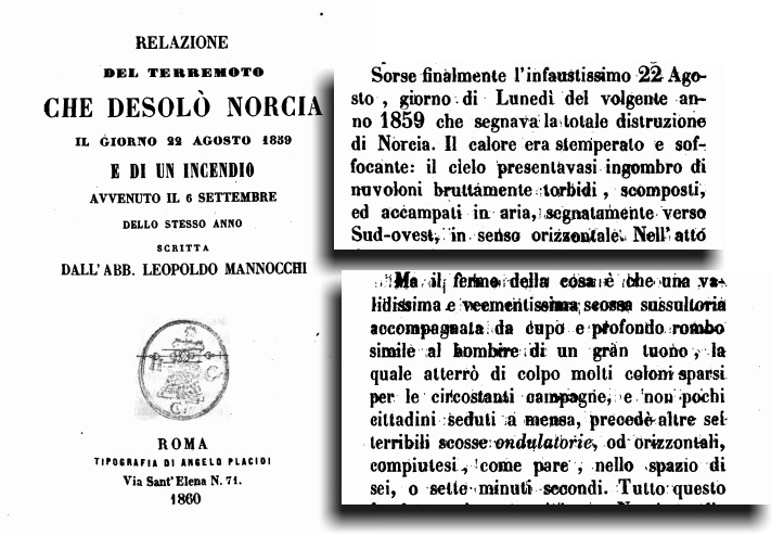

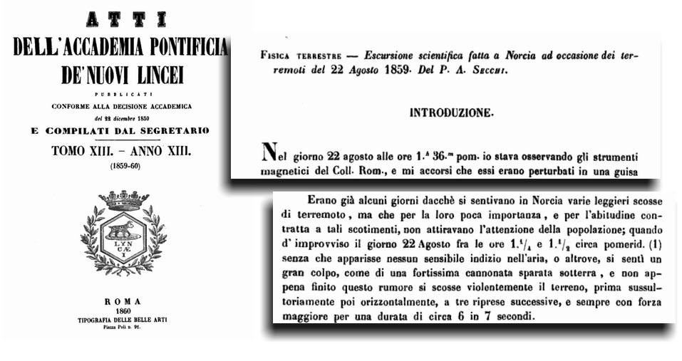

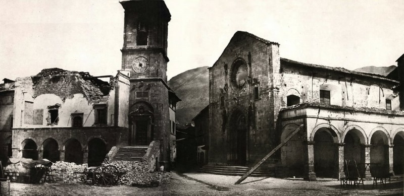

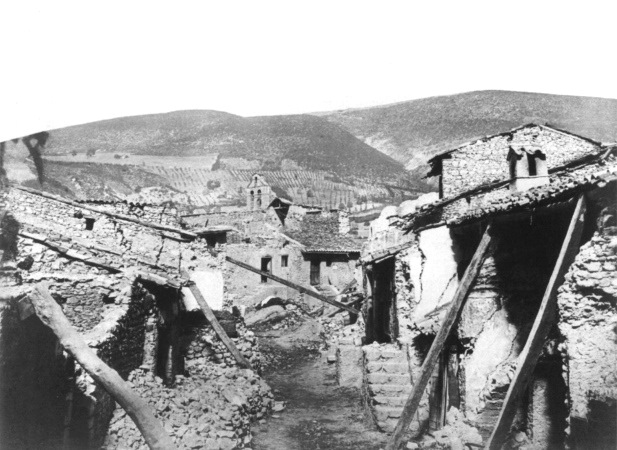

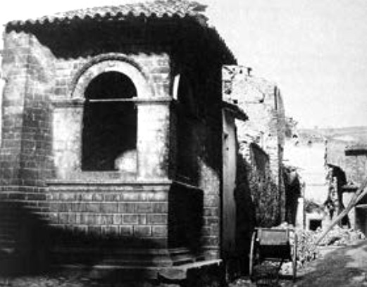





8 Dec 2020
Pontius Pilate and the shape of the waters /13. A nineteenth-century catastrophic event?
Before the nineteenth century, the Lake of Pilate is a single basin, with summer appearances as a dual lake. Later, in the twentieth century and up to our present times, it is commonly reduced to two smaller Lakes. Throughout the whole year. Even when accumulated snow, as attested by Pio Rajna, may remain deposited as a white blanket within the rocky arms of Mount Vettore's glacial cirque at the mid of August.
Was Lake duplication a long-term, prolonged, continuous process? Or, did something happen there instead, that changed the ordinary shape of the Lake of Norcia, also known as the Lake of Pilate? What happened to that Lake, laying within the mountains which raise their cliffs in the vicinity of Norcia, Italy, at the mid of the nineteenth century?
Let's find out in Pio Rajna's words, which were written in the year 1897 (Fig. 1):
«All that considered, today the lake is not what it was in past times anymore. Around forty years ago, it broke the natural dike at its front, a barrier that never formed again. So Antoine de la Sale beheld a lake with a significantly different appearance, and deeper».
[In the original Italian text: «Con tutto ciò il lago non è più ora ciò che fu un tempo. Circa quarant'anni addietro esso ruppe le dighe naturali della sua fronte, le quali non si sono più riformate. Antoine de la Sale lo vide dunque notevolmente diverso d'aspetto e più profondo»].
If the words written by the Italian philologist are true and reliable, we possibly find ourselves at a turning point in our research paper.
Prior to the occurrence of the breach mentioned by Pio Rajna, the Lake was larger and deeper: a single, wider Lake of Pilate, with transformations into two separate Lakes during summers only.
After the event, it split into two smaller Lakes. Basically throughout the year.
With his sentence, Pio Rajna provides our research with an astounding piece of information. However, how reliable is all that?
According to Rajna, who is certainly mentioning what was reported to him by his local guides from Montemonaco, nearly forty years earlier the rocky front of the glacial cirque of Mount Vettore would have collapsed for some reason. And water would have poured partially out and down across the underlying valley. From them on, the glacial cirque, its front portion broken, was possibly unable to hold a large amount of water as it used to do in the past, whatever the rainfall and snowfall levels may be. Just like a cup with a broken rim (Fig. 2).
Some forty years earlier, as Pio Raina specifies in 1897. Then, we are around the year 1860, or just a few years before.
Did anything happen in the vicinity of Norcia in 1860?
Yes, it did happen.
It was a mighty earthquake. An earthquake that unleashed its power on August, 22nd 1859. On this very land.
Ponzio Pilato e la forma delle acque /13. Un evento catastrofico ottocentesco?
Prima del diciannovesimo secolo, il Lago di Pilato era un singolo bacino, con apparizioni estive nella forma di un duplice lago. Successivamente, nel ventesimo secolo e fino ai nostri giorni, esso si presenta ordinariamente ridotto a una coppia di Laghi più piccoli. Durante tutto il corso dell'anno. Anche nel caso in cui si verifichi che accumuli di neve, come attestato da Pio Rajna, rimangano giacenti, come bianche coltri, tra le braccia di roccia del Monte Vettore e del suo circo glaciale, nel pieno del mese di agosto.
La duplicazione del Lago fu forse l'esito di un processo prolungato, continuo, di lungo termine? Oppure, invece, qualcosa è intervenuto modificando l'aspetto ordinario del Lago di Norcia, conosciuto anche come il Lago di Pilato? Cosa è accaduto a quel Lago, nascosto tra le montagne che innalzano i propri picchi in prossimità di Norcia, alla metà del diciannovesimo secolo?
Cerchiamo di scoprirlo nelle parole di Pio Rajna, parole che furono scritte nell'anno 1897 (Fig. 1):
«Con tutto ciò il lago non è più ora ciò che fu un tempo. Circa quarant'anni addietro esso ruppe le dighe naturali della sua fronte, le quali non si sono più riformate. Antoine de la Sale lo vide dunque notevolmente diverso d'aspetto e più profondo».
Se le parole vergate dal filologo italiano devono essere considerate come veritiere e affidabili, ci troviamo forse di fronte a un punto di svolta nella nostra ricerca.
Prima del verificarsi del collasso menzionato da Pio Rajna, il Lago era più ampio e più profondo: un singolo, esteso Lago di Pilato, che si trasformava in due Laghi solamente in estate.
Dopo l'evento, invece, esso si è suddiviso in due Laghi più piccoli. Sostanzialmente durante tutto il volgere dell'anno.
Con le sue parole, Pio Rajna rende disponibile alla nostra investigazione uno straordinario elemento informativo. Ma quanto possono essere affidabili queste informazioni?
Secondo Rajna, che certamente sta riportando parole a lui riferite dalle sue guide locali originarie di Montemonaco, circa quaranta anni prima il fronte roccioso del circo glaciale del Monte Vettore sarebbe collassato per qualche ragione. E l'acqua sarebbe parzialmente fuoriuscita dal bacino, defluendo lungo la valle sottostante. Da quel momento in poi, il circo glaciale, con il cedimento della propria porzione frontale, non sarebbe stato più in grado di contenere una significativa quantità di acqua come era solito permettere in passato, indipendentemente dai livelli di precipitazioni piovose e nevose. Proprio come una coppa dal bordo sbreccato (Fig. 2).
Circa quaranta anni prima, come Pio Rajna specifica nel 1897. Dunque, stiamo parlando del 1860, o di qualche anno prima.
È accaduto qualcosa, nel territorio di Norcia, nel 1860?
Sì, qualcosa è accaduto.
Si è verificato un potente terremoto. Un sisma che ha scatenato la propria energia il 22 agosto 1859. Su queste stesse terre.


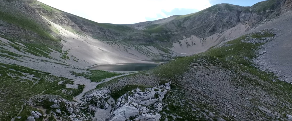

7 Dec 2020
Pontius Pilate and the shape of the waters /12. Pio Rajna and the first signs of persistent duplication
With the visit carried out to the Lake of Pilate by the renowned Italian philologist Pio Rajna, something seems to be changing with our necromantic basin set on Mount Vettore.
Because the Lake of Pilate appears to be gradually turning into a doubled mirror of waters, and not only in summers. Was it a gradual process, or, as it might seem from the scant sources available to us, did it happen in the course of a sudden, specific event?
Let's try and get through this truly tricky matter. With the help of the report written by a most distinguished witness: Pio Rajna, who visited the place in the last decade of the nineteenth century.
When Pio Rajna carried out his exploration of the Sibillini Mountain Range, in 1897, he was in search of the ancient legend of the Apennine Sibyl, in the wake of an increasing interest for her mysterious lore that was being aroused among scholars following the publication of insight papers by Alfred von Reumont and Arturo Graf, and out of the mounting philological quarrel over the origin of the German myth of Tannhäuser.
We fully described Rajna's visit in our previous articles “Sibillini Mountain Range, the chthonian legend” and “The nineteenth-century discovery of the Sibillini Mountain Range by the Italian Alpine Club”. Now we want to turn our attention to the most significant sentences he wrote about the shape of the Lake in his "In the territory of the Sibyl of Norcia" ("Nei paraggi della Sibilla di Norcia"), an account of his visit to the Sibyl's Cave and the necromantic basin that was included in the volume "Studii dedicati a Francesco Torraca nel XXXVI anniversario della sua laurea" (1912) (Fig. 1).
The following excerpts are taken from Pio Rajna's account:
«The clouds, which had threateningly gathered around Mount Vettore, and thus at the Lake of Pilate as well, had turned their threat into action, delivering a storm on us».
[In the original Italian text: «Le nubi, che s'erano andate addensando minacciose dattorno al Vettore, e però anche al Lago di Pilato, avevano tramutato le minacce in fatti, regalandoci un temporale»].
In August 1897, Pio Rajna ascends to what he knows with the name of «Lake of Pilate», with still a single, undivided shape hidden in the singular form of the name. The illustrious philologist and alpinist treads «the trail to the lake» towards «the spot where the lake lies» (in the original Italian text: «la via al lago e il luogo dove il lago è posto»), until he gets to the impressive glacial cirque of Mount Vettore, where «a sheer wall of rock raises for nearly 1,200 feet, looming over the lake from its western side and looking like the pinnacled facade of a giant-scale church» (in the original Italian text: «per ben trecentosessanta metri s'inalza la parete assolutamente verticale, che sovrasta al lago dalla parte di ponente, presentando l'aspetto della facciata policuspidale d'una chiesa gigantesca»).
And here is how the Lake of Pilate presented itself to the fascinated eyes of Pio Rajna on August, 15 1897 (Fig. 2):
«The Lake appeared to me divided in two elliptical mirrors, one of which elongates not in the middle but on one side instead, pointing to the other. The comparison with a pair of spectacles, which I heard earlier before from my guide in Castelluccio, is truly pictorial».
[In the original Italian text: «Il lago mi si è presentato diviso in due specchi elittici, uno dei quali si protende appuntandosi, non nel mezzo, ma da un lato, verso l'altro. Il paragone con un par d'occhiali, che avevo udito dalla mia guida del Castelluccio, è realmente grafico»].
Now the Lake is officialy recorded as a duplicated basin, made up by two smaller ponds. And as such it will appear in all later descriptions and photographic pictures.
Of course, there are occasions in which the Lakes still get back to their single configuration, as Pio Rajna himself notes when registering the dimensions of the water basin (Fig. 3):
«The length, which I reckoned by counting my steps - very roughly, mainly owing to the hindrance opposed to a steady walk by the many stones - can be for each mirror some 500 feet. I reckon the front pond to be a little longer in size, if we do not consider the prolonged portion of the rear pond. However, as I told you there are times in which the two portions come together; and I guess that then, gaining some further extension at the two far ends, the overall length will not be much shorter than 1,300 feet».
[In the original Italian text: «La lunghezza da me misurata a passi - assai grossolanamente, per ragione soprattutto dell'impedimento che a un camminare regolato mettevan le pietre - si approssimerà per ciascuno specchio a 150 metri. Stimo un po' più lungo lo specchio anteriore, se del posteriore non si computa il prolungamento. Ma ci son tempi, come vi dissi, in cui le due parti si riuniscono; e penso che allora, guadagnandosi certo in estensione anche alle due estremità, non si resterà troppo al di sotto dei 400 metri»].
The estimate presented by Pio Rajna for the maximum size of the Lake of Pilate, 1,300 feet, fully matches with our own, which we presented at the beginning of the present research paper: this is actually the size of Mount Vettore's glacial cirque, the physical space in which the Lake or Lakes are housed.
An important remark that the passionate philologist adds to his account is that the dual, spectacles-like shape of the Lake he sees in 1897 is not connected to the occurrence of any specific period of drought, as this same shape is detected during a normal, prolonged period in which the weather has ordinarily provided a customary quantity of rain and snow to feed the basin, possibly even in excess as Rajna records the presence of snow in August (Fig. 4):
«I found snow in fair quantity around the lake; and normally Mount Vettore never denies this garniture to itself, as Antonio told me. In Foce (a small hamlet lying in the valley underneath) people told me that once there was a period of nine years when a lack of snowfalls was registered in winters, too, but this occurred and ended twenty years ago».
[In the original Italian text: «Ho trovato neve in discreta quantità dattorno al lago: e per solito il Vettore non si priva mai, come dice Antonio, di questo ornamento. A Foce mi si è detto tuttavia esserci stato un periodo di nove anni, finito da un ventennio, in cui neve non s'ebbe neppure in inverno»].
So, when Pio Rajna makes his visit to the Lake, there is plenty of snow and the last drought dates back to twenty years earlier: but, despite all that. the Lake is split in two. And, he writes, «across most of its surface the water is thoroughly shallow» (in the original Italian text: «nella maggior parte dell'estensione l'acqua è bassissima»).
What's the matter, with the Lake of Pilate? Isn't there enough water in the glacial cirque to fill up the basin so as it becomes one? Or, has the Lake's bottom raised abruptly at its middle, so that water cannot distribute itself across the full length of the basin anymore?
How can it be? Why aren't rains and snows able to properly fill it up anymore, the way they have been using to do for centuries and centuries and even only twenty years earlier, in 1879, when the members of the Italian Alpine Club had the chance to behold a gorgeous Lake similar to that portrayed in Antoine de la Sale's fifteenth-century manuscript?
A possible answer seems to be suggested to our eager eyes just a few lines below. In that same account written by Pio Rajna.
Ponzio Pilato e la forma delle acque /12. Pio Rajna e i primi segnali di una persistente duplicazione
Con la visita condotta presso il Lago di Pilato dall'illustre filologo italiano Pio Rajna, qualcosa pare mutare nella configurazione del nostro negromantico bacino situato sul Monte Vettore.
Perché il Lago di Pilato sembra volersi trasformare progressivamente in un duplice specchio d'acqua, e non solamente d'estate. Si trattò di un processo graduale, o, come potrebbe apparire sulla base delle scarse fonti informative a noi disponibili, ciò ebbe luogo nel corso di uno specifico evento improvviso?
Proviamo a dipanare questa materia così particolarmente spinosa. Tenteremo di farlo con l'aiuto del resoconto scritto proprio da un testimone assai eminente: Pio Rajna, che si recò a visitare questi luoghi nell'ultimo decennio del diciannovesimo secolo.
Quando Rajna giunse presso i Monti Sibillini per compiere la propria esplorazione, nel 1897, egli era alla ricerca dell'antica leggenda della Sibilla Appenninica, sull'onda di un rinnovato interesse per la misteriosa tradizione sibillina suscitato, tra gli studiosi, a seguito della pubblicazione di articoli di approfondimento firmati da Alfred von Reumont e Arturo Graf, nonché nel contesto della montante diatriba filologica che riguardava l'origine del mito germanico di Tannhäuser.
Abbiamo avuto occasione di descrivere approfonditamente questa visita nei nostri precedenti articoli "Monti Sibillini, la leggenda ctonia" e "La riscoperta ottocentesca dei Monti Sibillini nei documenti del Club Alpino Italiano". Ora vogliamo rivolgere la nostra attenzione alle frasi maggiormente significative, vergate dal Rajna, a proposito del Lago nel suo articolo "Nei paraggi della Sibilla di Norcia", contenente il racconto dell'escursione da lui effettuata presso la Grotta della Sibilla e il bacino negromantico: una narrazione che fu inclusa nel volume "Studii dedicati a Francesco Torraca nel XXXVI anniversario della sua laurea" (1912) (Fig. 1).
I brani seguenti sono tratti dal resoconto propostoci da Pio Rajna:
«Le nubi, che s'erano andate addensando minacciose dattorno al Vettore, e però anche al Lago di Pilato, avevano tramutato le minacce in fatti, regalandoci un temporale».
Nell'agosto del 1897, Pio Rajna sale fino alle acque che a lui note con la denominazione di «Lago di Pilato», e dunque ancora con un aspetto singolo e indiviso nascosto nella forma singolare del nome. L'illustre filologo e alpinista percorre «la via al lago e il luogo dove il lago è posto», finché egli non giunge presso l'impressionante circo glaciale del Monte Vettore, dove «per ben trecentosessanta metri s'inalza la parete assolutamente verticale, che sovrasta al lago dalla parte di ponente, presentando l'aspetto della facciata policuspidale d'una chiesa gigantesca».
Ed ecco come il Lago di Pilato si appalesò allo sguardo affascinato di Pio Rajna il 15 agosto 1897 (Fig. 2):
«Il lago mi si è presentato diviso in due specchi elittici, uno dei quali si protende appuntandosi, non nel mezzo, ma da un lato, verso l'altro. Il paragone con un par d'occhiali, che avevo udito dalla mia guida del Castelluccio, è realmente grafico».
Ora il Lago viene ufficialmente registrato come un bacino duplice, composto da due specchi d'acqua più piccoli. E tale apparirà in tutte le successive descrizioni e immagini fotografiche.
Naturalmente, possono esservi occasioni nelle quali i Laghi tornano ancora a unirsi in una configurazione singola, come lo stesso Pio Rajna annota nel rilevare le dimensioni del bacino (Fig. 3):
«La lunghezza da me misurata a passi - assai grossolanamente, per ragione soprattutto dell'impedimento che a un camminare regolato mettevan le pietre - si approssimerà per ciascuno specchio a 150 metri. Stimo un po' più lungo lo specchio anteriore, se del posteriore non si computa il prolungamento. Ma ci son tempi, come vi dissi, in cui le due parti si riuniscono; e penso che allora, guadagnandosi certo in estensione anche alle due estremità, non si resterà troppo al di sotto dei 400 metri».
La stima che ci viene presentata da Pio Rajna in relazione alla dimensione massima del Lago di Pilato, 400 metri, è perfettamente sovrapponibile con quella da noi valutata, illustrata all'inizio del presente articolo di ricerca: si tratta, in effetti, della dimensione del circo glaciale del Monte Vettore, lo spazio all'interno del quale il Lago o i Laghi sono alloggiati.
Un importante riferimento che il nostro appassionato filologo aggiunge al proprio resoconto è relativo al fatto che la forma duale del Lago, simile a quella di un paio d'occhiali, da egli rilevata nel 1897, non è collegata al verificarsi di alcuno specifico periodo di siccità, in quanto tale forma viene osservata durante un normale, prolungato periodo in cui il tempo meteorologico è stato in grado di alimentare il bacino con una ordinaria quantità di piogge e nevi, forse addirittura oltremisura, potendo registrando il Rajna la presenza di neve in agosto (Fig. 4):
«Ho trovato neve in discreta quantità dattorno al lago: e per solito il Vettore non si priva mai, come dice Antonio, di questo ornamento. A Foce mi si è detto tuttavia esserci stato un periodo di nove anni, finito da un ventennio, in cui neve non s'ebbe neppure in inverno».
Dunque, quando Pio Rajna effettua la propria visita al Lago, è presente in quei luoghi una grande quantità di neve e l'ultima siccità risalirebbe a ben venti anni addietro: malgrado ciò, il Lago appare suddiviso in due. E, egli scrive, «nella maggior parte dell'estensione l'acqua è bassissima».
Quale è il problema, con il Lago di Pilato? Non c'è forse acqua a sufficienza, all'interno del circo glaciale, per riempire il bacino fino a farlo diventare uno specchio d'acqua singolo? Oppure, il fondo del Lago si è forse rialzato, nella sua porzione centrale, in modo improvviso, facendo sì che le acque non riescano più a distribuirsi lungo tutta l'estensione del bacino?
Come può essere? Perché le piogge e le nevi non sembrano essere più in grado di riempire completamente quel Lago, così come esse hanno saputo fare per secoli e secoli, e anche circa venti anni prima, nel 1879, quando i membri del Club Alpino Italiano poterono contemplare uno splendido Lago simile a quello ritratto nel manoscritto quattrocentesco di Antoine de la Sale?
Una possibile risposta sembra essere suggerita alla nostra indagine dalla lettura delle righe successive. In quella stessa relazione posta per iscritto da Pio Rajna.


6 Dec 2020
Pontius Pilate and the shape of the waters /11. Antoine de la Sale's Lake still in place in 1879
In our previous article “The nineteenth-century discovery of the Sibillini Mountain Range by the Italian Alpine Club”, we published for the first time ever in a modern research paper a stunning drawing of the Lake of Pilate dating to the year 1879.
In that year, Mount Vettore received a number of illustrious, aristocratic visitors: the participants in the distinguished annual meeting of the recently-born Italian Alpine Club, which was established sixteen years earlier in Turin by Quintino Sella and other eminent members of an affluent milieu that included politicians, noblemen, landowners and wealthy professionals, all enamoured of mountains and mountain sceneries, with their new appeal as a target for excursions in the wilderness and previously-unaddressed scientific investigations.
The XII Annual Meeting was held in Perugia, not far from the Sibillini Mountain Range, in August 1879. The distinguished attendees, coming from all over Italy, were welcomed and entertained by the local fashionable set, made up by the rich families of noble ancestry which lived in the small Umbrian town, not accustomed to large social events, yet able to arrange brilliant soirees at the gorgeous ballroom that was in Perugia (Fig. 1). Amid day trips to the main natural attractions in the regions, a gala dinner and workshop sessions dedicated to the new role of mountains in the tourism and leisure sectors, the participants had the chance to visit the king of the central-Italian mountains: Mount Vettore, with its arched crests providing a breathtaking vision of both the Adriatic Sea to the east and, far away to the west, the Tyrrhenian.
The leader of the party was Giuseppe Bellucci, a professor and founder of the Umbrian branch of the Italian Alpine Club; he was accompanied by a selected group of forty passionated alpinists who bore blue-blooded family names and resounding professional titles. At the end of August 1879, they reached the gloomy, isolated hamlet of Castelluccio di Norcia, spent the night there, and then confronted with the great mountain which raised from the grassy expanse of the Pian Grande:
«The next day, after a nap on straw, they headed to Forca Viola, or Forchetta, and following a three-hour climb, they reached the top of the giant of the Sibillini Mountain Range (8.031 feet) and contemplated the astounding vista provided by charming peaks, their tops naked and the underlying valleys covered with green, gorgeous woods of hornbeams, maple trees and oaks».
[In the original Italian text: «L'indomani mattina dopo una dormitella sulla paglia, s'avviarono per la Forchetta, o Forca Viola, e dopo tre ore di salita poterono dalla cima del gigante dei monti Sibillini (m. 2448) ammirare lo spettacolo meraviglioso della bella catena, brulla alle vette, verdeggiante nelle valli per splendidi boschi di carpini, di aceri, di quercie»].
This short account is reported in the pages of a widely-distributed illustrated magazine, "L'Illustrazione Italiana", in its first years at the time. In the issue published on 12 October 1879, a large space is actually devoted to the Annual Meeting held in Perugia.
But the most important piece of information presented by the renowned magazine is a full page dedicated to drawings which pictorially depict the event: a premium feature, the 'illustrations', that made that periodical publication so popular.
Amid the many images proposed to the magazine's readers, certainly the most impressive is the one labelled «Mount Vettore's top» («Cima del Vettore»).
And the mountaintop of Mount Vettore, represented under the threat of heavy, rainy clouds, is fully occupied by a large, deep, sinister Lake (Fig. 2).
This is, of course, the Lake of Pilate. An ominous, single, unduplicated Lake.
It seems to be no different from the Lake that Antoine de la Sale had the chance to see in the year 1420: a rounded basin, similar to the waters portrayed in the fifteenth-century manuscript of "The Paradise of Queen Sibyl". In both views, water seems to flow out of the Lake and into the underlying valley, a possible reference to the river Aso, which actually originates below the glacial cirque (Fig. 3).
Thus, in 1879 the Lake of Pilate still retained its ominous fascination as a large Lake hidden within the glacial cirque of Mount Vettore, in central Italy. Just as it used to be represented in literary references and geographical maps, for centuries and centuries, apart from single instances of duplication of its waters during the summer season (manuscript Vat. Lat. 5241 and essay written by Father Fortunato Ciucci).
However, something was about to change.
This is the last time we encounter the Lake of Pilate in its original, most thriving shape.
In the following years and decades, we will begin to meet further descriptions of our necromantic waters: descriptions of an increasingly depleted basin, ordinarily seen in the form of two separated Lakes. A change possibly to be ascribed to some sort of specific event, including potential earthquake effects, and/or a longer-term process linked to ever-decreasing levels of snowfalls and rainfalls. The first signs of a global climate change.
And the turning point in the above change may be conventionally set to the year 1897, when a new reliable visitor will register, once more, a duplicated shape for the Lake of Pilate.
Nothing new, one may say. As we saw earlier in this paper, summer duplication used to occur in previous centuries, too.
However, this time was different. Because snow was there, but this wasn't helping the Lake in maintaining its single appearance. Despite the presence of melting snow, it was split in two, like «a pair of spectacles»: the usual shape this water basin will present to visitors from them on and up to our present days, with only rare appearances in the old form of a single pond, though similarly reduced and depleted.
Our next reliable witness is a most illustrious scholar: the Italian philologist, professor and future member of the Italian Senate Pio Rajna.
Ponzio Pilato e la forma delle acque /11. Il Lago di Antoine de la Sale ancora visibile nel 1879
Nel nostro precedente articolo "La riscoperta ottocentesca dei Monti Sibillini nei documenti del Club Alpino Italiano", abbiamo pubblicato per la prima volta in assoluto, in una moderna ricerca, uno straordinario disegno relativo al Lago di Pilato e risalente al 1879.
In quell'anno, il Monte Vettore aveva accolto numerosi visitatori, illustri e aristocratici: si trattava dei partecipanti al prestigioso congresso annuale del giovane Club Alpino Italiano, che era stato fondato sedici anni prima a Torino da Quintino Sella e da altre eminenti personalità appartenenti a un altolocato ambiente che comprendeva politici, nobili, proprietari terrieri e benestanti professionisti, tutti appassionati di montagne e panorami d'alta quota, divenuti obiettivo di avventurose escursioni e oggetto di inedite investigazioni scientifiche.
Il XII Congresso Annuale fu tenuto a Perugia, non lontano dai Monti Sibillini, nell'agosto del 1879. La scelta platea, in arrivo da ogni parte d'Italia, fu accolta e intrattenuta dalla buona società del luogo: ricche famiglie di nobile lignaggio che vivevano nella piccola città umbra, non use ai grandi eventi sociali, ma comunque in grado di organizzare brillanti serate danzanti presso la splendida sala da ballo che si trovava in Perugia (Fig. 1). Tra escursioni alle principali attrazioni naturalistiche della regione, serate di gala e conferenze dedicate al nuovo ruolo della montagna nel settore del turismo e nel contesto di una fruizione allargata, i partecipanti ebbero la possibilità di visitare il re delle montagne dell'Italia centrale: il Monte Vettore, con le sue creste arcuate e le visioni mozzafiato del mare Adriatico, a oriente, e, in lontananza, a occidente, del Tirreno.
L'organizzatore di quell'escursione era Giuseppe Bellucci, professore e fondatore della Sezione umbra del Club Alpino Italiano; egli era accompagnato da un selezionato gruppo formato da quaranta appassionati alpinisti, i quali si fregiavano di aristocratici cognomi e risonanti titoli professionali. Alla fine di agosto dell'anno 1879, essi raggiunsero il povero, isolato villaggio di Castelluccio di Norcia, trascorsero la notte nel piccolo insediamento, e si confrontarono, il giorno successivo, con la grande montagna che si innalzava al di sopra della distesa erbosa del Pian Grande:
«L'indomani mattina dopo una dormitella sulla paglia, s'avviarono per la Forchetta, o Forca Viola, e dopo tre ore di salita poterono dalla cima del gigante dei monti Sibillini (m. 2448) ammirare lo spettacolo meraviglioso della bella catena, brulla alle vette, verdeggiante nelle valli per splendidi boschi di carpini, di aceri, di quercie».
Questo breve resoconto è tratto dalle pagine di una rivista illustrata all'epoca di grande diffusione: "L'Illustrazione Italiana", la quale si trovava a quei tempi nei primissimi anni di vita. Nel numero pubblicato il 12 ottobre 1879, uno spazio considerevole viene dedicato proprio a quel Congresso Annuale tenutosi a Perugia.
Ma il più importante elemento informativo contenuto nel rinomato periodico è costituito da un'intera pagina che riporta numerosi disegni che intendono rappresentare visivamente l'evento: una caratteristica di qualità superiore, le 'illustrazioni', che rendevano quella rivista così popolare tra i lettori del tempo.
Tra le numerose immagini proposte dal periodico, certamente la più impressionante è quella che è accompagnata dalla dicitura «Cima del Vettore».
E la cima del Monte Vettore, raffigurata sotto la minaccia di nuvole pesanti e oscure, risulta essere completamente occupata da un grande, profondo, sinistro specchio d'acqua (Fig. 2).
Si tratta, naturalmente, del Lago di Pilato. Un minaccioso, unico, singolo Lago.
Esso appare ai nostri occhi con un aspetto del tutto simile al Lago che Antoine de la Sale ebbe la ventura di osservare nell'anno 1420: un bacino circolare, analogo a quello rappresentato nel manoscritto quattrocentesco del "Paradiso della Regina Sibilla". In entrambe le raffigurazioni, pare inoltre che dell'acqua fuoriesca dal Lago e si getti nella valle sottostante: forse un riferimento al fiume Aso, il quale effettivamente ha origine al di sotto del circo glaciale (Fig. 3).
Dunque, nel 1879 il Lago di Pilato manteneva ancora la propria sinistra fascinazione nella forma di un grande Lago occultato all'interno del circo glaciale del Monte Vettore, nell'Italia centrale. Esattamente come esso era stato ordinariamente descritto nei riferimenti letterari e raffigurato nelle carte geografiche, per secoli e secoli, ad esclusione delle singole menzioni concernenti una partizione delle acque durante la stagione estiva (manoscritto Vat. Lat. 5241 e cronache vergate da Padre Fortunato Ciucci).
Eppure, qualcosa stava per cambiare.
È questa, infatti, l'ultima occasione nel corso della quale abbiamo la possibilità di osservare quel Lago nella sua forma originale e più florida.
Negli anni e nei decenni che seguiranno inizieremo a reperire ulteriori descrizioni delle nostre negromantiche acque: descrizioni che saranno relative a un bacino sempre più frequentemente deprivato, e usualmente osservato nella forma di due Laghi separati. Un mutamento forse da ascriversi a un qualche specifico evento, anche causato dagli effetti dei terremoti; oppure, da imputare a processi assai più dilatati nel tempo, connessi a una progressiva, continua diminuzione della quantità di precipitazioni, piovose e nevose. Il primo segnale di un cambiamento climatico globale.
E il punto di svolta nel predetto mutamento può essere convenzionalmente fissato all'anno 1897, quando un nuovo affidabile visitatore osserverà, nuovamente, una forma duplice per il Lago di Pilato.
Nulla di nuovo, si potrebbe pensare. Come già abbiamo avuto occasione di vedere in questo stesso articolo, una duplicazione estiva non era certamente infrequente nei secoli del passato.
Ma questa volta sarà diverso. Perché, pur essendo presenti accumuli di neve, questa presenza non risulterà essere d'aiuto al fine di permettere a quel Lago di mantenere il proprio aspetto unitario. Malgrado la presenza di neve in scioglimento, infatti, esso risulterà suddiviso in due Laghi, come «un par d'occhiali»: la forma usuale che questo bacino presenterà ai visitatori d'ora in poi e fino ai nostri giorni, con rare riapparizioni dello storico aspetto singolo, in versione comunque assai ridotta.
Il nostro prossimo testimone, dunque, sarà un illustre, affidabile studioso: il filologo, professore e futuro senatore del Regno d'Italia Pio Rajna.


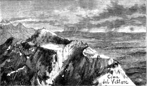


5 Dec 2020
Pontius Pilate and the shape of the waters /10. A Count, a businessman and two Lakes
In past centuries, the Lake of Pilate was usually presented by the ancient sources in the form of a single basin, with possible temporary duplication occurring during prolonged periods of scarce rainfalls in summer as presented in manuscript Vat. Lat. 5241 and Father Fortunato Ciucci's “Chronicles of the Antique Town of Norsia”.
But if the Lake was usually one Lake at least from the fourteenth to the mid of the nineteenth century, as shown in the Austrian cartography of the Papal States, while in our present days it is normally split in two even during winters, what happened to it? And when?
We have proceeded ahead in time for five centuries, up to the first half of the nineteenth, and we have found many mentions of the Lake. Now, we are going to see that something seems to have possibly occurred at a certain point in time. An event that possibly changed the nature of the place, from one single Lake to a basin ordinarily split in two separate ponds.
A first modern hint to a duplicated shape is found in an account included in a publication edited by the Italian Alpine Club in 1877. It narrates of a climb to Mount Vettore carried out by Count Girolamo Orsi and other distinguished members of the Club on 15 August 1876.
According to the original spirit which informed the then-young association of Italian alpinists, established in 1863 by Quintino Sella, a parliament member and minister of the Kingdom of Italy, their visit to the Sibillini Mountain Range was not a mere leisure trip:
«Our goal [...] is the investigation of the nature of the mountains; we intend to achieve a general progress, as we target, with our merry gatherings and personal enquiries, the advancement of science and trade».
[In the original Italian text: «Il fine [...] è lo studio della natura dei monti; è scopo la utilità comune, mirando noi nei lieti convegni o nelle indagini personali all'incremento della scienza e delle industrie»].
So Count Orsi's account, though pervaded by a number of romantic expressions and a sense of daring adventure, intends to provide reliable information and actual observations on many scientific aspects which mark the Sibillini's highlands set between the Italian provinces of Umbria and Marche.
It is within this narrative scenario that we find a first hint, in modern times, to a dual nature of the Lake of Pilate, as seen from the elevated, arched crests of Mount Vettore (Fig. 1):
«The Valley of the river Aso, which first splits the mountain sideways and then longitudinally, divides Mount Vettore in two separate branches: we are currently on one of them, and the other is before us, where Mount Petrara stands, the most elevated peak of all (8123 feet). Between the two branches, at the very bottom of titanic ravines, the Lakes of Pilate are found, fed by an extended volume of ice, the seed of a persistent glacier, which hides itself down there from direct sunlight».
[In the original Italian text: «La Valle dell'Aso, la quale dapprima lateralmente, poi longitudinalmente squarcia la montagna e divide il Vettore in due parti: quella su cui siamo, e l'altra là di fronte, ov'è Monte di Petrara, il quale ogni altro in altitudine sovrasta (metri 2,476). Fra queste, in fondo agli enormi precipizi, sono i Laghi di Pilato, alimentati da quella estesa lente di ghiaccio, embrione di un ghiacciaio perenne, che laggiù si nasconde ai raggi del sole»].
Event thoug Count Orsi does not provide any reference to a duplicated Lake, he writes the noun «Lakes», with an intentional plural. And this is no casual usage, as he repeats the same word in a subsequent sentence (Fig. 2):
«If the 'swallower' [the karst hollow lying on the Pian Grande near Castelluccio di Norcia - editor's note] had struck our minds out of the subterranean disappearance of waters, now [we are struck by] the Lakes of Pilate, and their deep-blue waters, and the frightful ravine nearby which goes down for around 1800 feet, where the river Aso originates».
[In the original Italian text: «Se l'inghiottitoio avevaci colpita la fantasia per lo inabissarsi delle acque, ora i Laghi di Pilato, e le loro acque sì intensamente azzurre, e l'orrido burrone che lì vicino sprofonda per un 500 a 600 metri, donde si origina l'Aso»].
Thus, Count Orsi and his fellow-alpinists did not see a single Lake of Pilate: they saw two. It was the summer of the year 1876. And this is the first reference we stumble upon, apart from Vat. Lat. 5241 dating to the sixteenth century and Father Fortunato Ciucci's work in the seventeenth century, which attests to the possible dual configuration of the Lake during the summer seasons.
However, Girolamo Orsi does not provide any specific detail on the actual shape he actually happened to behold, even though we can plausibly suppose that he saw what we are able to see even today: two smaller Lakes, divided by a narrow strip of rocky debris. A vista that recalls to the visitor's mind the typical shape of a pair of eyeglasses.
This is the very same description we find in a further account published in another issue of the Italian Alpine Club's "Bulletin" around ten years later. In 1887 Giovanni Battista Miliani, a successful businessman and owner of a large paper factory in Fabriano, not far from the Sibillini Mountain Range, wrote a narrative of his visit to Mount Vettore and Mount Sibyl, which he had carried out a year earlier as a passionate alpinist and hiker.
On a clear morning of September, Miliani ascended Mount Vettore and ventured along the sharp line of arched crests that runs from the western side of the mountain to the east (Fig. 3):
«From up there, I enjoyed the gorgeous vista which lies all around the giant of the Sibillini Range. Flooded in sunlight, I could see to the east the most beautiful province of Ascoli, while lost in the mists, very far at all appearances, I got glimpses of the mountains of Fabriano, and the ridges of Mount Catria; on the opposite side, amidst the clouds, outlined over the cyan background of the sky, the rough cliffs of Mount Terminillo and Gran Sasso stood out in the distance».
[In the original Italian text: «Di lassù, potei godere la veduta magnifica che sottostà all'intorno di questo gigante dei Sibillini. Tutta illuminata dal sole, si spiegava ad est, la bellissima provincia d'Ascoli, mentre perduti fra la caligine, in apparenza assai lontani, si scorgevano i monti di Fabriano, ed il gruppo del Catria; dall'altra parte, fra le nubi, ma sul fondo turchino del cielo, risaltavano a distanza le aspre giogaie del Terminillo e del Gran Sasso»].
Among the many wonders, Miliani cannot omit a reference to our fascinating, necromantic waters (Fig. 4):
«I passed a full hour in contemplation of the vast underlying scenario with the utmost enjoyment; then, by treading the wide hollowed half-circle which divides Mount Vettore from the cliff of Petrara, the most elevated point, I headed that way. Beyond the Vettore's mountaintop, going across the crest, down in the valley on the left side, the Lake of Pilate is seen; in summer, as when I saw it, it has the shape of spectacles».
[In the original Italian text: «Rimasi circa un'ora a contemplare l'immenso panorama con grandissima soddisfazione, e poi percorrendo il gran semicerchio avvallato che separa la cima del Vettore da quella di Petrara, che è il punto più elevato, mi diressi a quella volta. Oltrepassata di poco la cima del Vettore, percorrendo la cresta, in fondo a valle, a sinistra, si scorge il Lago di Pilato, che in estate, come quando lo vidi io, ha forma di occhiali»].
We are now fully in the fourth quarter of the nineteenth century, and once more the Lake appears to visitors the way it used to present itself in summer and is ordinarily seen throughout the year in our modern times: in the form of two separate ponds. And nineteenth-century alpinists, tipically climbing Mount Vettore in August, begin to register this spectacles-like summer shape in their accounts.
Possibly this is still nothing different from what we already saw in manuscript Vat. Lat. 5241 and Father Ciucci's account: an ordinary effect of typical summer droughts. However, we will see later in this research paper that this is the time in which a long-term depletion process is beginning to affect the Lake of Pilate, starting from the second half of the nineteenth century: a dual shape for the basin will be increasingly observed as its normal, ordinary state (Fig. 5).
Nonetheless, there will still be occasions in which Mount Vettore's waters will present themselves in their former gorgeous shape: a large, deep, single Lake of Pilate. Not different from the basin portrayed by Antoine de la Sale in his fifteenth-century manuscript.
And this sort of vision will appear before the eyes of fascinated visitors as late as year 1879. Possibly for the last time in history.
Ponzio Pilato e la forma delle acque /10. Un conte, un imprenditore e due Laghi
Negli scorsi secoli, il Lago di Pilato era ordinariamente rappresentato nelle fonti storiche in forma di singolo bacino, con una possibile temporanea duplicazione verificantesi durante prolungati periodi di scarse precipitazioni nel corso dell'estate, come illustrato nel manoscritto Vat. Lat. 5241 e nelle "Istorie dell'antica città di Norcia" di Padre Fortunato Ciucci.
Ma se il Lago era costituito sostanzialmente da un unico specchio d'acqua nel periodo che intercorre tra il quattordicesimo secolo e la metà del diciannovesimo, come mostrato nella cartografia austriaca relativa allo Stato Pontificio, mentre ai nostri giorni esso risulta essere normalmente suddiviso in due anche durante l'inverno, cosa può essere accaduto a quel bacino? E quando?
Abbiamo percorso circa cinque secoli, fino a giungere alla prima metà del 1800, e abbiamo potuto rinvenire molti riferimenti al nostro Lago. Ora, stiamo per andare a vedere come qualcosa, forse, possa essere accaduto in un certo momento del tempo. Un evento che potrebbe avere mutato la natura del luogo, da un singolo Lago a un bacino ordinariamente diviso in due specchi d'acqua separati.
Un primo moderno riferimento a una duplice conformazione è reperibile in un resoconto pubblicato dal Club Alpino Italiano nel 1877. In esso, si narra di un'ascensione effettuata sul Monte Vettore dal Conte Girolamo Orsi e da altri distinti membri del Club il 15 agosto 1876.
In accordo con lo spirito originario che caratterizzava quell'allora giovane associazione di alpinisti italiani, fondata nel 1863 da Quintino Sella, parlamentare e ministro del Regno d'Italia, quella visita condotta presso i Monti Sibillini non intendeva rappresentare una mera gita di piacere:
«Il fine [...] è lo studio della natura dei monti; è scopo la utilità comune, mirando noi nei lieti convegni o nelle indagini personali all'incremento della scienza e delle industrie».
E così il racconto del Conte Orsi, benché marcato dalla presenza di numerose espressioni romantiche e da un senso di ardita avventura, intende fornire ai lettori una serie di informazioni affidabili e di osservazioni tratte dal campo a proposito di molti aspetti scientificamente connotanti le terre sibilline, poste in altitudine tra le regioni dell'Umbria e delle Marche.
Ed è proprio nel contesto di questo specifico scenario narrativo che possiamo rinvenire un primo indizio, in tempi moderni, in merito alla natura duale del Lago di Pilato, così come visibile dalle arcuate, elevate creste del Monte Vettore (Fig. 1):
«La Valle dell'Aso, la quale dapprima lateralmente, poi longitudinalmente squarcia la montagna e divide il Vettore in due parti: quella su cui siamo, e l'altra là di fronte, ov'è Monte di Petrara, il quale ogni altro in altitudine sovrasta (metri 2,476). Fra queste, in fondo agli enormi precipizi, sono i Laghi di Pilato, alimentati da quella estesa lente di ghiaccio, embrione di un ghiacciaio perenne, che laggiù si nasconde ai raggi del sole».
Benché il Conte Orsi non fornisca alcun riferimento a un Lago in forma duplice, egli utilizza la parola «Laghi», con un plurale certamente intenzionale. E che non si tratti di un utilizzo casuale lo si può osservare considerando la ripetizione della medesima parola in una frase successiva (Fig. 2):
«Se l'inghiottitoio avevaci colpita la fantasia per lo inabissarsi delle acque, ora i Laghi di Pilato, e le loro acque sì intensamente azzurre, e l'orrido burrone che lì vicino sprofonda per un 500 a 600 metri, donde si origina l'Aso».
Così, il Conte Orsi e i suoi colleghi alpinisti non videro un singolo Lago di Pilato: essi ne videro due. Correva l'estate dell'anno 1876. Ed è questo il primo riferimento in cui ci imbattiamo, dopo il cinquecentesco manoscritto Vat. Lat. 5241 e la seicentesca opera di Padre Fortunato Ciucci, attestante la possibile configurazione duale del Lago durante le stagioni estive.
Malgrado ciò, Girolamo Orsi non rende disponibile alcuno specifico dettaglio a proposito della conformazione da lui effettivamente osservata, anche se possiamo plausibilmente supporre che egli abbia potuto vedere ciò che anche noi siamo in grado di contemplare oggi: due Laghi più piccoli, separati da una stretta striscia di detriti rocciosi. Una visione che richiama alla mente del visitatore la tipica forma di un paio di occhiali.
Ed è proprio questa la descrizione che troviamo in un'ulteriore relazione pubblicata, circa dieci anni dopo, all'interno di un altro numero del "Bollettino" del Club Alpino Italiano. Nel 1887 Giovanni Battista Miliani, imprenditore di successo e proprietario di una grande cartiera a Fabriano, non lontano dai Monti Sibillini, scrisse un resoconto a proposito della propria visita al Monte Vettore e al Monte Sibilla, effettuata l'anno precedente in qualità di alpinista ed appassionato escursionista.
In una serena giornata di settembre, Miliani ascende il Monte Vettore e si avventura lungo la stretta linea di cresta che corre tra il versante occidentale della montagna e quello orientale (Fig. 3):
«Di lassù, potei godere la veduta magnifica che sottostà all'intorno di questo gigante dei Sibillini. Tutta illuminata dal sole, si spiegava ad est, la bellissima provincia d'Ascoli, mentre perduti fra la caligine, in apparenza assai lontani, si scorgevano i monti di Fabriano, ed il gruppo del Catria; dall'altra parte, fra le nubi, ma sul fondo turchino del cielo, risaltavano a distanza le aspre giogaie del Terminillo e del Gran Sasso».
Tra le numerose meraviglie, Miliani non può omettere di includere un riferimento alle nostre affascinanti, negromantiche acque (Fig. 4):
«Rimasi circa un'ora a contemplare l'immenso panorama con grandissima soddisfazione, e poi percorrendo il gran semicerchio avvallato che separa la cima del Vettore da quella di Petrara, che è il punto più elevato, mi diressi a quella volta. Oltrepassata di poco la cima del Vettore, percorrendo la cresta, in fondo a valle, a sinistra, si scorge il Lago di Pilato, che in estate, come quando lo vidi io, ha forma di occhiali».
Ci troviamo ora pienamente nell'ultimo quarto del diciannovesimo secolo, e ancora una volta il Lago appare ai visitatori nel modo in cui esso era solito presentarsi in estate, e come è osservabile durante tutto l'anno nel nostro tempo presente: in forma di due specchi d'acqua separati. E gli alpinisti ottocenteschi, che si recavano tipicamente sulla cima del Monte Vettore in agosto, iniziano a registrare la presenza di questa configurazione ad occhiale all'interno dei propri resoconti.
È possibile che ciò non rappresenti nulla di diverso rispetto a quanto abbiamo già avuto modo di osservare nel manoscritto Vat. Lat. 5241 e nella cronaca di Padre Ciucci. Nondimeno, vedremo nel presente articolo di ricerca come questi siano gli anni in cui un processo di progressivo depauperamento di lungo termine inizi a caratterizzare il Lago di Pilato, cominciando proprio dalla seconda metà del diciannovesimo secolo: per il nostro bacino, infatti, sarà sempre più frequentemente rilevabile una duplice forma, che diventerà in seguito l'aspetto usuale e ordinario (Fig. 5).
Malgrado ciò, vi saranno ancora occasioni in cui le acque del Monte Vettore si presenteranno nella loro precedente e più smagliante configurazione: un grande e profondo Lago di Pilato, in forma singola. Non molto diverso dal bacino ritratto da Antoine de la Sale nel proprio manoscritto quattrocentesco.
E questo genere di visione si appaleserà di fronte agli occhi di alcuni affascinati visitatori non più tardi dell'anno 1879. Forse per l'ultima volta nella storia.


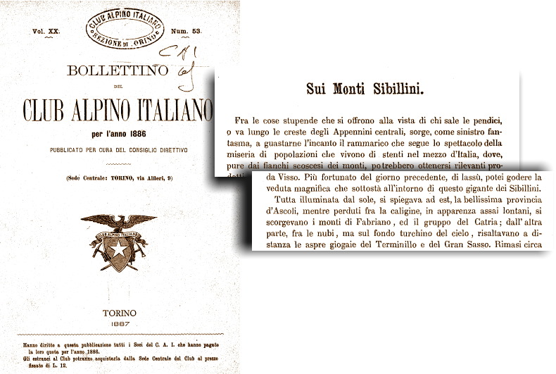

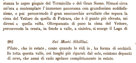

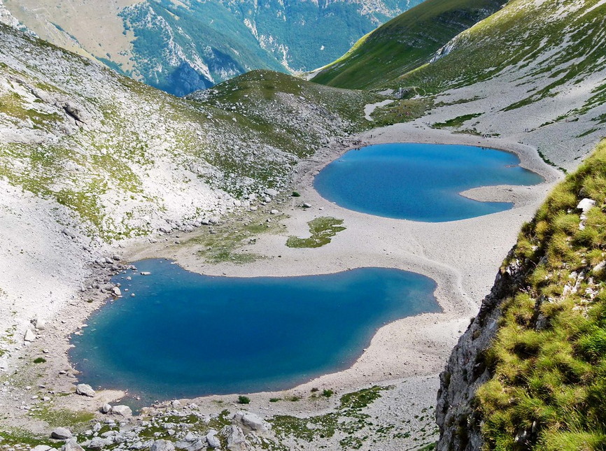

2 Dec 2020
Pontius Pilate and the shape of the waters /9. The Lake in the first half of the nineteenth century
If we proceed further into the centuries, in the second quarter of the nineteenth century we come upon the astounding cartography that was produced by the Imperial and Royal Military Geographical Institute of Austria ("Kaiserlich und königliche Militärische Geografische Institut"), within the framework of a comprehensive mapping project which was carried out across the territories subject to the rule of the Austrian Empire at that time.
The Austrian cartographers edited a series of geographical maps which also portrayed the areas of Italy that were included within the extended political reach of Austria, namely the Grand Duchy of Tuscany and the Papal States. This large map, made up by 53 detailed, accurate tables in total, was «built on astronomical and trigonometric measurements» (in the original Italian text: «costrutta sopra misure astronomico trigonometriche»), and was the product of a specific geodetical campaign which was carried out, between 1841 and 1843, by a geographer from Lombardy, Giovanni Marieni, who made the results of his measurement work available to the scientific community in 1846 with the publication of the volume "Trigonometrische Vermessungen im Kirchenstaate und in Toscana". The Tuscany and Papal States maps were published a few years later, in 1851 in Wien (Fig. 1).
In this finely-drawn map, Giovanni Marieni carefully portrayed the area of Norcia, Castelluccio and the Monti Sibillini. Within the embracing arms of Mount Vettore («M.te Vittore»), with its eastern peak labelled as «M.te Pretara» and its western cliffs as «Balzo Borghese», we find a tiny, light-blue-colored mirror of clear waters: this is the «Lago di Pilato». And it is a single basin, though remarkably elongated, as Marieni correctly nested it in its oblong glacial valley. Perhaps a darker mark traced at the very middle of the Lake may possibly hint to a potential line of separation between two smaller Lakes; and yet there is no doubt that when the Lombard cartographer visited the Sibillini Mountain Range and saw that magical Lake with his very (and professional) eyes, it was one (Fig. 2).
Thus, from the fourteenth century onward, and up to the mid of the nineteenth century, we come upon descriptions and images of the Lake of Pilate which constantly portray a single basin, with two peculiar exceptions, represented by the drawing contained in manuscript Vat. Lat. 5241 and the description provided by Father Fortunato Ciucci in his “Chronicles of the Antique Town of Norsia” (Fig. 3).
However, this situation is rapidly going to change. Some specific event is possibly about to occur: an event that might have turned the usual appearance of the Lake of Norcia from one to two smaller Lakes, as its normal, most frequently encountered condition.
And the first published, widely-distributed mention of a duplicated aspect of the Lake of Pilate is to be found in an account written in the year 1876: a reliable narrative, written by an aristocratic member of the Italian Alpine Club.
Let's read the words written by a distinguished, enthusiastic nobleman: Count Girolamo Orsi.
Ponzio Pilato e la forma delle acque /9. Il Lago nella prima metà del diciannovesimo secolo
Se proseguiamo ulteriormente attraverso i secoli, giungendo al secondo quarto del diciannovesimo secolo ci imbattiamo nella straordinaria cartografia che fu prodotta dall'Imperiale e Regio Istituto Geografico Militare austriaco ("Kaiserlich und königliche Militärische Geografische Institut"), nel contesto di un'estesa campagna di mappatura dei territori soggetti al dominio austro-ungarico effettuata a quell'epoca.
I cartografi austriaci elaborarono una serie di tavole geografiche che rappresentavano, tra l'altro, i territori italiani legati alla sfera di influenza dell'Austria, in particolare il Granducato di Toscana e lo Stato Pontificio. Questa grande mappa, costituita da 53 tavole dettagliate e accuratamente disegnate, fu «costrutta sopra misure astronomico trigonometriche», e fu il risultato di specifiche campagne di misurazione geodetica effettuate, tra il 1841 e il 1843, dall'ingegnere e geografo lombardo Giovanni Marieni, il quale le rese in seguito disponibili alla comunità scientifica pubblicandole, nel 1846, all'interno del volume "Trigonometrische Vermessungen im Kirchenstaate und in Toscana". Le cartografie della Toscana e dello Stato Pontificio furono pubblicate alcuni anni dopo, a Vienna nel 1851 (Fig. 1).
In questa splendida carta geografica, finemente tracciata, Giovanni Marieni rappresentò in modo dettagliato il territorio di Norcia, Castelluccio e dei Monti Sibillini. Tra le braccia avvolgenti del «M.te Vittore», con la cima più orientale segnata come «M.te Pretara» e le creste occidentali come «Balzo Borghese», troviamo un minuscolo specchio di pure acque cilestrine: è il «Lago di Pilato». E si tratta di un singolo bacino, malgrado la sua forma appaia essere particolarmente allungata, in quanto Marieni lo collocò, correttamente, all'interno del suo oblungo circo glaciale. Forse, un segno più scuro, tracciato esattamente al centro del Lago potrebbe rappresentare il primo indizio di una possibile linea di separazione tra due Laghi più piccoli; certamente però, quando il cartografo lombardo si recò a visitare i Monti Sibillini e poté osservare il magico Lago con i propri occhi (e con lo sguardo del professionista), esso era costituito da un unico bacino (Fig. 2).
E dunque, a partire dal quattordicesimo secolo e fino alla metà del diciannovesimo, ci imbattiamo in descrizioni e rappresentazioni del Lago di Pilato che ritraggono in modo costante un singolo bacino, con due peculiari eccezioni, rappresentate dal diagramma contenuto nel manoscritto Vat. Lat. 5241 e dalla descrizione fornita da Padre Fortunato Ciucci nelle sue "Istorie dell'antica città di Norcia" (Fig. 3).
Eppure, questa situazione sta per mutare molto rapidamente. Qualcosa sta forse per accadere: un evento che potrebbe avere trasformato l'ordinaria apparenza del Lago di Norcia, da un singolo specchio d'acqua a due Laghi di minori dimensioni, che sarebbero così divenuti l'aspetto più frequentemente rilevabile per quel bacino.
E la prima menzione a proposito di un aspetto duplice del Lago di Pilato, pubblicata in un testo a stampa di larga diffusione, è rinvenibile in un resoconto vergato nell'anno 1876: un racconto affidabile, elaborato da un nobile socio del Club Alpino Italiano.
Andiamo a leggere le parole scritte da un distinto, appassionato aristocratico: il Conte Girolamo Orsi.
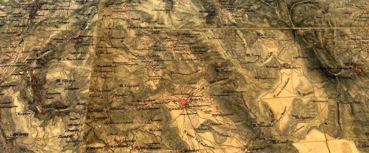

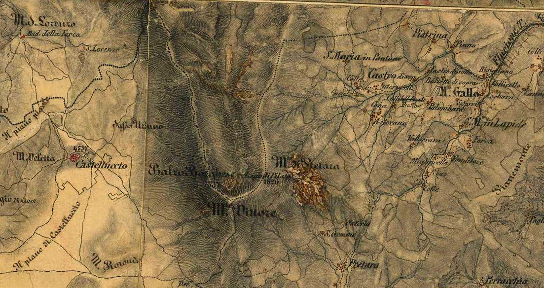

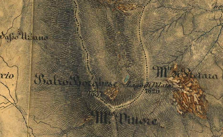

28 Nov 2020
Pontius Pilate and the shape of the waters /8. Eighteenth century: one Lake again (despite its summer shape)
When we begin to move across the eighteenth century, the representations of the Lake of Norcia appear to be consistent with the historical, widely-accepted tradition based on Antoine de la Sale's work, the early references by Pope Pius II Piccolomini, Flavio Biondo, Arnold von Harff and Leandro Alberti, the drawing on the walls of the Gallery of Maps at the Vatican Museums in Rome, and then the cartographic works published by Giuseppe Moleti, Gerard de Jode, Gerardus Mercator, Giovanni Antonio Magini, Joan Blaeu: single, single and single again. And this piece of information widely circulated across Europe, in printed books and maps.
In this framework, the sixteenth-century manuscripted diagram stored in the Vatican and the further manuscripted description written by Father Fortunato Ciucci in the seventeenth century, both providing a dual vision of the summer shape of the Lake, had no circulation and did not experience any quotation nor mention by anybody in Italy and Europe.
Between 1699 and 1703, the usual oblong shape of the Lake can be spotted in Silvestro Amanzio Moroncelli's map of “La Marca anconitana e fermana”, with an imposing Mount Vettore raising its precipitous cliffs over the Lake, which is presented as an elongated surface of water of considerable size (Fig. 1).
And another map, edited by Guillaume de L'Isle in 1711, portrays the Lake the way we already saw it in Philipp Clüver's geographical drawing: a single, dark basin nested within the rocky sides of the «Tetricus Mons» (Fig. 2).
Within the present research paper we cannot certainly overlook the capital work carried out by two great Jesuit cartographers, English-born Christopher Maire and Ruggero Giuseppe Boscovich from Dalmatia, who at the mid of the eighteenth century were entrusted by Pope Benedict XIV with the task to build the New Geographical Map of the Papal States, the first Italian cartography drawn by the use of scientific measurements and ground surveys, with the aim to assess the actual length of the meridian arc which runs across the whole extent of the territories under the Pope's rule, cutting through the town of Rimini and crossing, at its very centre, the dome of St. Peter's in Rome. Unfortunately their comprehensive map, published in 1755, does not show the Lake of Pilate at all, as it only features the label «Sibyl's Mountains» («Montagne della Sibilla») in the area where the Sibillini Mountain Range raises its peaks (Fig. 3).
This may appear as a inexplicable omission which is hard to account for. However, the whole occurrence is easily understood if we open the pages of the extensive, lively report written by Boscovich and Maire themselves about their own scientific expedition across the Papal States («De litteraria expeditione per pontificiam ditionem ad dimetiendos duos meridiani gradus et corrigendam mappam geographicam», 1755). The two cartographers explored central Italy throughout the years 1751 and 1752, making geodetical measures and collecting the geographical information which was to be used in their map. And when they confronted with the «Sibyl's Mountains», in 1752, it was hard work (Fig. 4):
«The tallest amid all the mountains which are found within the boundaries of the Papal States is the one that is known as Mount of the Sibyl».
[In the original Latin text: «Montium omnium, quotquot in ditione Pontificia continentur, editissimus est quem Montem Sibyllae nominant»].
It was at the beginning of October when, leaving the small town of Visso, on the northwestern side of the Sibillini Mountain Range, Boscovich and Maire directed their course to the highlands beneath Mount Vettore and the remote hamlet of Castelluccio. The summer was already over and the weather conditions seemed to warn them not to defy the majesty of the high peaks above (Fig. 5):
«While we crossed that valley [the Pian Perduto], the cliffs on the left side [the ridges to Mount Sibyl and Mount Vettore] were covered with dense clouds; up there, the snow was ceaselessly falling, and was even being transported by the blowing wind down to us across a remarkable distance, even though the sky over our heads was clear».
[In the original Latin text: «Dum autem iremus per eam vallem, jugum ipsum ad laevam densis nubibus e superiori parte contegebatur, unde nivem etiam, quae perpetuo decidebat, venti ad nos obliquo ingenti tractu deferebant, caelo nobis sereno»].
The two Jesuits arrived in Castelluccio, a sort of timeless, secluded settlement placed in the middle of nowhere, in which, they note in the French edition of their scientific account, «most people live through the winter season the way they use to do in Lapland [...] buried in their houses under the snow» («la plupart des habitans passent l'hyver à la maniere des Lapons [...] ensevelis dans leurs maisons sous la neige»).
It was not the case for any hazardous climb to Mount Vettore and the Lake of Pilate. So they just leave Castelluccio and take their way to Arquata, on the southernmost side of the Sibillini Mountain Range. However, this has never been an easy task, and the weather wasn't supporting them at all (Fig. 6):
«At the far end of the valley which I mentioned, we fell into a most narrow gorge, which leads from the mountain of the Sibyl down to the Marches of Ancona; the narrowness of the ravine increased the strength of the wind, to the point that the clouds brought by the wind against the mountainside rolled and broke as sea waves do, and seemed to vanish into foam; our horses had great trouble in moving onward. We were told that this passage is often impracticable, and that more than once wayfarers had been lifted up by the ravaging wind with all their horses, cast away and crushed against the rocks».
[In the original French text: «Au bout de la vallèe dont je viens de parler, nous tombâmes dans une gorge fort étroite, par laquelle on descend de la montagne de la Sibille dans la Marche d'Ancone: la petitesse du détroit augmentoit la force du vent, au point que les nuages portés par le vent contre la flanc de la montagne, s'elevoient en se brisant comme des vagues, et sembloient jetter de l'écume, enforte que nos chevaux avoient beaucoup de peine à avancer. On nous apprit que ce passage est souvent impraticable, et qu'il este arrivé plus d'une fois que des voyageurs, enlevés avec leurs chevaux par un vent impetueux, ont été jettés fort loin, et écrasés contre les rochers»].
More than a century later, in 1876, the same perilous path will be hastily trodden by Count Girolamo Orsi and his fellow-colleagues of the Italian Alpine Club under a heavy rain, «taking the cragged ravine which heads to the Valley of the River Tronto: it is sheer and precipitous, scattered with rocks and with no plants at all, full of hardships and hazardous passages, through which we rolled rather than walked. It was a disastrous descent...» (in the original Italian text: «prendendo a scender l'erta dirupata che volge alla Valle del Tronto e pare quasi a picco, irta di roccie, nuda di vegetazione, piena di seni e d'asprezze, sulla quale più che scendere si rotolava. Fu disastrosa discesa...») (Fig. 7).
So this is the reason for the absence of the Lake of Pilate in the fine, accurate map of the Papal States designed by Christopher Maire and Ruggero Giuseppe Boscovich at the mid of the eighteenth century: they never saw the Lake, and they completely overlooked the small mirror of water in the recollection of the unwelcoming weather and dire straits they had experienced during their visit to the Pian Grande and Mount Vettore, the «Sibyl's Mountains».
What happens if we proceed further in time to the first half of the nineteenth century? Again, we still find a single Lake, as we will see in the next chapter.
Ponzio Pilato e la forma delle acque /8. Diciottesimo secolo: ancora un singolo Lago (malgrado la forma estiva)
Quando iniziamo a muovere i nostri passi attraverso il diciottesimo secolo, le rappresentazioni del Lago di Norcia continuano a uniformarsi alla storica tradizione, ampiamente condivisa, che si fonda sull'opera di Antoine de la Sale, sui risalenti riferimenti presenti nei testi di Papa Pio II Piccolomini, Flavio Biondo, Arnold von Harff e Leandro Alberti, sugli affreschi presenti nella Galleria delle Carte Geografiche presso i Musei Vaticani in Roma, e sulle successive elaborazioni cartografiche pubblicate da Giuseppe Moleti, Gerard de Jode, Gerardus Mercator, Giovanni Antonio Magini, Joan Blaeu: singolo, singolo e ancora singolo. E questo elemento informativo risultava circolare capillarmente in tutta Europa, attraverso libri e mappe a stampa.
In questo contesto, il cinquecentesco diagramma manoscritto conservato in Vaticano e l'ulteriore testo manoscritto redatto da Padre Fortunato Ciucci nel diciassettesimo secolo, i quali fornivano entrambi una visione duplice della forma estiva del Lago, non ebbero alcuna circolazione e non furono oggetto di alcun riferimento o menzione da parte di nessun autore in Italia e in Europa.
Tra il 1699 e il 1703, nella mappa de “La Marca anconitana e fermana” prodotta da Silvestro Amanzio Moroncelli, è possibile osservare il Lago nell'usuale forma allungata, con un imponente Monte Vettore che innalza le proprie creste precipiti al di sopra del Lago stesso, rappresentato come uno specchio d'acqua oblungo e di notevoli dimensioni (Fig. 1).
E un'altra mappa, elaborata da Guillaume de L'Isle nel 1711, ritrae il Lago nel modo in cui avevamo già avuto modo di rilevarlo nella carta geografica di Philipp Clüver: un singolo, tenebroso bacino annidato tra i fianchi rocciosi del «Tetricus Mons» (Fig. 2).
Nell'ambito del presente lavoro di ricerca, non possiamo certamente tralasciare l'opera fondamentale prodotta da due grandi cartografi appartenenti alla Compagnia di Gesù, l'inglese Christopher Maire e il dalmata Ruggero Giuseppe Boscovich, i quali, alla metà del diciottesimo secolo, furono incaricati da Papa Benedetto XIV di predisporre la Nuova Carta Geografica dello Stato Ecclesiastico, la prima cartografia italiana ottenuta per mezzo di rilievi e triangolazioni scientifiche, con l’obiettivo di misurare la lunghezza dell’arco di meridiano che percorreva per intero i possedimenti pontifici, attraversando la città di Rimini e intersecando, al suo centro, la cupola di San Pietro in Roma. Sfortunatamente, la loro elaboratissima mappa, pubblicata nel 1755, non riporta affatto il Lago di Pilato, presentando, nell'area degli odierni Monti Sibillini, solamente un'etichetta con la dicitura «Montagne della Sibilla» (Fig. 3).
Ciò potrebbe apparire come un'inesplicabile omissione, particolarmente difficile da spiegare. In realtà, l'intera vicenda diviene facilmente comprensibile andando ad aprire le pagine dell'ampia e vivace relazione che gli stessi Boscovich e Maire hanno inteso lasciarci a proposito della spedizione scientifica da essi compiuta attraverso le terre dello Stato Pontificio («De litteraria expeditione per pontificiam ditionem ad dimetiendos duos meridiani gradus et corrigendam mappam geographicam», 1755). I due cartografi esplorarono infatti l'Italia centrale nel corso degli anni 1751 e 1752, effettuando misure geodetiche e raccogliendo le informazioni geografiche che sarebbero poi state inserite nella loro cartografia. E quando essi si recarono ad affrontare le «Montagne della Sibilla», nel 1752, scoprirono di avere a che fare con un obiettivo assai difficile (Fig. 4):
«Di tutte le montagne che si ergono all'interno dei confini pontifici, la più alta è quella che è chiamata Monte della Sibilla».
[Nel testo originale latino: «Montium omnium, quotquot in ditione Pontificia continentur, editissimus est quem Montem Sibyllae nominant»].
Era l'inizio di ottobre quando, lasciando il piccolo borgo di Visso, posto sul lato nordoccidentale dei Monti Sibillini, Boscovich e Maire diressero i propri passi verso gli altipiani situati al di sotto del Monte Vettore e presso il remoto insediamento di Castelluccio. L'estate era già terminata e le condizioni del tempo parevano voler avvisare quei due uomini di scienza, affinché non tentassero di sfidare la maestà dei picchi che li sovrastavano (Fig. 5):
«Mentre attraversavamo quella valle [il Pian Perduto], le rupi che si innalzavano sulla sinistra [le creste che conducono al Monte Sibilla e al Monte Vettore] erano nascoste, in alto, da dense nuvole; e senza posa su quei picchi cadeva la neve, che i venti trasportavano obliquamente da quella grande distanza fino a noi, mentre il cielo sulle nostre teste si mostrava sereno».
[Nel testo originale latino: «Dum autem iremus per eam vallem, jugum ipsum ad laevam densis nubibus e superiori parte contegebatur, unde nivem etiam, quae perpetuo decidebat, venti ad nos obliquo ingenti tractu deferebant, caelo nobis sereno»].
I due gesuiti arrivarono infine a Castelluccio, una sorta di luogo isolato e senza tempo, piazzato nel bel mezzo del nulla, presso il quale, come essi annotano nell'edizione francese del proprio resoconto scientifico, «la maggior parte degli abitanti trascorrono l'inverno come si usa in Lapponia [...] sepolti nelle loro case sotto la neve» («la plupart des habitans passent l'hyver à la maniere des Lapons [...] ensevelis dans leurs maisons sous la neige»).
Non era il caso di tentare alcuna rischiosa ascensione al Monte Vettore e al Lago di Pilato. Così essi abbandonarono Castelluccio e si incamminarono in direzione di Arquata del Tronto, situata sul lato più meridionale dei Monti Sibillini. Ma neanche questo percorso è stato mai particolarmente amichevole, e il tempo non li stava certamente favorendo (Fig. 6):
«Al termine della valle della quale ho già parlato, discendemmo in una gola assai stretta, attraverso la quale si discende dalla montagna della Sibilla verso la Marca d'Ancona: la ristrettezza del passaggio non faceva che incrementare la forza del vento, al punto che le nuvole, trasportate da quello stesso vento contro il fianco della montagna, si innalzavano infrangendosi come delle onde marine, e sembravano quasi gettare della schiuma, tanto che i nostri cavalli incontrarono estrema difficoltà nel procedere. Ci dissero che quel passaggio risultava essere sovente del tutto impraticabile, e che è accaduto più di una volta che dei viandanti, sollevati in aria assieme ai propri cavalli da un vento impetuoso, ne siano stati gettati lontano, e fracassati contro le rocce».
[Nel testo originale francese: «Au bout de la vallèe dont je viens de parler, nous tombâmes dans une gorge fort étroite, par laquelle on descend de la montagne de la Sibille dans la Marche d'Ancone: la petitesse du détroit augmentoit la force du vent, au point que les nuages portés par le vent contre la flanc de la montagne, s'elevoient en se brisant comme des vagues, et sembloient jetter de l'écume, enforte que nos chevaux avoient beaucoup de peine à avancer. On nous apprit que ce passage est souvent impraticable, et qu'il este arrivé plus d'une fois que des voyageurs, enlevés avec leurs chevaux par un vent impetueux, ont été jettés fort loin, et écrasés contre les rochers»].
Più di un secolo dopo, nel 1876, lo stesso pericoloso sentiero sarà percorso con grande celerità dal Conte Girolamo Orsi e dai suoi colleghi del Club Alpino Italiano, sferzati da una pioggia battente, «prendendo a scender l'erta dirupata che volge alla Valle del Tronto e pare quasi a picco, irta di roccie, nuda di vegetazione, piena di seni e d'asprezze, sulla quale più che scendere si rotolava. Fu disastrosa discesa...» (Fig. 7).
Dunque è questa la ragione dell'assenza del Lago di Pilato nella pregevole, accuratissima mappa dello Stato Ecclesiastico tracciata da Christopher Maire e Ruggero Giuseppe Boscovich alla metà del diciottesimo secolo: essi non videro mai quel Lago, e tralasciarono così di menzionare quel piccolo specchio d'acqua nel racconto di quel tempo così ostile e delle grandi difficoltà da loro esperimentate nel corso della visita al Pian Grande e al Monte Vettore, le «Montagne della Sibilla».
Ma cosa succede se procediamo ancora più oltre, verso la prima metà del diciannovesimo secolo? Di nuovo, troviamo ancora un singolo Lago, come avremo modo di vedere nel prossimo capitolo.
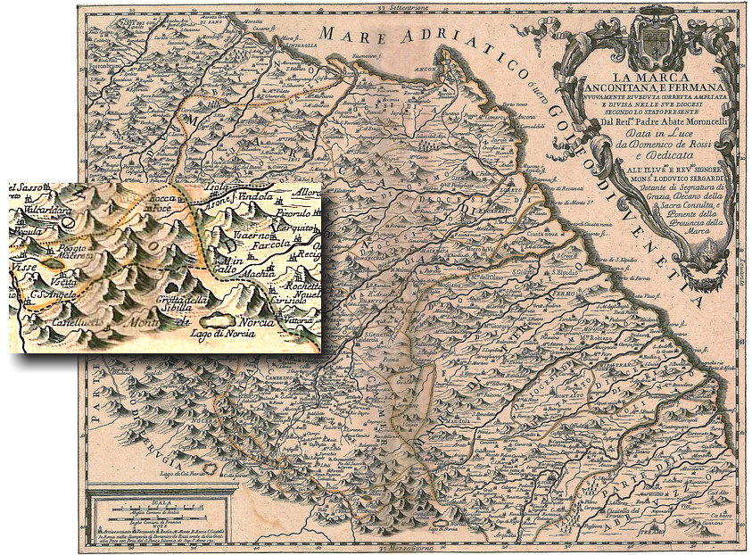

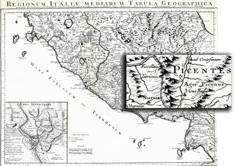

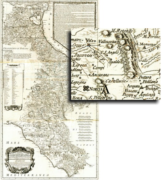


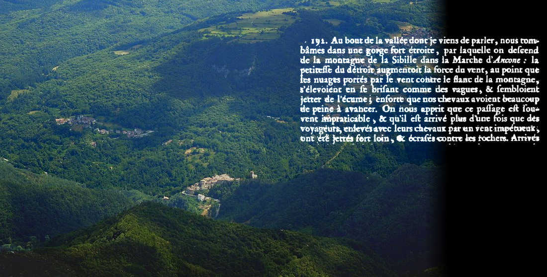

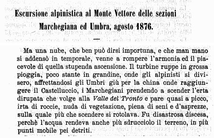

25 Nov 2020
Pontius Pilate and the shape of the waters /7. A seventeenth-century description of two Lakes
Father Fortunato Ciucci was a monk at the benedictine abbey of Norcia. He was born in the same town. For four years, between 1648 and 1651, he was assigned to the small church of St. Scholastica, set not far from the town walls, in a quiet and isolated place amid the plain (Fig. 1). There he spent his time in the elaboration of an historical essay, entitled “Chronicles of the Antique Town of Norsia”: a true mine of information on the history, legends and traditions of the principal settlement of the Sibillini Mountain Range, written in a colourful, redundant seventeenth-century style. A prose which still bewitches the reader with the archaic, fanciful sound of long strings of words, depicting the vistas and notable spots whick marked the mountainous territory. A very rare manuscript which is extant in four instances only and was transcripted and printed by Giampiero Ceccarelli and Caterina Comino in 2003 (Fig. 2).
As a lover of his homeland, Fortunato Ciucci cannot omit to include a comprehensive reference to the major legendary glories of the area: the Sibyl's Cave and the Lakes of Pilate (and we must note here the plural). A full chapter, the last in the book, is dedicated to the two renowned, necromantic places lost amid the mountains of Norcia.
His dissertation opens with a grandiloquent celebration of the titanic king of the whole land, Mount Vettore:
«No doubt at all, the sound of the Name of the great Mount Victor reverberates throughout Italy, together with the fame of the manifold, though ambiguous, Prophecies rendered at the Sibyl's Cave, and the Lakes that lie at its top; so I reckoned that I should dedicate an entire book to them, in which the inquisitive reader may satisfy his thirst for truth [...] Its Mount [of Castelluccio] is called Victor because it is the greatest of all, and it retains the same magnitude as for beauty and other remarkable features. [...] Like a gigantic Pyramid it so raises its peak towards the clouds above that only Jupiter's winged bird can reach its mountaintop».
[In the original Italian text: «Risuona, non è dubbio alcuno, il Nome per tutta l'Italia del gran Monte Vittore, dei molti, benché incerti Vaticinj della Spelonca della Sibilla, e dei Laghi che nella sommità di esso giacciono, che perciò mi è parso convenevole farne un libro intero, nel quale potrà il curioso lettore appieno soddisfarsi della verità [...]. il suo Monte [di Castelluccio] si chiama Vittore per essere di tutti il maggiore, così egli l'istessa qualità ritiene in bellezza ed altre prerogative. [...] Questo a guisa di smisurata Piramide tant'oltre si innalza con la sua cima verso le nuvole, che solo l'alato augello di Giove vi poggia»].
With his sparking opening, Fortunato Ciucci immediately provides the reader a fundamental piece of information: the Lake is not a single Lake, at least in selected periods of the year.
Let's keep on reading from Ciucci's work:
«If on various Mountains many different waters can be seen; on this an astounded World cannot but ask how it happened that Nature could store Water, on the very top of so tall a peak, in two huge Lakes, as we will later tell».
[In the original Italian text: «Se in diversi Monti si vedono acque di varia qualità; in questo stupisce il Mondo come abbia possuto la Natura nella Sommità d'un Monte sì alto farvi ricetto d'Acqua in due grossi Laghi, siccome più oltre diremo»].
So the Lakes are two. Two basins, as we already found in manuscript Vat. Lat. 5241, whose diagram was drawn by an unknown hand a century earlier. We will see that Ciucci is explicitly referring to a double configuration occurring during the summer season.
The extensive description set down by Father Fortunato Ciucci provides us with a detailed portrait of the glacial cirque of Mount Vettore, with its arched cliffs and precipitous ravines, and a comprehensive vision of the two Lakes (Fig. 3):
«On the elevated cliffs of Mount Vittore and the mountains of the province of Marche, which lies on the other side, and which make up a Liturgical Mitre; in the deep valley, at their very core where Winter has its perennial nest, locking the land in ceaseless elderliness with manacles made of crystal and chains of accumulated snow, there the renowned Lakes of the Demons are found, in the form of spectacles, with this very shape».
[In the original Italian text: «Sul l'alte cime de' Monti di Vittore e della Marca, che dirimpetto lì giace, quali formano appunto una Mitra Pastorale, nella profonda valle, in mezzo di loro dove ha perpetuo nido l'Inverno, che con ceppi di cristallo e catene di vecchie nevi tien serrata la terra in sempiterna vecchiezza giacciono i famosi Laghi de Demonj, in forma d'occhiale, in questa guisa appunto»].
Again, we see two Lakes. Again, their shape is that of eyeglasses, as it was a century earlier in manuscript Vat. Lat. 5241.
Two small basins, further portrayed by Fortunato Ciucci in his accurate description. And the duplicated shape, writes Ciucci, is typically observed in summer:
«The first of them has a circumference of 1365 survey Feet, and the second 1137; and this is measured during the Summer season; however, in Winter and Spring, out of the water produced by the melting snow which flows down from the creeks that mark the nearby peaks, I saw from various signs that they come together making up a single lake; but in Summer, in the lack of running water, they split, so that they are seen in the shape of eyeglasses, encumbered by large Boulders of fallen Rocks, and their water is fresh and clear and their chillness is like frost, because on the left side perennial snow is found, which is known to be crystal-like».
[In the original Italian text: «Il Primo dei quali contiene Piedi geometri 1365 per circuito, ed il secondo 1137: e questo in tempo d'Estate, ma il Verno e la Primavera per esser l'acqua di neve discesa dai Rivi dei vicini Monti, ho visto, e considerato da molti segni che si riduchino insieme e faccino un sol lago; ma l'Estate mancandoli il corso dell'acqua vengono a separarsi, come si vedono in forma d'occhiali, ingombrati da grossi Macigni di ruinate Pietre l'acqua dei quali sono dolci, e chiare e la freddezza è simile al ghiaccio, atteso che al sinistro lato vi sono continue nevi, dove è fama sia ridotta in alcune parti in cristallo»].
So at the middle of the seventeenth century a monk from Nursia, Father Fortunato Ciucci, saw the Lake of Pilate in the form of two smaller, separate Lakes: a typical summer condition, as he himself reports; a condition also attested by manuscript Vat. Lat. 5241 and commonlhy observed, as we will see later, in our present days. Not only during summer, but throughout the year instead.
What were the dimensions of the two ponds? Ciucci sets down the circumference of both Lakes. The ancient «survey foot», in the Papal States, was slightly less than a modern foot. Therefore, the circumference of the Lakes at the time when Ciucci wrote was nearly 1.340 and 1.120 feet: and this is actually the typical sizes we can register today for our two Lakes under conditions of significantly strong water depletion, when the two distinct basins present themselves in a fully-separated configuration (Fig. 4).
The Lake of Pilate, in summer, used to turn into two different basins.
However, even though our ancient Lake happened to be so frequently reduced to two Lakes in past centuries, we do not find traces of such dual shape in old maps and cartographies: throughout the sixteenth, seventeenth and eighteenth centuries we cannot retrieve any image which potrays the Lake as two Lakes. Apart from Vat. Lat. 5241 and Ciucci's written report: two rare witnesses, with virtually no circulation across Italy and Europe.
This is a clue to the fact that the Lake of Pilate, in past centuries, was less prone to duplication. And its appearance was, more often, that of a single, sinister basin. Except in particularly hot summer seasons.
And there might be reasons for this. Reasons we will come upon when considering the state of the Lake in the nineteenth century and beyond.
However, before we go that far, let's continue our perusal of ancient cartography. What we will see is, as anticipated, the repeated portrait of a single Lake.
Ponzio Pilato e la forma delle acque /7. Una seicentesca descrizione di due Laghi
Padre Fortunato Ciucci era un monaco dell'abbazia benedettina di Norcia, e originario di quella stessa città. Per quattro anni, tra il 1648 e il 1651, egli era stato assegnato alla piccola chiesa di Santa Scolastica, situata non lontano dalle mura urbiche, in luogo quieto e isolato nella vicina pianura (Fig. 1). Fu lì che egli impiegò il proprio tempo nella stesura di un saggio storico, dal titolo "Istorie dell'antica città di Norsia": una vera e propria miniera di informazioni in merito alla storia, alle leggende e alle tradizioni del principale insediamento dei Monti Sibillini, redatta in un ridondante, colorito stile seicentesco. Una prosa ancora oggi capace di affascinare il lettore con il suono arcaico e fantasioso delle sue lunghe sequenze di vocaboli, che dipingono i panorami e i luoghi notevoli che segnavano quel territorio collocato tra alte montagne. Un manoscritto estremamente raro, pervenuto fino a noi in soli quattro esemplari, e nel 2003 trascritto e ristampato da Giampiero Ceccarelli e Caterina Comino (Fig. 2).
Profondamente innamorato della propria terra, Fortunato Ciucci non può certo omettere di inserire, nella propria opera, un'estesa menzione a proposito delle maggiori glorie leggendarie di quelle contrade: la Grotta della Sibilla e i Laghi di Pilato (e notiamo qui l'uso del plurale). Un intero capitolo, l'ultimo del volume, è dedicato proprio ai due rinomati siti negromantici perduti tra le montagne di Norcia.
La sua dissertazione si apre con una magniloquente celebrazione del titanico signore dell'intero territorio, il Monte Vettore:
«Risuona, non è dubbio alcuno, il Nome per tutta l'Italia del gran Monte Vittore, dei molti, benché incerti Vaticinj della Spelonca della Sibilla, e dei Laghi che nella sommità di esso giacciono, che perciò mi è parso convenevole farne un libro intero, nel quale potrà il curioso lettore appieno soddisfarsi della verità [...]. il suo Monte [di Castelluccio] si chiama Vittore per essere di tutti il maggiore, così egli l'istessa qualità ritiene in bellezza ed altre prerogative. [...] Questo a guisa di smisurata Piramide tant'oltre si innalza con la sua cima verso le nuvole, che solo l'alato augello di Giove vi poggia».
Con questa scintillante introduzione, Fortunato Ciucci fornisce al lettore un fondamentale elemento informativo: il Lago non è affatto un Lago singolo, quantomeno in specifici periodi dell'anno.
Ed ecco come prosegue la descrizione contenuta nell'opera di Ciucci:
«Se in diversi Monti si vedono acque di varia qualità; in questo stupisce il Mondo come abbia possuto la Natura nella Sommità d'un Monte sì alto farvi ricetto d'Acqua in due grossi Laghi, siccome più oltre diremo».
E così, i Laghi sono due. Due specchi d'acqua, così come abbiamo già avuto occasione di vedere nel manoscritto Vat. Lat. 5241, il cui diagramma era stato tracciato da una mano ignota un secolo prima. Vedremo anche come Ciucci stia facendo esplicito riferimento a una duplice configurazione tipica delle stagioni estive.
L'elaborata descrizione vergata da Padre Fortunato Ciucci ci presenta un dettagliato ritratto del circo glaciale del Monte Vettore, con le sue arcuate scogliere e i dirupati precipizi, assieme a una visione d'insieme dei due Laghi (Fig. 3):
«Sul l'alte cime de' Monti di Vittore e della Marca, che dirimpetto lì giace, quali formano appunto una Mitra Pastorale, nella profonda valle, in mezzo di loro dove ha perpetuo nido l'Inverno, che con ceppi di cristallo e catene di vecchie nevi tien serrata la terra in sempiterna vecchiezza giacciono i famosi Laghi de Demonj, in forma d'occhiale, in questa guisa appunto».
Ed ecco, di nuovo, che possiamo contemplare due distinti Laghi. Ancora una volta, la forma è quella di un paio d'occhiali, esattamente come cento anni prima, sulla base di quanto raffigurato nel manoscritto Vat. Lat. 5241.
Due piccoli bacini, ulteriormente illustrati da Fortunato Ciucci nella propria accuratissima descrizione. E la duplice forma, scrive Ciucci, è tipicamente rinvenibile in tempo d'estate:
«Il Primo dei quali contiene Piedi geometri 1365 per circuito, ed il secondo 1137: e questo in tempo d'Estate, ma il Verno e la Primavera per esser l'acqua di neve discesa dai Rivi dei vicini Monti, ho visto, e considerato da molti segni che si riduchino insieme e faccino un sol lago; ma l'Estate mancandoli il corso dell'acqua vengono a separarsi, come si vedono in forma d'occhiali, ingombrati da grossi Macigni di ruinate Pietre l'acqua dei quali sono dolci, e chiare e la freddezza è simile al ghiaccio, atteso che al sinistro lato vi sono continue nevi, dove è fama sia ridotta in alcune parti in cristallo».
Dunque, alla metà del diciassettesimo secolo un monaco di Norcia, Padre Fortunato Ciucci, osservò il Lago di Pilato in forma di due piccoli Laghi separati tra di loro: una tipica condizione estiva, come egli stesso riferisce; una condizione che viene attestata anche dal manoscritto Vat. Lat. 5241, e risulta essere comunemente osservabile, come avremo modo di vedere in seguito, anche ai nostri giorni. Non solo durante il periodo estivo, ma lungo tutto l'arco dell'anno.
Ma quali erano le dimensioni dei due specchi d'acqua? Ciucci pone per iscritto la circonferenza di entrambi i Laghi. L'antico «piede agrimensorio», nello Stato Pontificio, era leggermente più corto del moderno piede. Dunque, la circonferenza dei Laghi all'epoca in cui Ciucci scriveva era pari a circa 410 metri e 340 metri: e sono queste, effettivamente, le dimensioni tipiche che anche oggi possiamo registrare per i nostri due Laghi in condizioni di notevole carenza d'acqua, quando i due distinti bacini si presentano all'osservatore in modo totalmente separato (Fig. 4).
Il Lago di Pilato, in estate, era solito mutarsi in due differenti bacini.
Eppure, benché il nostro antico Lago, negli scorsi secoli, potesse frequentemente ridursi a due Laghi più piccoli, non è possibile rinvenire tracce di questa configurazione duale nelle antiche mappe e cartografie: nel corso dei secoli sedicesimo, diciassettesimo e diciottesimo, non siamo in grado di reperire alcuna immagine che rappresenti il Lago come due Laghi distinti. Ad esclusione del Vat. Lat. 5241 e della testimonianza scritta vergata da Ciucci: due fonti del tutto uniche, che non ebbero virtualmente alcuna circolazione in Italia e in Europa.
Si tratta, dunque, di un indizio che pare indicarci come il Lago di Pilato, negli scorsi secoli, fosse meno frequentemente soggetto a duplicazione. E che quindi il suo sembiante fosse, assai più sovente, quello di un singolo, sinistro bacino. Ad eccezione di stagioni estive particolarmente aride.
E potrebbero esservi anche ulteriori ragioni per tutto ciò. Ragioni nelle quali ci imbatteremo quando andremo a considerare la condizione del Lago nel diciannovesimo secolo e in epoche ancora più recenti.
Nondimeno, prima che la nostra investigazione vada a spingersi così lontano, proseguiamo con la nostra consultazione delle antiche cartografie. E ciò che vedremo è, come già anticipato, il ripetuto ritratto di un singolo Lago.


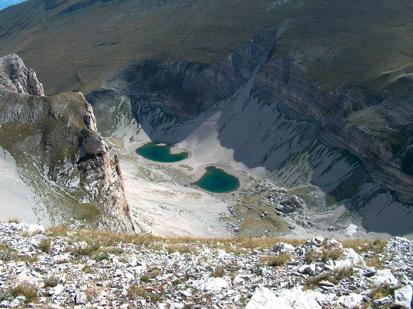

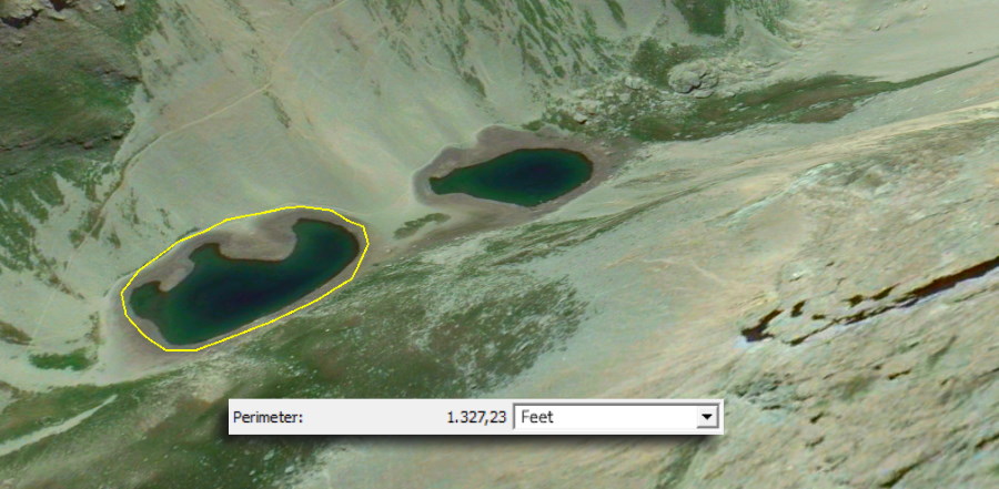

23 Nov 2020
Pontius Pilate and the shape of the waters /6. A sixteenth-century, first-hand visit to two Lakes
In 1982, a librarian at the Vatican Apostolic Library, Augusto Campana, was perusing the vellum leaves of a manuscripted volume preserved amid the tens of thousands of ancient, precious manuscripts which belong to the Holy See's collection in Rome. And he stumbled upon a stunning surprise.
The codex he was exploring was registered as Vat. Lat. 5241 (Fig. 1). On its first page it bore a date: 1566. And it contained a large number of references to classical Latin inscriptions, which some impassioned Renaissance collector had copied from monuments, marble slates, and graves dating back to ancient Rome. The volume had actually belonged to Aldus Manutius the Younger, a member of the renowned family of publishers and scholars from Venice, who were at the forefront of the revolution that, in the course of the fifteenth and sixteenth centuries, the new printing technologies were introducing across the European culture.
When Augusto Campana got to the folia 9v and 10r, he found something different from Latin inscriptions. Something utterly astonishing.
It was a drawing. A drawing of towns and mountains and lakes. It was an ancient drawing of what we know today as the Sibillini Mountain Range (Fig. 2). Untouched, totally forgotten, it had been sleeping for four hundred years, concealed amid the many pages of manuscript Vat. Lat. 5241, until a passionate librarian came upon it and brought it to light. And it was a very special drawing.
Because it portrayed a journey into legend.
An unknown sixteenth-century traveller, starting from the minutely-portrayed towns of Cascia and Norcia in the Valnerina Valley, had ascended the steep trails to the small hamlet of Castelluccio and had reached the Pian Grande, labelled in the diagram with the words «the plain of Castelluccio, two miles without a single stone» (in the original Italian text: «il piano del castelluccio son due miglia sensa una pietra») (Fig. 3). Then, the unnamed wayfarer had entered the secluded, magical kingdom of the Apennine Sibyl, beneath the shadows of lofty mountains which raised in that remote territory: «this mount is called the 'chiavetoie' (Vettore?)», he writes, «also known as The Mountain of the Sibyl» (in the original Italian text: «questa montagna dicono de chiavetoie, altramente La montagna della Sibilla»).
But the very core of this sinister journey is drawn at the very centre of the diagram. It is called «the Lake Avernus of Norcia» (in the original Italian text: «il laco averno di Norcia»), a name which marks a significative narrative correspondance with the famous, classical entryway to the House of Hades set in Cumae.
It is the Lake of Norcia, also known as the Lake of Pilate. And, in this diagram, it is no single Lake: because there are two of them (Fig. 4).
As we saw in the previous paragaraph of the present research article, in all the geographical maps available to us and dating to the sixteenth and seventeenth century, the Lake of Norcia is always and invariably represented as a single basin. However, someone was there around the middle of the sixteenth century. And what he saw was a Lake split into two smaller mirrors of water.
This peculiar, fascinating vision, contained in manuscript Vat. Lat. 5241 and extensively investigated by Romano Cordella ("'Il Laco Averno di Norcia' in un disegno cinquecentesco della Biblioteca Apostolica Vaticana", 2015), shows that at the mid of the sixteenth century the Lake of Norcia, at least at some moments of its life, was so shallow as to shrink to two distinct lakes, not different from the way we are used to behold it in our present days. Amid the two smaller basins, necromantic rituals were performed by visitors at circular walls made of piled-up stones, as shown in the diagram.
Two small Lakes, as opposed to the single basin always displayed in the known cartography that had been drawn throughout the same centuries.
What is the meaning of this drawing? And why the Lake appears to be split in two, while all other sources present it in the shape of a single pond?
What the unknown visitor's drawing seems to signify to the modern reader is that the Lake of Norcia, or Pilate's Lake, has never been particularly deep: it has always been a shallow basin, as clearly portrayed in the manuscript, with waters which go from a darker hue at the middle of the two pools to grey hatchings that represent shallower areas. And the scarce quantity of water detected by our sixteenth-century visitor is plausibly connected to the time of his visit, carried out in summer as assumed by Romano Cordella in his detailed analysis:
«The time of the journey is that of hay harvesting, in July or August, in accordance with the arid conditions of the lake as seen in the drawing».
[In the original Italian text: «l'epoca del viaggio coincide con la raccolta del fieno, cioè luglio-agosto, in accordo con lo stato siccitoso del lago come si vede nel disegno»].
So extended periods of drought during summers were able to deplete severely the water amount in the Lake, reducing it to two smaller Lakes: during the sixteenth century as today.
This is a confirmation of the remarkable shallowness of the Lake of Pilate, strongly affected by local weather conditions in terms of snow and rain quantities.
And summer will be invoked by another witness, Fortunato Ciucci, to explain the appearance of the Lake of Pilate a hundred years later, at the mid of the seventeenth century.
A duplicated Lake, in the form of spectacles.
Ponzio Pilato e la forma delle acque /6. Una visita cinquecentesca presso le rive di due Laghi
Nel 1982, un bibliotecario della Biblioteca Apostolica Vaticana, Augusto Campana, stava volgendo le pagine di pergamena di uno dei volumi manoscritti conservati, tra le decine di migliaia di altri antichi, preziosi manoscritti, presso la collezione della Santa Sede in Roma.
Il codice che Campana aveva tra le mani era catalogato come Vat. Lat. 5241 (Fig. 1). Sulla prima pagina, esso recava una data: 1566. E il contenuto era costituito da un grande numero di riferimenti a iscrizioni della classicità latina, che qualche appassionato collezionista del Rinascimento aveva copiato da monumenti, lastre di marmo e tombe risalenti all'epoca di Roma antica. Quel volume era in effetti appartenuto a Aldo Manuzio il Giovane, membro della celebre famiglia di editori e studiosi attiva in Venezia, all'avanguardia di quella grande rivoluzione che, nel corso dei secoli quindicesimo e sedicesimo, le nuove tecnologie di stampa stavano introducendo nel mondo della cultura europea.
Quando Augusto Campana giunse alle pagine 9v e 10r, egli si imbatté in qualcosa di assai diverso dalle iscrizioni latine. Qualcosa di assolutamente straordinario.
Si trattava di un disegno. Un disegno di città e montagne e laghi. Era un'antica rappresentazione di ciò che noi conosciamo, oggi, con il nome di Monti Sibillini (Fig. 2). Mai toccato, totalmente dimenticato, quel diagramma aveva atteso per quattrocento anni, dormendo nascosto tra le molteplici pagine del manoscritto Vat. Lat. 5241, finché un appassionato bibliotecario non lo aveva ritrovato, riportandolo alla luce. E, quel disegno, era molto speciale.
Perché raccontava di un viaggio nella leggenda.
Un ignoto viaggiatore del sedicesimo secolo, partendo dalle raffigurazioni minuziose e dettagliate delle città di Cascia e Norcia, in Valnerina, aveva risalito i ripidi sentieri che conducono al piccolo insediamento di Castelluccio e aveva poi raggiunto il Pian Grande, indicato nel diagramma con le parole «il piano del castelluccio son due miglia sensa una pietra» (Fig. 3). In seguito, lo sconosciuto viandante aveva fatto ingresso nel regno magico e nascosto della Sibilla Appenninica, all'ombra di elevate montagne che si innalzavano in quel territorio remoto: «questa montagna dicono de chiavetoie (Vettore?)», egli scrive, «altramente La montagna della Sibilla».
Ma il nucleo più profondo di questa sinistra escursione è tracciato al centro del diagramma. È chiamato «il laco averno di Norcia», un nome che segna una significativa corrispondenza narrativa con il famoso punto di ingresso classico all'Ade, situato a Cuma.
È il Lago di Norcia, conosciuto anche come Lago di Pilato. E, in questo diagramma, non si tratta affatto di un Lago singolo: perché, di Laghi, ve ne sono due (Fig. 4).
Come abbiamo avuto modo di vedere nel precedente capitolo della presente ricerca, in tutte le carte geografiche a noi disponibili e risalenti al sedicesimo e diciassettesimo secolo, il Lago di Norcia è sempre e invariabilmente rappresentato come un singolo bacino. Eppure, qualcuno si trovava lì alla metà del sedicesimo secolo. E ciò che egli ebbe modo di vedere fu un Lago suddiviso in due piccoli specchi d'acqua.
Questa peculiare, affascinante visione, contenuta nel manoscritto Vat. Lat. 5241 e approfonditamente indagata da Romano Cordella ("'Il Laco Averno di Norcia' in un disegno cinquecentesco della Biblioteca Apostolica Vaticana", 2015), mostra come alla metà del sedicesimo secolo le acque del Lago di Norcia, in alcuni momenti della propria vita, fossero così basse da ridursi a due laghi distinti, un'occorrenza del tutto simile a ciò che siamo soliti osservare ai nostri giorni. Tra i due piccoli bacini, rituali negromantici venivano praticati dai visitatori presso mura circolari costruite con accumuli di pietre, così come mostrato nel disegno.
Due piccoli Laghi, in contrasto rispetto al singolo bacino sempre rappresentato nella cartografia a noi nota, tracciata attraverso gli stessi secoli.
Cosa significa questo diagramma? E perché il Lago vi appare suddiviso in due, mentre tutte le altre fonti lo rappresentano come un singolo specchio d'acqua?
Ciò che il disegno tracciato dallo sconosciuto visitatore pare voler significare al moderno lettore è che il Lago di Norcia, o Lago di Pilato, non è mai stato particolarmente profondo: esso si è sempre presentato come un bacino caratterizzato da una limitata profondità, come chiaramente illustrato nel manoscritto, con le acque che muovono da una tonalità oscura, al centro dei due Laghi, fino ad arrivare a un tratteggio grigio, che intende rappresentare le zone scarsamente profonde. E la limitata quantità d'acqua rilevata dal nostro cinquecentesco visitatore pare essere assai plausibilmente connessa al momento in cui quella visita è stata effettuata, probabilmente in estate, come ipotizzato da Romano Cordella nella propria dettagliata analisi:
«L'epoca del viaggio coincide con la raccolta del fieno, cioè luglio-agosto, in accordo con lo stato siccitoso del lago come si vede nel disegno».
E così i lunghi periodi di siccità che si verificano usualmente in tempo d'estate erano in grado di ridurre notevolmente la quantità di acqua presente nel Lago, riducendolo, in questo modo, in due Laghi più piccoli: nel sedicesimo secolo, così come anche oggi.
Si tratta dunque di una conferma della limitata profondità del Lago di Pilato, fortemente influenzato dalle condizioni meteorologiche locali in termini di quantità di precipitazioni, anche nevose.
E l'estate sarà invocata anche da un altro testimone, Fortunato Ciucci, proprio allo scopo di spiegare lo specifico aspetto del Lago di Pilato, cento anni più tardi, alla metà del diciassettesimo secolo.
Un duplice Lago, in forma d'occhiale.


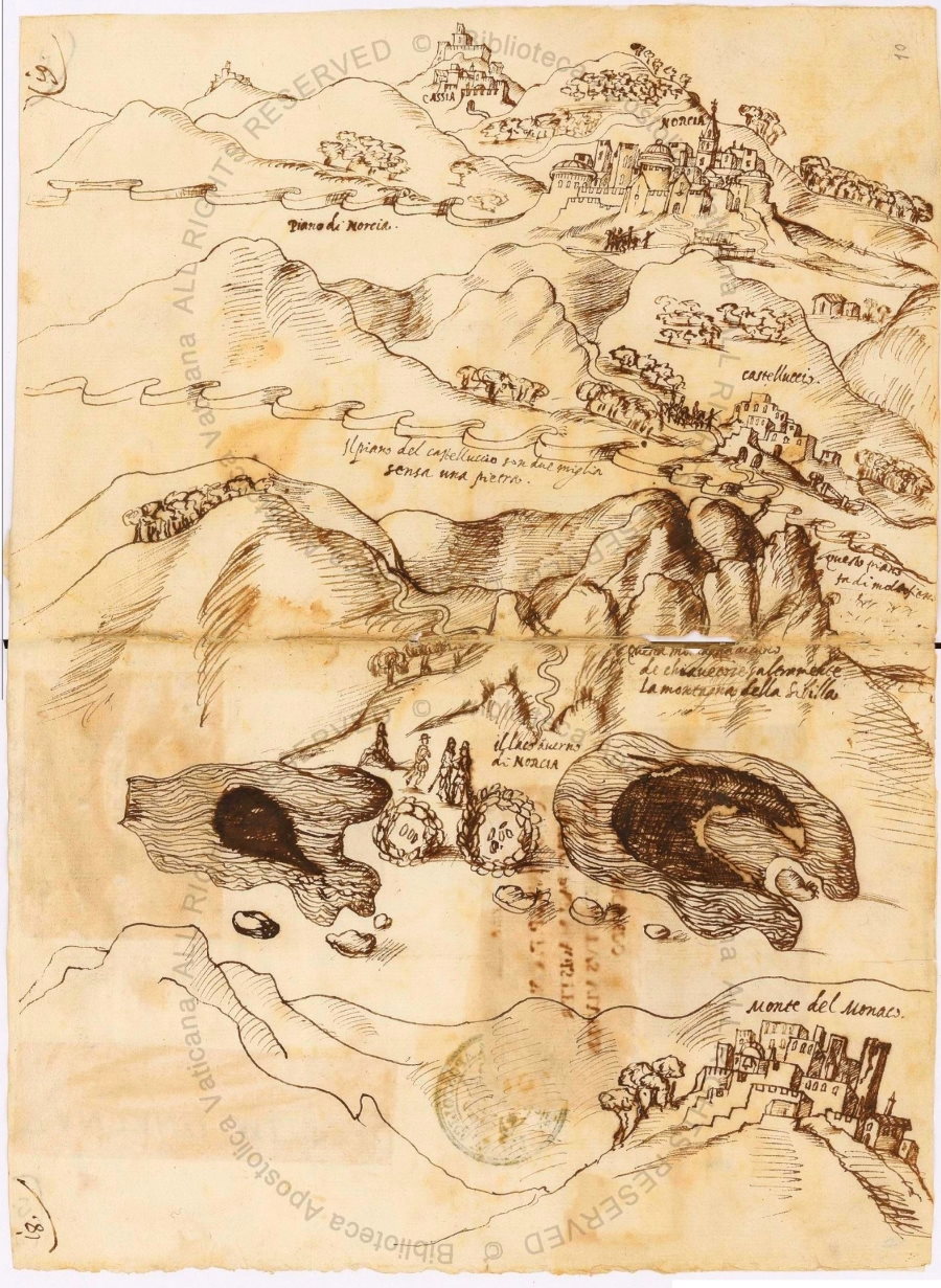

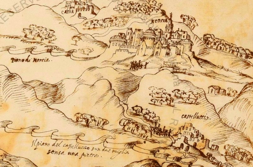

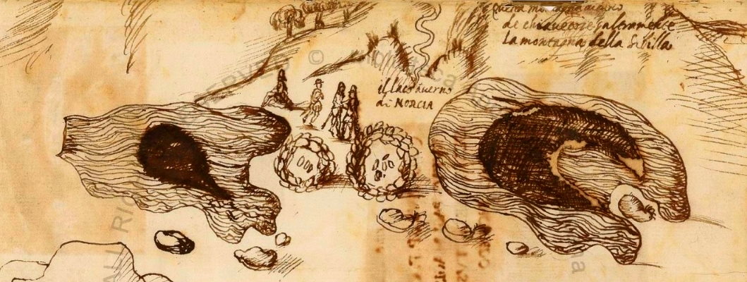

22 Nov 2020
Pontius Pilate and the shape of the waters /5. The ancient likeness of a single Lake
From the sixteenth century to the eighteenth we cannot retrieve any additional, largely-known reference to the Lake of Pilate in the European literature. And yet, the Sibyl's Cave and the waters dedicated to Pontius Pilate, set in the middle of the Italian Apennines, still seem to unfold enough appeal as to attract the attention of Italian and Flemish geographers, as manuscripted and printed collections of atlases begin to be edited throughout Europe.
And the Lake of Pilate, also known as the Lake of Norcia, is portrayed with its seemingly original shape: a single, magical Lake. A Lake that, almost certainly, was not the object of a direct observation carried out by the very eyes of those same geographers: most plausibly its shape was reported to them by local correspondents and sources. Whatever the case, the maps we know bear no testimony to a duplicated nature of the Lake, though in hot summers the Lake itself certainly used to part into two smaller basins, as attested by two main sources we are going to address later in the present paper: a duplication which, apparently, will become more stable in later, more recent centuries, as we will see in the next paragraphs.
A most clear, most stunning pictorial representation of the Lake of Norcia, together with the Sibyl's Cave nearby, is presented in the renowned Gallery of Maps at the Vatican Museums in Rome. Designed by the Italian mathematician and geographer Ignazio Danti and painted on the walls of the Gallery between the years 1580 and 1581, the giant maps of the many parts and territories of sixteenth-century Italy shine with their blue and green hues before the astonished eyes of visitors (Fig. 1).
It is in the map which portrays the town and countryside of Spoletium (Fig. 2), in central Italy, that we find the image of the Apennine area where the two magical geographical features lie: the «Grotta della Sibilla» opens its gloomy jaws not far from the towns of Norcia («Nursia») and Visso, in the middle of what we know today as the Sibillini Mountain Range; and the «Lago di Norcia» stands as a deep-blue pool on high grounds near Mount Vettore, which is uncorrectly depicted as a different mountain (Fig. 3).
Despite this inconsistency, which testifies to the fact that Ignazio Danti couldn't but draw most of his maps basing on second-hand information provided by other geographers and local correspondents, it is clear that our necromantic Lake was well known to sixteenth-century scholars. It was so renowned, just like the Sibyl's Cave, as to deserve a graphical mention in the geographical paintings housed in the Vatican. And it was known to be a single, sinister basin of water.
Only twenty years earlier, in the edition of the “Geographia Claudii Tolomaei Alexandrini”, as edited and expanded by the Italian mathematician Giuseppe Moleti in 1562, the Lake hidden within the Italian Apennines is shown as a single, irregularly-shaped pool of water, with the following accompanying text (Fig. 4, 5):
«The town of Norcia, the lake and the Cave of Norcia are seen. Tales are told that in the Cave dwells a Sibyl, and Demons in the lake».
[In the original Latin text: «Nursiae civitas, lacus, et Caverna Nursiae, reperiuntur. In Caverna fertur habitare Sybillam, et in lacu Demones»].
We find the Sibyl's Cave but not the Lake in the gorgeous editions of Abraham Ortelius' “Theatrum Orbis Terrarum”, published between the end of the sixteenth century and the beginning of the seventeenth, possibly out of the fact that Ortelius' work was taken from a map of “La Marca d'Ancona” drawn by Vincenzo Luchino in 1564, which equally did not include the Lake of Pilate. However, we do find our necromantic waters in the work of a main competitor of Ortelius: the “Speculum Orbis Terrae”, in the edition published in 1593 by Gerard (or Petrus) de Jode and his son Cornelis: here the «Lake of Norcia» («Lago de Norcia») is drawn as an elongated geographical feature sitting not far from the Cave. But, again, it is a single Lake (Fig. 6, 7).
The Lake and its companion, the Sibyl's Cave, are also staged in a most rare map contained in a manuscript preserved at the Vatican Apostolic Library (Barb. Lat. 9906). The map was first set down by Mauro Giubilio in 1592 and then drawn by Giovanni Maggi in 1617: it shows a large basin lying in the territory of Norcia, «hometown of St. Benedict and Quintus Sertorius» (Fig. 8).
We find a curious representation of the Lake of Norcia in the large “Atlas sive Cosmographicae Meditationes de fabrica mundi et fabricati figura”, published by the Flemish cosmographer Gerardus Mercator and his son in 1595. In it, the pool of water is shown positively connected to the hometown of St. Benedict via a streamlet or creek, a possible reference to the Torbidone river and its alleged, subterranean connection to the Lake of Pilate (Fig. 9, 10).
In 1620, Fabio Magini, the son of Giovanni Antonio Magini, the great Italian astronomer and cartographer, published “Italy - A General Description”, the last work completed by his father, who had passed away three years earlier (Fig. 11). The book contained a bounty of detailed maps depicting seventeenth-century Italy, and Giovanni Antonio Magini did not miss the chance to outline the exact position of Mount Sibyl and the Lake of Norcia in two different maps: a first one which depicted the Duchy of Spoletium and a second dedicated to the Marches of Ancona.
In the first map, we see Norcia with its multitude of small castles lying in the vicinity: S. Pellegrino, Frascaro, Paganelli, Valcaldara, Notoria, S. Marco, Pescia, Castel S. Maria, Santa Maria della Neve, Ancaiano, Rocca Anolfi, Castelluccio, all featuring almost the same spelling as the names we use today. In the upper portion of the map, the Sibyl's Cave («Grotta della Sibilla») opens its gloomy jaws on a mount raising beside Mount Vettore («Vittore»). Nearby, the Lake of Norcia («Lago di Norcia») is drawn as a single, large water surface (Fig. 12).
In the second map, the same magical places appear again, with the small hamlet of Castelluccio guarding the plain and the trails leading to the two sites: and the Lake is still portrayed as a single basin (Fig. 13).
We can also observe our necromantic Lake in a work by German geographer Philipp Clüver, “Italia Antiqua”, dating to 1624: a nameless, ominous pool of dark waters sits on a mountain labelled as «Tetrica», the ancient Latin name for the most precipitous portion of the Sibillini Mountain Range, including Mount Vettore. So no doubt that this basin is to be identified with our Lake of Norcia, the town which lies close in the map (Fig. 14, 15).
At the middle of the seventeenth century it is the Dutch cartographer Joan Blaeu who draws the outlines of the Lake and Cave lying within the Italian Apennines in central Italy: with his impressive “Nova et accuratissima totius terrarum orbis tabula”, published in Amsterdam in 1659 (but other versions were edited by him since 1640), he shows the «Marca d'Ancona», once known as «Picenum», and the «Duchy of Spoletium», or «Umbria», in two adjacent maps, each featuring the Sibyl's Cave and the Lake of Norcia, once again with a single, elongated shape (Fig. 16, 17, 18).
Single, single and single again.
However, we know two remarkable, significant instances of literary and graphical mentions of a Lake split into two smaller lakes, out of summer droughts.
They date back to the sixteenth and seventeenth century. At that time, in the good season, the Lake could appear before the eyes of visitors in the form of two distinct Lakes, a shape that the water basin often happened to take during hot, dry summers, as it still occurs today with increasing frequency and throughout the year.
Let's begin from the oldest, graphical mention: it makes up a most astounding reference to the two famous, magical locations set within the Sibillini Mountain Range.
It is preserved at the Vatican. A manuscripted drawing. Of such a sort that it seems to plunge the reader straight into a gloomy journey carried out five hundred years ago. A journey into prohibited arts, effected not to a single, but a duplicated Lake of Norcia.
Ponzio Pilato e la forma delle acque /5. L'antico sembiante di un singolo Lago
Tra il sedicesimo e il diciottesimo secolo non è possibile rinvenire, nella letteratura europea, ulteriori riferimenti, che siano ampiamente noti, al Lago di Pilato. Malgrado ciò, dalla Grotta della Sibilla e da quelle acque dedicate a Ponzio Pilato, poste al centro degli Appenninini, sembra ancora scaturire un fascino particolare, in grado di attirare l'attenzione dei geografi italiani e fiamminghi, a mano a mano che le collezioni di mappe e atlanti, manoscritte e a stampa, iniziano a essere pubblicate e diffuse in tutta Europa.
E il Lago di Pilato, conosciuto anche come il Lago di Norcia, viene ritratto con quella che pare essere la sua forma originale: un singolo, magico Lago. Un Lago che, quasi certamente, non fu oggetto di osservazione personale e immediata, effettuata sotto lo sguardo diretto di quei geografi: assai più probabilmente, la natura della sua forma veniva riferita ai cartografi da fonti e corrispondenti locali. In ogni caso, le mappe a noi note non rendono testimonianza alcuna a una natura duplice del Lago, benché nelle estati più calde il Lago stesso tendesse certamente a suddividersi in due bacini più piccoli, come attestato da due significative fonti, che andremo ad analizzare successivamente in questo stesso articolo: una duplicazione che, apparentemente, diventerà maggiormente stabile in secoli più tardi, come avremo modo di vedere nei prossimi paragrafi.
Un'eloquentissima, straordinaria rappresentazione pittorica del Lago di Norcia, raffigurata assieme alla vicina Grotta della Sibilla, è presente nella celebre Galleria delle Carte Geografiche, presso i Musei Vaticani in Roma. Progettata dal matematico e geografo Ignazio Danti, e dipinta sulle pareti della Galleria tra gli anni 1580 e 1581, le gigantesche mappe relative alle varie parti dell'Italia del sedicesimo secolo risplendono dei loro colori blu e verdi di fronte agli occhi affascinati dei visitatori (Fig. 1).
È nella mappa che ritrae la città e il territorio di Spoleto (Fig. 2), nell'Italia centrale, che rinveniamo l'immagine della regione appenninica nella quale si trovano i due magici elementi geografici: la «Grotta della Sibilla» apre le proprie tenebrose fauci non lontano dalle città di Norcia («Nursia») e Visso, nel mezzo di ciò che oggi conosciamo con il nome di Monti Sibillini; e il «Lago di Norcia» si staglia con il suo bacino di un colore blu profondo sulle elevazioni poste nelle immediate vicinanze del Monte Vettore, il quale viene erroneamente rappresentato come una diversa montagna (Fig. 3).
Malgrado questa imprecisione, che testimonia del fatto che Ignazio Danti non poté che tracciare la maggior parte delle proprie mappe sulla base di informazioni di seconda mano, tratte da altri geografi o fornite da corrispondenti locali, appare chiaro come il nostro negromantico Lago fosse ben noto agli studiosi del sedicesimo secolo. Era così rinomato, proprio come la Grotta della Sibilla, da meritarsi una menzione pittorica negli affreschi geografici situati in Vaticano. Ed era noto come un singolo, sinistro specchio d'acqua.
Solamente venti anni prima, nell'edizione della "Geographia Claudii Tolomaei Alexandrini", elaborata e ampliata dal matematico italiano Giuseppe Moleti nel 1562, il Lago nascosto tra gli Appennini veniva rappresentato come un bacino singolo e dalla forma irregolare, accompagnato dal seguente testo (Fig. 4, 5):
«La città di Norcia, il lago e la Caverna di Norcia qui si trovano. Si dice che nella Caverna dimori una Sibilla, e demoni nel lago».
[Nel testo originale latino: «Nursiae civitas, lacus, et Caverna Nursiae, reperiuntur. In Caverna fertur habitare Sybillam, et in lacu Demones»].
Troviamo invece la Grotta della Sibilla, ma non il Lago, nelle stupende edizioni del "Theatrum Orbis Terrarum" di Abraham Ortelius, pubblicate tra la fine del sedicesimo secolo e l'inizio del diciassettesimo, probabilmente a causa del fatto che l'opera di Ortelius venne tratta da una mappa denominata "La Marca d'Ancona" disegnata da Vincenzo Luchino nel 1564, la quale parimenti non riporta la presenza del Lago di Pilato. Ma ritroviamo le nostre acque negromantiche nell'opera di uno dei principali concorrenti di Ortelius: lo "Speculum Orbis Terrae", nell'edizione pubblicata nel 1593 da Gerard (o Petrus) de Jode e da suo figlio Cornelis: qui il «Lago de Norcia» è tracciato come un elemento geografico oblungo, posto a poca distanza dalla Grotta. Di nuovo, esso si presenta come un singolo Lago (Fig. 6, 7).
Il Lago e la sua compagna, la Grotta della Sibilla, sono nuovamente posti in scena in una rarissima mappa contenuta in un manoscritto conservato presso la Biblioteca Apostolica Vaticana (Barb. Lat. 9906). La mappa fu inizialmente elaborata da Mauro Giubilio nel 1592 e in seguito disegnata da Giovanni Maggi nel 1617: essa mostra un grande bacino giacente nel territorio di Norcia, «patria di S. Benedetto e Q. Sertorio» (Fig. 8).
Ci imbattiamo in una curiosa rappresentazione del Lago di Norcia nel grande "Atlas sive Cosmographicae Meditationes de fabrica mundi et fabricati figura", pubblicato dal cosmografo fiammingo Gerardus Mercator e da suo figlio nel 1595. In esso, lo specchio d'acqua è disegnato in manifesta connessione con la città di San Benedetto tramite un ruscello o torrente: un possibile riferimento al fiume Torbidone e alla sua asserita, sotterranea connessione con il Lago di Pilato (Fig. 9, 10).
Nel 1620, Fabio Magini, figlio di Giovanni Antonio Magini, il grande astronomo e cartografo italiano, pubblicò "Italia descritta in generale", l'ultima opera completata dal padre, scomparso tre anni prima (Fig. 11). Il volume contiene una ricca collezione di dettagliate mappe raffiguranti l'Italia del diciassettesimo secolo, e Giovanni Antonio Magini non si lasciò sfuggire l'occasione per delineare l'esatta posizione del Monte Sibilla e del Lago di Norcia in due diverse rappresentazioni cartografiche: la prima relativa al Ducato di Spoleto e una seconda dedicata alla Marca Anconetana.
Nella prima mappa, possiamo osservare Norcia con la sua moltitudine di piccoli castelli sparsi nelle vicinanze: S. Pellegrino, Frascaro, Paganelli, Valcaldara, Notoria, S. Marco, Pescia, Castel S. Maria, Santa Maria della Neve, Ancaiano, Rocca Anolfi, Castelluccio, tutti riportati con la medesima grafia utilizzata ai nostri giorni. Nella porzione superiore della mappa, la «Grotta della Sibilla» apre il proprio oscuro ingresso sulla cima di una montagna che si erge accanto al Monte Vettore («Vittore»). A poca distanza, viene ritratto il «Lago di Norcia», un singolo, esteso specchio d'acqua (Fig. 12).
Nella seconda mappa, gli stessi magici luoghi appaiono nuovamente, con il piccolo insediamento di Castelluccio posto a guardia dell'altipiano e dei sentieri che conducono ai due siti: e il Lago è rappresentato, ancora una volta, come un unico bacino (Fig. 13).
Possiamo anche osservare il nostro negromantico Lago in un'opera del geografo tedesco Philipp Clüver, “Italia Antiqua”, risalente al 1624: una tenebrosa superficie d'acqua senza nome è collocata su di una montagna indicata come «Tetrica», l'antico nome latino per la porzione più precipite dei Monti Sibillini, comprendente anche il Monte Vettore. Così non vi è dubbio che questo bacino debba essere identificato con il nostro Lago di Norcia, la città che giace non lontano in quella stessa mappa (Fig. 14, 15).
Alla metà del diciassettesimo secolo è il cartografo olandese Joan Blaeu a disegnare i contorni del Lago e della Grotta giacenti tra le vette dell'Appennino nell'Italia centrale: con la sua straordinaria “Nova et accuratissima totius terrarum orbis tabula”, pubblicata ad Amsterdam nel 1659 (ma ulteriori versioni erano state da lui elaborate sin dal 1640), egli mostra la «Marca d'Ancona», in antico nota come «Picenum», e il «Ducato di Spoleto», o «Umbria», in due mappe adiacenti, ognuna delle quali riporta le posizioni della Grotta della Sibilla e del Lago di Norcia, ancora una volta rappresentato con una forma singola e oblunga (Fig. 16, 17, 18).
Singolo, singolo e ancora singolo.
Nondimeno, siamo a conoscenza di due notevolissimi esempi, concernenti riferimenti letterari e grafici, di un Lago suddiviso in due laghi più piccoli, in conseguenza di siccità estive.
Essi sono databili al sedicesimo e diciassettesimo secolo. A quel tempo, nella buona stagione, il Lago poteva presentarsi agli occhi dei visitatori nella forma di due Laghi distinti, un aspetto che il bacino montano spesso assumeva durante estati particolarmente calde e aride, così come accadde anche ai nostri giorni con crescente frequenza e nel corso dell'intero anno.
Cominciamo dalla più antica menzione, in formato grafico: essa costituisce uno straordinario riferimento ai due famosi luoghi magici situati nel territorio dei Monti Sibillini.
È conservata in Vaticano. Un disegno manoscritto. Di un genere tale da immergere il lettore direttamente in una sinistra visita effettuata cinquecento anni fa. Un viaggio attraverso arti proibite, condotto questa volta non presso un singolo specchio d'acqua, ma sulle rive di un duplice Lago di Norcia.


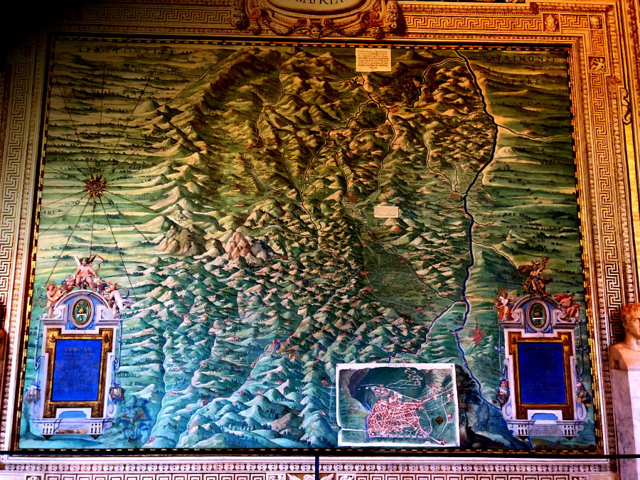

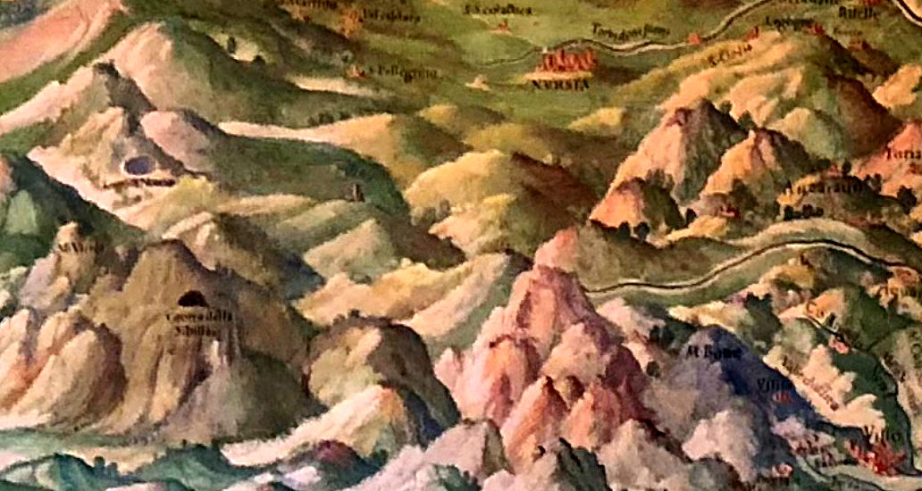

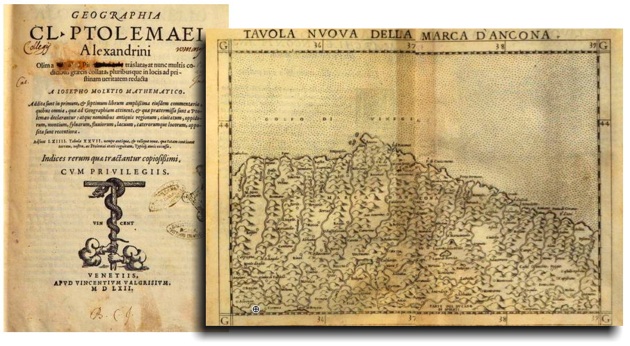

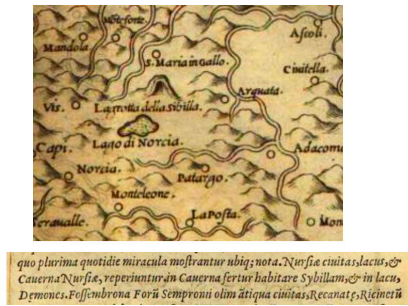


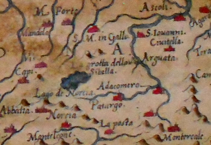

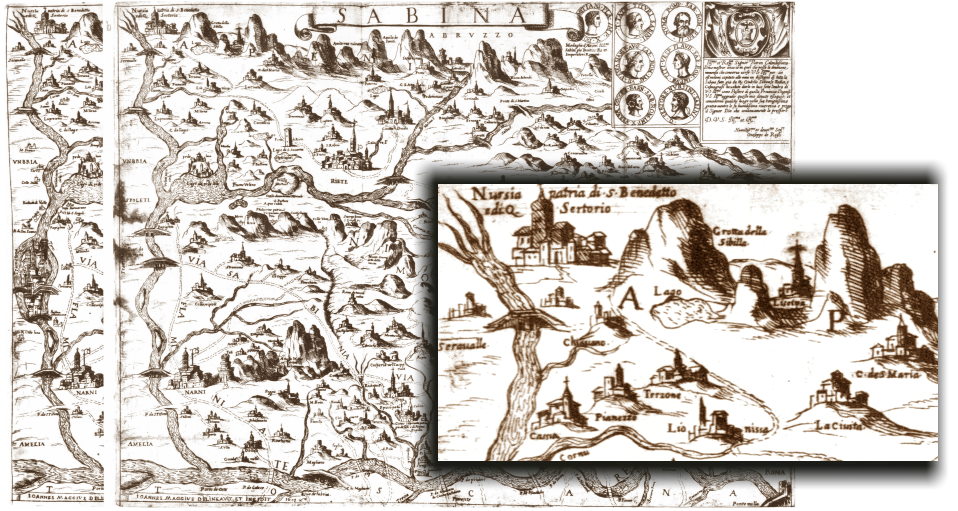

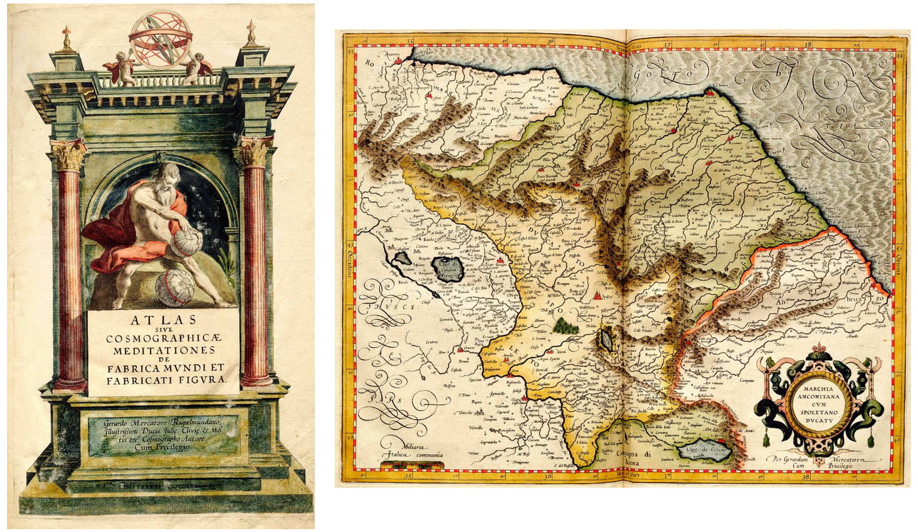

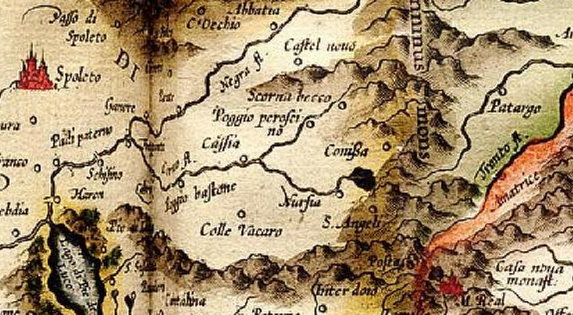


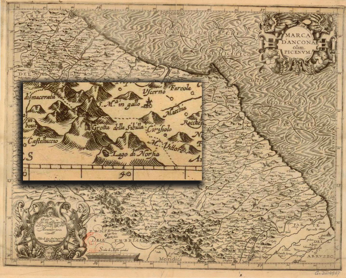

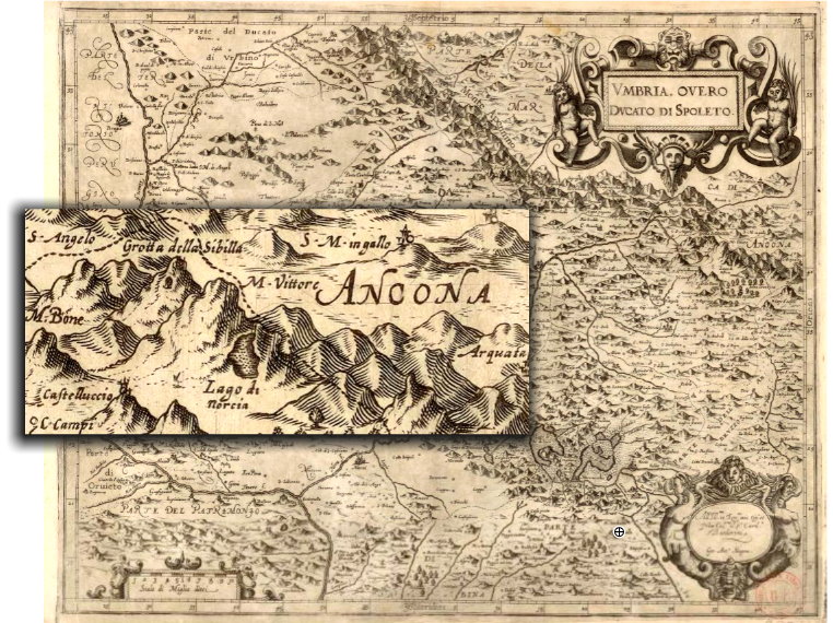


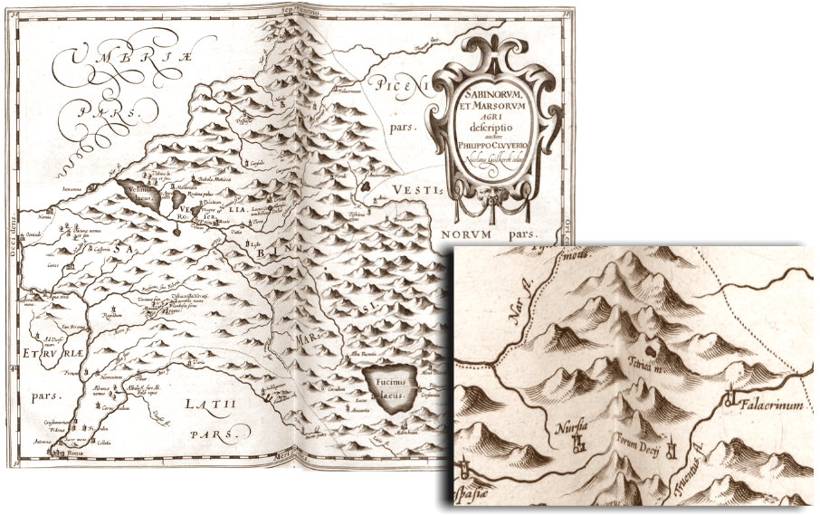


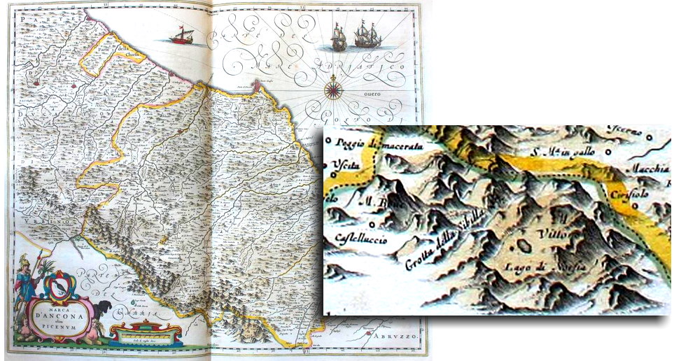

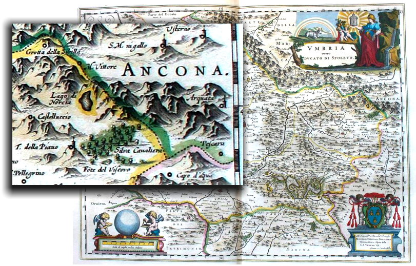

18 Nov 2020
Pontius Pilate and the shape of the waters /4. When the Lake was one
As fully known to the readers of our series of research articles “The Apennine Sibyl, a Mystery and a Legend”, the earliest mention ever retrieved about the eerie Lake which sits amid the mountains in the vicinity of Norcia is contained in a precious fourteenth-century manuscript, the “Reductorium Morale” by Petrus Berchorius (Pierre Bersuire), a French benedictine monk and abbot, who lived between 1290 and 1362. At that time, the Lake was known to be a single pool of water (Fig. 1):
«Amid the peaks which raise near that town [Norcia] there is a lake, which from antique times is sacred to demons and conspicuously inhabited by them [...] walls were built around the shore of the lake, and watched over by guards, lest necromancers be allowed to access the place to consecrate their books to the demons».
[In the original Latin text: «Inter montes isti civitati proximos esse lacum ab antiquis daemonibus consecratum et ab ipsis sensibiliter inhabitatum [...] circa terminos lacus facti sunt muri qui a custodibus servantur, ne necromantici pro liberis suis consecrandis daemonibus illuc accedere permittantur»].
In that same century, a second reference is found in a work written by a poet from Tuscany, Fazio degli Uberti; in his “Dittamondo”, written in the second half of the fourteenth century, the Lake is equally referred to as one (Fig. 2):
«I don't want to overlook the renown of the Mount of Pilate, where a lake is - which in summers is carefully guarded by watches on duty - because here Simon the Sorcerer ascends to consecrate his spellbook...».
[In the original Italian text: «la fama qui non vo’ rimagna nuda - del monte di pillato, dov’è il lago - che si guarda l'estate a muda a muda - però che qua s’intende in Simon mago - per sagrar il suo libro in su monta...»].
But the most impressive, pictorial description of the Lake of Pilate is provided by Antoine de la Sale, who in 1420 ascended the Italian Sibillini Mountain Range and reported the details of his visit in his work “The Paradise of Queen Sibyl”:
«First I will tell of the mountain of the lake of Queen Sibyl, which some name the mountain of the lake of Pilate [...] part of the Duchy of Spoletium and in the territory of the town of Norcia [...] This lake, in my opinion, is the size of your town of Moulins [...] In the middle there is a small islet made of one boulder which was once walled all around...».
[In the original French text: «Et premierement diray du mont du lac de la royne sibille, que aucuns appellent le mont du lac de pillate [...] parties de la Duchié despolit et ou terrouer de la cite de norse [...] Ce lac est en mon semblant du tour de vostre ville de moulins [...] Au milieu a une petite islete dun rochier qui jadis fut muree tout en tour...»].
The shape of the Lake, a single pool of water, is described by Antoine de la Sale as roughly circular. And we are given a full vision of this shape in the fine miniatures which enrich the de la Sale's manuscripted work, with the Lake standing in its rocky nest on the top of what we know today as Mount Vettore. Water seems to pour from the Lake itself, reaching down to the lower cliffs of the mountain (Fig. 3).
A similar picture is provided by the French gentleman when describing the ghastly chariot that, according to the legend, carried the dead body of Pontius Pilate up to the Lake's icy waters (Fig. 4).
So, at the time of Antoine de la Sale, the Lake of Pilate was one, as further confirmed by the drawing contained in a later printed edition of “The Paradise of Queen Sibyl”, dating to 1527: in this picture, we also see the small island set in the middle of the Lake itself (Fig. 5).
It is important to note that, according to Antoine de la Sale, the central islet is made by a single, large boulder («une petite islete dun rochier»): this remark seems to indicate that the Lake of Pilate, though presenting itself as a single basin at that time, was not particularly deep, as the top of a boulder laying in the water, huge as it may be, can emerge from the liquid surface only if the waters are shallow enough. And this conjecture is confirmed by a further remark provided by Antoine de la Sale himself:
«From the shore to the small island there is a narrow walkway submerged by the water which is five feet high as people told me...».
[In the original French text: «De la terre à celle isle a une petite chausse couverte deaue a la haulteur de v piez comme les gens me dirent...»].
So at the beginning of the fifteenth century the Lake of Pilate was a single basin, though markedly shallow in some portions. In our previous paper “A legend for a Roman prefect: the Lakes of Pontius Pilate”, we also succeeded in estimating the size of the Lake as seen by Antoine de la Sale's eyes, basing on a specific remark written by the French gentleman («this lake, in my opinion, is the size of your town of Moulins», in the original French text «ce lac est en mon semblant du tour de vostre ville de moulins»). The downtown area of Moulins-sur-Allier, the former capital of the Duchy of Bourbon, in central France, is around 1,300 feet wide, and it corresponds to the original castle (Fig. 6). This is not so different from the size of the valley which houses the two lakes of Pilate which we see today, so that the rough estimate provided by Antoine de la Sale in his manuscript proves to be fairly right.
A single Lake, nearly 1,300 feet wide, and remarkably shallow. Not a double one, made up by two smaller Lakes, the way it appears today. And the Lake's singleness is also retrieved in nearly all later literary sources which subsequently provide a reference to the magical waters that lie in the territory of Norcia. Only, we will later see that a few mentions portray a Lake in its summer condition: split in two distinct ponds, as an effect of canicular heat and scarcity of rainfalls during the warmer months of the year.
Despite its dual appearance in summers, which we will see later in the present research paper, throughout the subsequent centuries the Lake will be usually referred to and portrayed in maps as a single basin.
Pope Pius II Piccolomini, in his most famous letter, written on January, 15th 1444 to his cousin and friend Gregorio Lolli, wrote that «there is a place, in Umbria - which is known as the province of the Duchy - not far from the town of Norcia [...] he once mentioned to me the name of the lake and also provided a description of the place» [in the original Latin text: «locum esse in umbria, quae provincia ducatus dicitur, non longe ab Urbe Nursia [...] haec mihi vera esse asseveravit lacum nominavit et locum descripsit»] (Fig. 7).
In 1474 the Italian scholar Flavio Biondo published his “De Italia illustrata” (“Italy illustrated”), subsequently translated into Italian in 1542, in which he writes that «further above, in the territory of Norcia, there is that renowned lake where according to false rumours the waters would be replete of evil spirits rather than fish...» [in the original Italian text: «poco più su è quel lago famoso nel territorio di Norcia, dove dicono falsamente, che in vece di pesci, è pieno di demoni...»] (Fig. 8).
Bernardino da Bonavoglia, a Franciscan preacher who lived in the fifteenth century in Foligno, not far from the Sibillini Mountain Range, reports that «people say that near Norcia there is a mountain in which a lake named after Pilate stands...» (in the original Latin text: «dicitur autem quod iuxta Nursiam est quidam mons in quo est lacus qui dicitur Pilati...»). And in the same century Pietro Ranzano, a Dominican friar and bishop from Sicily, in his "Annales omnium temporum" wrote that «in the territory of Norcia there is a lake [...]: it is called the Lake of Norcia by the local inhabitants [...] a most elevated mountain was in the region of Norcia and a Lake was in it where demons dwelled».
At the end of the fifteenth century, the German knight Arnold von Harff provides the following account in his “Pilgrimage”: «After midday he [the lord of the place] rode with us up the mountain to where was a little lake. By this lake was a little chapel like a holy house...» [in the original German text: «Nae myttaghe reyt he mit vns oeuen off desen berch. Daer off stund eyn kleyne staynde see. By deser see stunt eyn kleyn cappelgen...»]. And in 1550 Leandro Alberti, a Dominican friar, wrote in his “Descrittione di tutta l'Italia” that «further high above in the Apennines, in the land of Norcia, there is the Lake [...] which is called the Lake of Norcia...» [in the original Italian text: «poscia alquanto più in su nell'Apennino nel territorio Nursino, evi il Lago [...] addimandato Lago di Norsa...»] (Fig. 9).
The many available literary sources we perused in this chapter seem to hint to a single Lake, with no duplication of basins as we observe in our present days. As we will see later in the present paper, duplication will be actually observed, but only during summers, when the water supplies from rainfalls and accumulated snow fall short and evaporation caused by intense heat may severely deplete the basin.
What about ancient cartography? Can we spot the shape of the Lake of Pilate in the maps drawn by the greatest Italian and Flemish geographers of past centuries? Let's try to navigate the pages of the major atlases published during the sixteenth, seventeenth, eighteenth centuries and the first half of the nineteenth: we will always see our magical Lake depicted as a single basin (but with one notable exception, registered during a summer visit to Mount Vettore).
Ponzio Pilato e la forma delle acque /4. Quando il Lago era uno
Come ben noto ai lettori della nostra serie di articoli di ricerca "Sibilla Appenninica - Il Mistero e la Leggenda", il più antico riferimento mai reperito in relazione al sinistro Lago situato tra i monti che si innalzano in prossimità di Norcia è contenuto in un prezioso manoscritto trecentesco, il "Reductorium Morale" di Petrus Berchorius (Pierre Bersuire), un monaco e abate benedettino francese, vissuto tra il 1290 e il 1362. A quel tempo, il Lago era conosciuto come un singolo specchio d'acqua (Fig. 1):
«Tra le montagne che si innalzano in prossimità di questa città [Norcia] si trova un lago, dagli antichi consacrato ai dèmoni, e da questi visibilmente abitato [...] attorno al lago sono state costruite delle mura che sono sorvegliate da guardie, affinché non sia permesso ai negromanti di accedere a quel luogo per consacrare i propri libri ai dèmoni».
[Nel testo originale latino: «Inter montes isti civitati proximos esse lacum ab antiquis daemonibus consecratum et ab ipsis sensibiliter inhabitatum [...] circa terminos lacus facti sunt muri qui a custodibus servantur, ne necromantici pro liberis suis consecrandis daemonibus illuc accedere permittantur»].
Nel corso dello stesso secolo, è possibile rinvenire un secondo riferimento nell'opera scritta da un poeta trecentesco originario della Toscana, Fazio degli Uberti; nel suo "Dittamondo", redatto nella seconda metà del quattordicesimo secolo, il Lago viene ancora descritto come un singolo bacino (Fig. 2):
«La fama qui non vo’ rimagna nuda - del monte di pillato, dov’è il lago - che si guarda l'estate a muda a muda - però che qua s’intende in Simon mago - per sagrar il suo libro in su monta...».
Ma la più straordinaria descrizione del Lago di Pilato ci viene graficamente fornita dallo sguardo affascinato di Antoine de la Sale, il quale ascese i Monti Sibillini nel 1420 e narrò in dettaglio della propria visita nell'opera "Il Paradiso della Regina Sibilla":
«In primo luogo vi narrerò del monte del lago della regina Sibilla, che alcuni chiamano il monte del lago di Pilato [...] parte del Ducato di Spoleto e nel territorio della città di Norcia [...] Questo lago, a mio parere, ha la circonferenza della vostra città di Moulins [...] Nel mezzo si trova una piccola isoletta costituita da un'enorme roccia, che un tempo fu murata tutt'attorno».
[Nel testo originale francese: «Et premierement diray du mont du lac de la royne sibille, que aucuns appellent le mont du lac de pillate [...] parties de la Duchié despolit et ou terrouer de la cite de norse [...] Ce lac est en mon semblant du tour de vostre ville de moulins [...] Au milieu a une petite islete dun rochier qui jadis fut muree tout en tour...»].
La forma del Lago, un singolo bacino, viene descritto da Antoine de la Sale come sostanzialmente circolare. E al lettore viene fornita una completa visione di questa forma nelle pregiate miniature che arricchiscono l'opera manoscritta dello scrittore provenzale, con il Lago annidato nella propria sede di roccia sulla cima di ciò che oggi conosciamo con il nome di Monte Vettore. Dell'acqua sembra fuoriuscire dal Lago stesso, e precipitarsi giù verso le falde della montagna (Fig. 3).
Un'immagine simile è proposta da Antoine de la Sale nel descrivere il macabro carro che, come racconta la leggenda, avrebbe trasportato le spoglie mortali di Ponzio Pilato su fino alle gelide acque di quel Lago (Fig. 4).
Dunque, ai tempi di Antoine de la Sale il Lago di Pilato era unico, come anche confermato nel disegno contenuto nella più tarda edizione a stampa del "Paradiso della Regina Sibilla", risalente al 1527: in questa immagine, possiamo anche osservare la piccola isola situata al centro del Lago medesimo (Fig. 5).
È importante notare come, secondo Antoine de la Sale, l'isoletta centrale sia formata da un solo, enorme masso («une petite islete dun rochier»): questa osservazione pare indicare come il Lago di Pilato, pur presentandosi a quell'epoca come un singolo bacino, non fosse particolarmente profondo, in quanto la cima di un masso che giace nell'acqua, per quanto grande esso possa essere, può emergere dalla liquida superficie solamente se le acque non sono particolarmente profonde. E questa ipotesi ci viene confermata dalle ulteriori parole vergate dallo stesso Antoine de la Sale:
«Dalla riva a quest'isola corre un piccolo passaggio, sommerso nell'acqua profonda cinque piedi, così come la gente mi disse...».
[Nel testo originale francese: «De la terre à celle isle a une petite chausse couverte deaue a la haulteur de v piez comme les gens me dirent...»].
E così all'inizio del quindicesimo secolo il Lago di Pilato era un singolo bacino, anche se di limitata profondità in alcune sue parti. Nel nostro precedente articolo, "Una leggenda per un prefetto romano: i Laghi di Ponzio Pilato", avevamo potuto stimare la dimensione del Lago contemplato dagli occhi di Antoine de la Sale sulla base di una specifica osservazione annotata dal gentiluomo provenzale («questo lago, a mio parere, ha la circonferenza della vostra città di Moulins», nel testo originale francese «ce lac est en mon semblant du tour de vostre ville de moulins»). Il centro cittadino dell'odierna Moulins-sur-Allier, l'antica capitale del Ducato di Borbone, nella Francia centrale, si estende per circa 400 metri di ampiezza e corrisponde all'originale castello (Fig. 6). Questa ampiezza non è molto diversa dalla dimensione della vallata che ospita i due laghi di Pilato così come oggi visibili. Dunque, la stima fornitaci da Antoine de la Sale appare essere sufficientemente corretta.
Un singolo Lago, avente un'ampiezza pari a circa 400 metri, e non particolarmente profondo. Non un Lago doppio, formato da due Laghi più piccoli, come invece ci appare oggi. E questa unicità della forma del Lago ci viene riferita anche dalla quasi totalità delle successive fonti letterarie contenenti un riferimento alla magiche acque che si trovano nel territorio di Norcia. Vedremo in seguito come esista solamente un numero limitatissimo di menzioni che ritraggano il Lago così come esso si presentava nella propria versione estiva: suddiviso in due specchi d'acqua, in conseguenza del calore torrido e della scarsità di piogge durante i mesi più caldi dell'anno.
Malgrado la sussistenza di un aspetto duplice nel corso della stagione estiva, un aspetto che avremo modo di considerare nei prossimi capitoli, nel corso dei secoli successivi il Lago sarà menzionato, e ritratto nelle mappe, come un singolo bacino.
Papa Pio II Piccolomini, in una delle proprie lettere più famose, vergata il 15 gennaio 1444 e indirizzata al cugino e amico Gregorio Lolli, scriveva che «esiste un lago, in Umbria, detta anche provincia del Ducato, non lontano dalla città di Norcia [...] mi assicurò che tutte queste cose sono vere, mi fece menzione del lago e mi descrisse il luogo» [nel testo originale latino: «locum esse in umbria, quae provincia ducatus dicitur, non longe ab Urbe Nursia [...] haec mihi vera esse asseveravit lacum nominavit et locum descripsit»] (Fig. 7).
Nel 1474, lo studioso italiano Flavio Biondo pubblicò la propria opera "De Italia illustrata", in seguito tradotta in lingua italiana nel 1542, in cui egli scrive che «poco più su è quel lago famoso nel territorio di Norcia, dove dicono falsamente, che in vece di pesci, è pieno di demoni...» (Fig. 8).
Bernardino da Bonavoglia, un predicatore francescano vissuto nel quindicesimo secolo a Foligno, non lontano dai Monti Sibillini, riferisce che «si dice anche che in prossimità di Norcia si trovi un certo monte, nel quale è situato un lago che è detto di Pilato...» (nel testo originale latino: «dicitur autem quod iuxta Nursiam est quidam mons in quo est lacus qui dicitur Pilati...»). E nello stesso secolo Pietro Ranzano, frate dominicano e vescovo originario della Sicilia, nella sua opera "Annales omnium temporum" ebbe modo di scrivere che «nel territorio di Norcia c'è un lago [..]: è chiamato il Lago di Norcia dalle genti del luogo [...] un'altissima montagna si trova in quella regione e in essa c'è un Lago nel quale dimorano i demoni».
Alla fine del quindicesimo secolo il cavaliere tedesco Arnold von Harff riferisce le seguenti informazioni nel suo "Pellegrinaggio": «Dopo mezzogiorno [il signore della contrada] cavalcò con noi sulla montagna, fino ad arrivare dove si trovava un piccolo lago. Accanto a questo lago si trovava una piccola cappella» [nel testo originale tedesco: «Nae myttaghe reyt he mit vns oeuen off desen berch. Daer off stund eyn kleyne staynde see. By deser see stunt eyn kleyn cappelgen...»]. E nel 1550 Leandro Alberti, un frate domenicano, scrisse nella sua “Descrittione di tutta l'Italia” che «poscia alquanto più in su nell'Apennino nel territorio Nursino, evi il Lago [...] addimandato Lago di Norsa...» (Fig. 9).
Le numerose fonti letterarie disponibili, da noi ripercorse nel presente capitolo, sembrano riferirsi a un singolo Lago, senza che sia rinvenibile alcuna duplicazione dei bacini come è possibile osservare ai nostri giorni. Come vedremo in seguito nel presente articolo, questa duplicazione sarà effettivamente osservata, ma solamente durante l'estate, quando le scorte di acqua provenienti da piogge e accumuli di neve tendono a esaurirsi e l'evaporazione che si produce in conseguenza delle elevate temperature può drasticamente ridurre il contenuto del bacino.
Ma cosa possiamo invece desumere dall'antica cartografia? Siamo forse in grado di verificare la forma del Lago di Pilato consultando le mappe disegnate dai più grandi geografi italiani e fiamminghi del passato? Proviamo a navigare tra le pagine dei maggiori atlanti pubblicati nei secoli sedicesimo, diciassettesimo e diciottesimo, fino ad arrivare alla prima metà del diciannovesimo secolo: vedremo come il nostro magico Lago si presenti sempre nella forma di un singolo bacino (con una sola notevole eccezione, registrata proprio nel corso di una visita estiva al Monte Vettore).


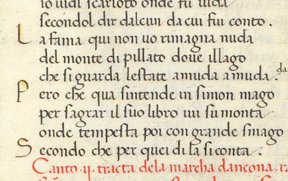

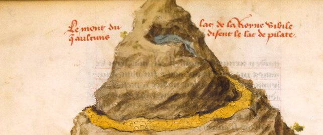

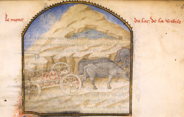

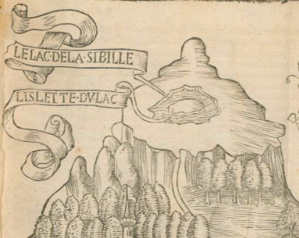


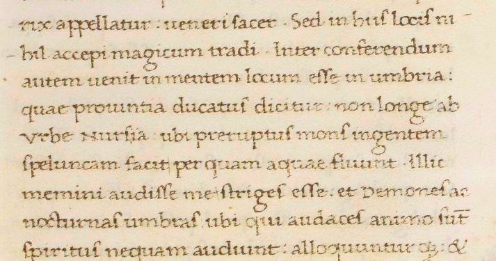


15 Nov 2020
Pontius Pilate and the shape of the waters /3. Two, one, zero: the many faces of a Lake
What is the appearance of the Lakes of Pilate today? And, what might this appearance have been like in past centuries? To find the answer, let's start describing the rocky setting in which the present Lakes stand.
Mount Vettore is the result of the titanic strain produced by the clash of two tectonic plates, confronting each other over the full length of the Apennines and clashing with giant might in the area of today's Sibillini Mountain Range. Ten million years ago the mountainous landform began to raise its peaks and crests from the bottom of a vanished sea. The process lasted many million years and the geological outcome was the massive ridges we see today.
It was at the end of the Pleistocene, during the Würm glaciation, a period extending from 100,000 to 10,000 years ago, that the Ice Age produced the most impressive feature which marks Mount Vettore as we know it today: the glacial cirque, a colossal hemicycle carved in the very matrix of the landform, which gives the mount its fantastic, astounding U-shaped structure, a sort of immense horseshoe. A glacier made all this, eroding and grinding the mount's rock by its ceaseless motion under the pull of gravity, for hundreds and hundreds of centuries.
Today, the ancient glacier has vanished, but the savage effects of its incessant action are fully visible. Mount Vettore is hollowed out from the inside: a large valley (the Valley of the Lakes of Pilate) is carved in its bowels, going from the elevated cliffs above, the razor-sharp rim of a rocky semicircular wall, straight down to the lower lands below, surrounded by further peaks, including Mount Sibyl (Fig. 1).
Up there, at the very centre of a vertiginous hemisphere of stone, whose walls are more than 1,500 feet high, the Lakes of Pilate stand, lying in their shallow cradle filled with rocky debris and feeding on rainfall and molten snow.
What is the size of this glacial nest concealed within the arms of stone of Mount Vettore?
In our previous paper “A legend for a Roman prefect: the Lakes of Pontius Pilate” we presented an image which easily shows the dimensions of the cradle in which the Lakes lie. A 'virtual' ruler is deposited in the middle of Mount Vettore's glacial cirque: it has a length of 1,300 feet and occupies the available space which goes from the steep southern sides of the mountain to the northern front edge of the glacial cirque, which then precipitously proceeds down into the Valley of the Lakes of Pilate (Fig. 2). Thus, the Lakes live their solitary lives within this maximum linear dimension, with a width which cannot exceed that of the glacial cirque itself, not greater than 1,300 feet.
Within the above physical constraints, the Pilate's waters may present as one single Lake, two separate Lakes, or no Lake at all, depending on the quantity of rainfalls and melting snow.
An interesting article written by L. Martarelli et al. (“The Pilato Lake (Sibillini Mts., Central Italy): first results of a study on the supposed variations of its hydrogeological conditions induced by the seismic sequence 2016-2017”, 2019) effectively illustrates the direct relationship which is found between the present depth of the Lakes and the way they appear to visitors today.
In our present days, the bottom of the glacial cirque is not flat, as its elevation above sea level goes from 6365 feet at the bed to a central, raised elevation of 6430 feet: a 65-feet difference which accounts for the variable appearance of the pond or ponds depending on water levels (Fig. 3).
Sometimes, when heavier snowfalls occur in winters, the two Lakes come partially together, so presenting themselves in the form of a single Lake as in springtime the snow melts and fills up the basin to high water levels, surpassing the 6430-feet threshold. However, the overall appearance is never that of a single, oblong Lake: at its best, you still see two distinct Lakes, one reaching out towards the other by means of a narrow strip of water which establishes a link between the two (Fig. 4).
On the other hand, during hot, dry summers the evaporation process brings the Lakes to complete disappearance, with the waters vanishing below the 6365-feet minimum level (Fig. 5).
The intermediate, usual appearance of the water basin is a spectacles-like, double Lake, made up by two small Lakes separated by a ridge of rocky debris, whose elevation is 6430 feet above sea level.
This is what we find today. Was it different in the past?
There are significant chances that the place may have undergone a certain degree of mutation.
To begin with, falling rocks and rubble precipitated by storms, landslides and earthquakes from the overhanging cliffs may have produced a raise in the elevation of the Lake's bottom: more rocks in the water, the shallower its depth, and more chances to have it split in two separate ponds. Of course, within this framework the Lake would have been deeper in the past than we see today (Fig. 6).
And there is a second consideration we may put forward: today the glacial cirque's front edge, which overlooks the underlying Valley of the Lakes of Pilate to the north and sets the maximum potential height for the waters, reaches a maximum elevation of 6,463 feet; however, as we will see in later paragraphs, according to a nineteenth-century source it seems that the front edge may have collapsed some one hundred seventy years ago, freeing part of the Lake's water into the Valley underneath. Again, in this scenario the Lake's depth would have been greater in past centuries.
Finally, as a third observation we must note that the growing effects of an adverse climate change are hitting the Lakes of Pilate just as other areas in the globe: in recent years, snowfalls have experienced a significant reduction in the territory where the Sibillini Mountain Range lie, and the same applies to rainfalls. As a result, the Lakes are increasingly underfed, and their appearance is more often than ever before that of small pair of eyeglasses, or even that of a fully dried-up basin.
From these simple considerations, we have reasons to conjecture that the shallow, almost scanty Lakes we see today might have been much more significant in the past, with a Lake usually presenting itself as a single, deeper basin before the fascinated eyes of the incoming visitors, determined to perform necromantic rituals by its shore.
Is the above conjecture true?
Possibly, it is. And we are going to explore all the literary and cartographic clues which may help us in confirming, or discarding, our assumption.
Ponzio Pilato e la forma delle acque /3. Due, uno, zero: i molti volti di un Lago
Come si presentano, oggi, i Laghi di Pilato? E quale aspetto avevano nei secoli passati? Per trovare la risposta, partiamo dalla descrizione del grandioso scenario di roccia all'interno del quale si trovano gli odierni Laghi.
Il Monte Vettore è il risultato delle titaniche tensioni generatesi nello scontro di due placche tettoniche, che si fronteggiano lungo tutta la lunghezza degli Appennini, collidendo con spinte colossali nell'area dei Monti Sibillini. Dieci milioni di anni fa il massiccio montuoso cominciò a innalzare le proprie creste e i propri picchi dal fondo di un mare oggi svanito. Il processo si è protratto per molti milioni di anni, e l'effetto geologico di esso è proprio quell'insieme di elevati rilievi che oggi osserviamo.
Fu al termine del Pleistocene, durante la glaciazione di Würm, un periodo terminato 10.000 anni fa e cominciato circa 100.000 anni prima, che l'Era Glaciale ha prodotto l'impressionante struttura che caratterizza il Monte Vettore così come oggi lo conosciamo: il circo glaciale, un colossale emiciclo scavato nella nuda matrice del monte, il quale conferisce alla montagna la sua fantastica, stupefacente forma a 'U', una sorta di immenso ferro di cavallo. Fu un ghiacciaio a compiere tutto questo, erodendo e frantumando la roccia della montagna con la propria incessante traslazione, sotto la spinta della gravità, per centinaia e centinaia di secoli.
Oggi, l'antico ghiacciaio non esiste più, ma i dirompenti effetti della sua ininterrotta azione sono ancora pienamente visibili. Il Monte Vettore appare infatti scavato dall'interno: un'enorme vallata (la Valle dei Laghi di Pilato) è intagliata nelle sue viscere, una cavità che procede dalle cime più elevate in altitudine, marcata dai bordi sottili e quasi taglienti di una muraglia di roccia semicircolare, giù fino alle terre poste a quote meno elevate, circondate da ulteriori vette, tra le quali il Monte Sibilla (Fig. 1).
Lassù, nel centro esatto di quel vertiginoso emisfero di pietra, le cui pareti si innalzano per più di cinquecento metri, si trovano i Laghi di Pilato, adagiati nella loro culla di roccia ricolma di detriti, e alimentati dalle piogge e dallo scioglimento delle nevi.
Quali sono le dimensioni del grande circo glaciale nascosto tra le braccia di pietra del Monte Vettore?
Nel nostro precedente articolo "Una leggenda per un prefetto romano: i Laghi di Ponzio Pilato" abbiamo proposto un'immagine che permette facilmente di intuire le dimensioni della conca in cui i Laghi si trovano a giacere. Un righello 'virtuale' viene posto al centro del circo glaciale del Monte Vettore: la sua lunghezza è pari a circa 400 metri e occupa lo spazio disponibile tra i ripidi versanti meridionali della montagna fino al limite frontale della conca, situato a settentrione, da cui discende precipite la Valle dei Laghi di Pilato (Fig. 2). Dunque, i Laghi vivono la propria vita solitaria e remota all'interno di questa massima dimensione lineare, con una larghezza che non può eccedere quella che caratterizza lo stesso circo glaciale, anch'essa non superiore ai 400 metri.
Nel contesto di tali limiti fisici, le acque dedicate a Pilato possono presentarsi nella forma di un singolo Lago, di due Laghi distinti, o anche di nessun Lago, in dipendenza della quantità di piogge e di neve in scioglimento.
Un interessante articolo elaborato da L. Martarelli et al. (“The Pilato Lake (Sibillini Mts., Central Italy): first results of a study on the supposed variations of its hydrogeological conditions induced by the seismic sequence 2016-2017”, 2019) riesce a rappresentare in modo efficace la relazione diretta che sussiste tra l'attuale profondità dei Laghi e il modo nel quale essi si presentano oggi agli occhi dei visitatori.
Ai nostri giorni, il fondo del circo glaciale non risulta essere piatto, e la sua altitudine rispetto al livello del mare si colloca tra un minimo di 1940 metri e un'elevazione centrale posta a 1960 metri: una differenza di 20 metri che spiega l'aspetto variabile del bacino o dei bacini, a seconda dei livelli che vengono raggiunti dalle acque (Fig. 3).
Talvolta, quando in inverno si verificano nevicate più intense, i due Laghi si riuniscono parzialmente, presentandosi nella forma di un singolo Lago quando, in primavera, quelle nevi si sciolgono e riempiono il bacino con elevate quantità di acqua, sorpassando la soglia dei 1960 metri. Malgrado ciò, l'aspetto generale non risulta mai essere quello di un singolo Lago dalla forma allungata: nei momenti migliori, si possono ancora osservare due laghi distinti, protesi l'uno verso l'altro per mezzo di una stretta lingua d'acqua, che stabilisce un contatto tra i due bacini (Fig. 4).
Nel caso opposto, durante le estati più calde e aride, il processo di evaporazione può condurre i Laghi fino alla completa cancellazione, con le acque che svaniscono al di sotto del livello minimo, pari a 1940 metri (Fig. 5).
L'aspetto intermedio, e maggiormente usuale, delle acque è quello di un doppio Lago, in forma d'occhiale, costituito da due piccoli Laghi separati da una bassa cresta di detriti rocciosi, la quale si innalza fino a 1960 metri sul livello del mare.
Questo è ciò che troviamo oggi. In passato, era forse diverso?
Certamente, sussistono notevoli probabilità che il sito abbia potuto subire un certo grado di mutamenti.
Tanto per cominciare, le rocce in caduta e i detriti precipitati dalle scogliere verticali verso il basso, a causa delle sollecitazioni prodotte da tempeste, frane e terremoti, potrebbero avere causato un innalzamento del fondo del Lago: maggiore la quantità di pietre nell'acqua, minore la sua profondità, e maggiore dunque la possibilità che si pervenga a una partizione del Lago in due bacini separati. Naturalmente, in tale contesto il Lago sarebbe risultato maggiormente profondo in passato rispetto a quanto possiamo osservare ai nostri giorni (Fig. 6).
E vi è anche una seconda considerazione che potremmo porre in evidenza: oggi il limite frontale del circo glaciale, che guarda a settentrione verso la sottostante Valle dei Laghi di Pilato e segna la massima altezza potenziale per le acque, raggiunge un'elevazione pari a 1970 metri; sembrerebbe, però, come andremo a vedere nei prossimi paragrafi e sulla base di una fonte ottocentesca, che questo fronte roccioso possa avere subito un collasso circa centosettanta anni orsono, liberando parte delle acque del Lago nella Valle che si trova al di sotto. Di nuovo, anche in questo scenario la profondità del Lago sarebbe risultata maggiore negli scorsi secoli.
Infine, come terza osservazione, dobbiamo notare come gli effetti crescenti di un cambiamento climatico avverso stiano influenzando in modo critico i Laghi di Pilato, così come sta accadendo anche in altre aree del mondo: in anni recenti, il territorio in cui si trovano i Monti Sibillini ha potuto registrare una significativa riduzione delle nevicate, e lo stesso può affermarsi a proposito delle piogge. In conseguenza di ciò, i Laghi sono oggi alimentati in modo sempre più scarso, e il loro aspetto assume, assai più spesso che in passato, quello di un minuscolo paio di occhiali, o addirittura l'apparenza di un bacino completamente disseccato e asciutto.
Partendo da queste semplici considerazioni, abbiamo motivo di congetturare come i Laghi attuali, poco profondi e in uno stato di peculiare sofferenza, potrebbero avere avuto, in tempi ormai trascorsi, un aspetto assai più significativo, quando il Lago era solito presentarsi nella forma di un singolo, profondo bacino di fronte allo sguardo affascinato degli arditi visitatori, intenzionati a porre in scena i propri rituali negromantici sul bordo di quelle acque.
E forse fondata, questa congettura?
Probabilmente lo è. E stiamo per andare a esplorare la vasta serie di indizi, letterari e cartografici, che possono aiutarci a confermare, o confutare, la nostra ipotesi.
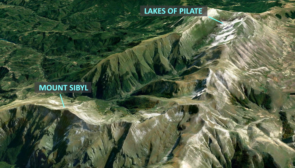

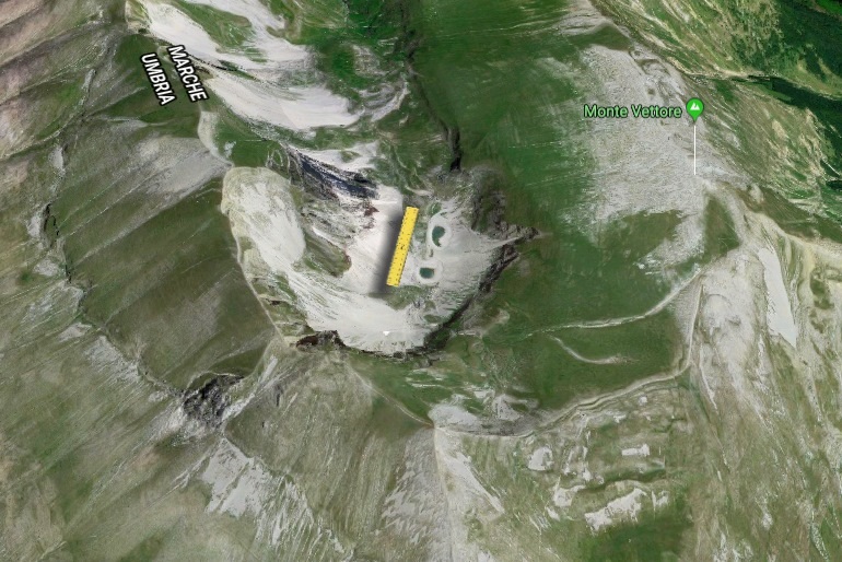

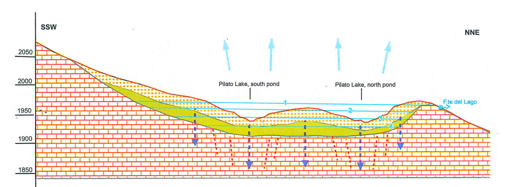

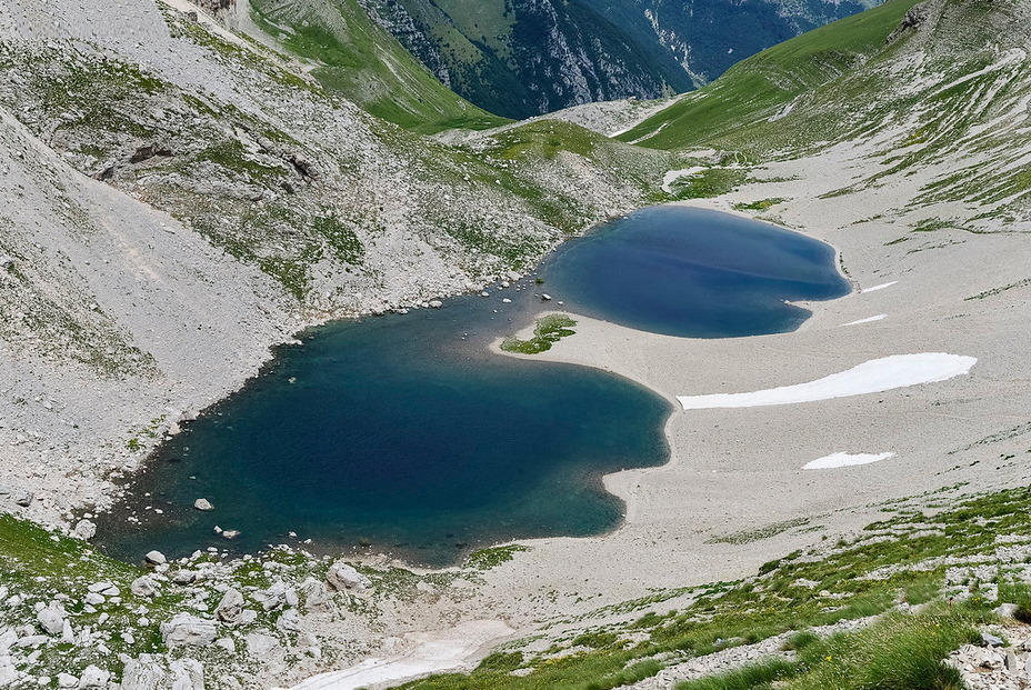

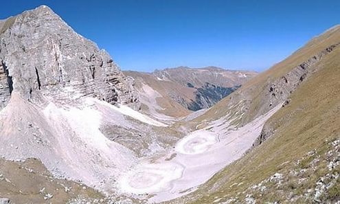

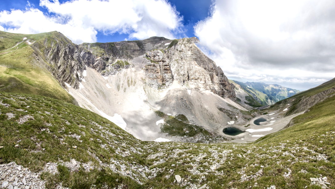

13 Nov 2020
Pontius Pilate and the shape of the waters /2. Portrait of a Lake, today
At the very centre of Italy the fastnesses of the Sibillini Mountain Range, a portion of the Italian Apennines, stand out from the main chain as an impregnable fortress. On the southernmost side of this massive ridge, facing the crowned peak of Mount Sibyl, raises the titanic shape of Mount Vettore, with its huge, imposing mass, an arched behemoth that overwhelms the whole mountainous region with its elevated top and vertiginous, sinister cliffs (Fig. 1).
Deeply enclosed within the precipitous arms of this giant of stone, two small mirrors of pure, clear water lie in silence and stillness. They are the Lakes of Pilate, waiting in their solitary nest, surrounded by loooming, overhanging versants of vertical rock (Fig. 2).
The Lakes of Pilate: two icy, crystal-like surfaces, set at the bottom of Mount Vettore's glacial cirque, high up amid sheer walls of rock, quietly reflecting the sky above (Fig. 3).
Whoever had the chance to climb the gigantic mountain and visit the place hidden between the cliffs of rock knows well the feeling of indistinct, dumbfounded awe that seizes a human soul when left alone before this overpowering might, echoing any step that may be taken, any sound and any word that might be uttered, with hesitant whispers, by the unwary visitor.
As we wrote in our previous paper “A legend for a Roman prefect: the Lakes of Pontius Pilate”, this is a truly blood-curdling place. A sort of theatrical scenery, ready for some kind of eerie performance. The very nature of the site is such as to convey the listed feelings, bringing to the mind a weird impression of apprehension and expectation. And this is the site where obscure, sinister legends resolved to settle down: the resting place for a cursed corpse, that of a Roman prefect, Pontius Pilate; and the place where necromantic rituals have been performed for many centuries. A place which is marked by a legendary, otherwordly character (see our previous papers “Sibillini Mountain Range, the legend before the legends” and “Sibillini Mountain Range, a cave and lake to the Otherworld”) and is ruled, as we detailed in another paper (“Sibillini Mountain Range, the chthonian legend”), by the appalling power of earthquakes, owing to the peculiar sesmic nature of the territory.
In the present paper, we will not address the legendary tradition which lives at the Lakes of Pilate, a fascinating topic we already illuminated in full in the series of research articles “The Apennine Sibyl - A Mystery and a Legend”, which includes the papers listed above. We will focus instead on the physical appearance of the Lakes of Pilate which, as we will show in the next chapters, once were known to be a single Lake, while today we are usually presented with two separate ponds, which come together only in rare occasion and only partially, when melting snow and rainfalls provide the basin with enough water.
So what is the shape of the Lakes of Pilate today?
Let's start our investigation with the illustration of the lofty, impressive rocky cradle in which the Lakes are hosted.
Ponzio Pilato e la forma delle acque /2. Ritratto di un Lago, oggi
Al centro dell'Italia, i bastioni del massiccio dei Monti Sibillini, una porzione del sistema montuoso degli Appennini, si innalzano dalla catena principale come un'imprendibile fortezza. Nella parte più meridionale di queste imponenti elevazioni, proprio di fronte alla cima coronata del Monte Sibilla, si erge la forma titanica del Monte Vettore, con la sua enorme, incombente massa, un gigante arcuato che sovrasta e domina l'intera regione con la sua altissima vetta e i suoi ripidissimi, spaventosi precipizi (Fig. 1).
Profondamente incassati tra le braccia precipiti di questo gigante di pietra, due piccoli specchi d'acque pure e chiarissime giacciono nel silenzio assoluto di questi luoghi. Sono i Laghi di Pilato, che attendono nel loro solitario riparo, circondati dalle pareti, minacciose e colossali, di roccia verticale (Fig. 2).
I Laghi di Pilato: due superfici di gelida acqua cristallina, poste nel fondo del circo glaciale del Monte Vettore, in alta quota, tra mura di roccia torreggianti, placidamente riflettenti il cielo lontano, nelle altitudini infinite (Fig. 3).
Chiunque abbia mai avuto la possibilità di ascendere questa gigantesca montagna e visitare quel luogo, occultato tra le altissime scogliere di pietra, conosce bene quella sensazione di indistinto, attonito timore che coglie lo spirito dell'uomo quando si rimane soli dinanzi a questa terrificante potenza, che echeggia del rumore di ogni passo, che riverbera il suono di ogni parola che possa essere pronunciata, con riluttante sussurro, dall'incauto visitatore.
Come avemmo occasione di scrivere nel nostro precedente articolo "Una leggenda per un prefetto romano: i Laghi di Ponzio Pilato", si tratta di un luogo pauroso, agghiacciante. Una sorta di scenario teatrale, pronto per una magica, inquietante rappresentazione. È la natura stessa di questi luoghi a suscitare i sentimenti illustrati, evocando nell'animo suggestive impressioni di apprensione e aspettativa. Ed è questo il sito presso il quale leggende oscure e sinistre hanno deciso, in un lontano passato, di stabilirsi: il luogo di sepoltura di un corpo maledetto, quello di un prefetto romano, Ponzio Pilato; e lo scenario nel quale rituali negromantici sono stati effettuati per molti secoli. Un sito che è caratterizzato da un leggendario carattere sovrannaturale (si vedano a questo proposito i nostri precedenti articoli "Monti Sibillini: la leggenda prima delle leggende" e "Monti Sibillini, un Lago e una Grotta come accesso oltremondano") e soggetto, come illustrato in un'ulteriore ricerca ("Monti Sibillini, la leggenda ctonia") all'imperio terrificante dei terremoti, in connessione con la peculiare natura sismica del territorio.
Nel presente articolo, non andremo ad affrontare la tradizione leggendaria che vive presso i Laghi di Pilato, un tema affascinante che abbiamo già avuto modo di illuminare in modo completo nel contesto della serie di articoli di ricerca "Sibilla Appenninica - Il Mistero e la Leggenda", che comprende gli studi appena citati. Ci concentreremo, invece, sull'apparenza fisica dei Laghi di Pilato che, come avremo modo di illustrare nei successivi capitoli, in passato erano conosciuti come un singolo Lago, mentre oggi siamo soliti trovarci di fronte a due separati specchi d'acqua, che si uniscono solamente in rare occasioni e solamente in modo parziale, quando la neve in fusione e le piogge riescono a rifornire il bacino con una quantità di acqua sufficiente.
E dunque, quale è la forma dei Laghi di Pilato, oggi?
Diamo inizio alla nostra investigazione illustrando il vertiginoso, impressionante anfiteatro di roccia che ospita i Laghi al proprio interno.


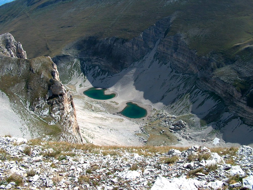

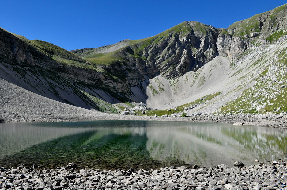

11 Nov 2020
Pontius Pilate and the shape of the waters /1. One Lake, two Lakes
In the middle of the Italian Apennines the peaks of the Sibillini Mountain Range raise amid cloudy mists. Ancient legends inhabit the elevated cliffs and the sheer valleys which mark this portion of the land of Italy: a Cave set on the top of Mount Sibyl is dedicated to the name of a sibilline oracle, for centuries the destination of adventurous journeys made by visitors who were coming from all regions of Europe; a few miles away, the Lake of Pilate, nested within the glacial cirque of Mount Vettore, awaited its own attendance of magicians and necromancers in search of a suitable place for the consecration of spellbooks. Legends we have fully addressed in the series of papers “The Apennine Sibyl - A Mystery and a Legend” which provides detailed information on the whole legendary tradition, with the definition of a conjectural framework in which to set the origin of mythical tales that were not born there, as they were plausibly attracted to the Sibillini Mountain Range by far more antique legendary credences connected to the peculiar seismic behaviour of the territory.
In this paper we want to address a different aspect of the legendary heritage which is linked to the Lake of Pilate, one of the two specific geographical features in which the Sibillini Mountain Range's myth dwells.
We are going to address the issue of the shape of the Lake.
An issue, and a thorny one. Because the fascinating, sinister Lake we see today is not one Lake at all: it is two Lakes in total, and both small indeed. They are so small that, in times of climate change and global warming, they increasingly tend to disappear altogether during the hot, ardent summers that affect the elevated crests of the Sibillini Mountain Range with ever growing frequency: an effect which is worsened by the scarce amount of snow that happens to fall on the same cliffs during the once-frigid winters that mark a land which is now experiencing rising average temperatures all round the year.
So as a matter of fact today the Lakes are basically two, while once ordinarily there used to be just one, apart from summer droughts: in the past, the Lake of Pilate was seemingly bigger though possibly not exceedingly deep, as the literary sources appear to tell us. Centuries ago, the place was often indicated as “Lake of Norcia”, while today it is usually referred to as “Lakes of Pilate”.
What has happened? And why? Was it a long-term process, possibly induced by climate change? Or, did any specific event happen at some point in time?
Let's start probing deep into this tricky matter. Because the answers are possibly more than one, with a central role to be played by the nineteenth century, a time during which major changes possibly occurred.
With the help of ancient sources and cartographies, and using new, previously-unpublished information, which we already presented in our paper “The nineteenth-century discovery of the Sibillini Mountain Range by the Italian Alpine Club”, we will be able to deal in deeper detail with this hitherto-unaddressed matter.
Ponzio Pilato e la forma delle acque /1. Un Lago, due Laghi
Nella parte centrale degli Appennini si innalzano le vette dei Monti Sibillini, immerse tra nebulose caligini. Antiche leggende abitano le alte cime e le profonde vallate che segnano questa porzione della terra d'Italia; una Grotta, posta sul picco del Monte Sibilla, è dedicata al nome di un oracolo sibillino, per secoli meta di viaggi avventurosi effettuati da uomini provenienti da ogni parte d'Europa; a pochi chilometri di distanza, il Lago di Pilato, annidato all'interno del circo glaciale del Monte Vettore, attendeva maghi e negromanti, che lì si recavano alla ricerca di un luogo che fosse adatto alla consacrazione di magici libri. Leggende che abbiamo avuto modo di investigare in profondità in una serie di articoli denominati "Sibilla Appenninica - Il Mistero e la Leggenda", all'interno dei quali abbiamo reso disponibili informazioni dettagliate sull'intera tradizione leggendaria, con la definizione di un quadro congetturale nel quale collocare l'origine di quei mitici racconti, i quali non nacquero in quelle specifiche regioni, essendo invece stati plausibilmente attratti verso i Monti Sibillini dalla presenza in quei luoghi di credenze leggendarie assai più antiche, connesse alla peculiare natura sismica del territorio.
Nel presente articolo intendiamo però affrontare un differente aspetto relativo all'eredità leggendaria che è connessa al Lago di Pilato, uno dei due specifici elementi geografici presso i quali ha trovato dimora il mito che anima i Monti Sibillini.
Andremo infatti ad affrontare la questione della forma del Lago.
Una questione, e anche spinosa. Perché il sinistro, affascinante Lago che possiamo contemplare oggi non è affatto un unico Lago: abbiamo invece due Laghi, e significativamente piccoli. Così piccoli che, in tempi di cambiamento climatico e riscaldamento globale, essi manifestano la crescente tendenza a scomparire completamente durante le roventi estati che sembrano scagliarsi sulle alte creste dei Monti Sibillini con frequenza sempre maggiore: un effetto che è reso ancora più critico dalle scarse quantità di neve che, ai nostri giorni, vediamo cadere su quelle stesse creste durante inverni che non sono più rigidi, e che caratterizzano un territorio che sta ormai facendo esperienza di elevate temperature medie nel corso di tutto l'anno.
E così risulta essere un fatto come i Laghi, oggi, siano sostanzialmente due, mentre un tempo esso era unico, a meno di particolari condizioni di siccità estiva: in passato, il Lago di Pilato era apparentemente più grande, anche se probabilmente non eccessivamente profondo, come le fonti letterarie sembrano narrarci. Secoli fa, il luogo era spesso indicato come "Lago di Norcia", mentre oggi viene usualmente menzionato come "Laghi di Pilato".
Cosa è accaduto? E perché? Si è trattato di un mutamento avvenuto nel corso di un lungo periodo, forse in conseguenza di fenomeni legati al cambiamento climatico? Oppure, ciò ha avuto luogo a causa di uno specifico evento occorso in un particolare momento del tempo?
Cominciamo a investigare in profondità all'interno di questa intricata materia. Perché le possibili risposte potranno essere più di una, con un ruolo centrale che sarà giocato dal secolo diciannovesimo, epoca nel corso della quale alcuni significativi cambiamenti potrebbero essere avvenuti.
Con l'aiuto delle fonti storiche e delle antiche cartografie, e facendo uso di nuove informazioni, mai pubblicate in precedenza e da noi già presentate nel nostro articolo "La riscoperta ottocentesca dei Monti Sibillini nei documenti del Club Alpino Italiano", avremo modo di affrontare in particolareggiato dettaglio questo specifico argomento, mai analizzato prima.
